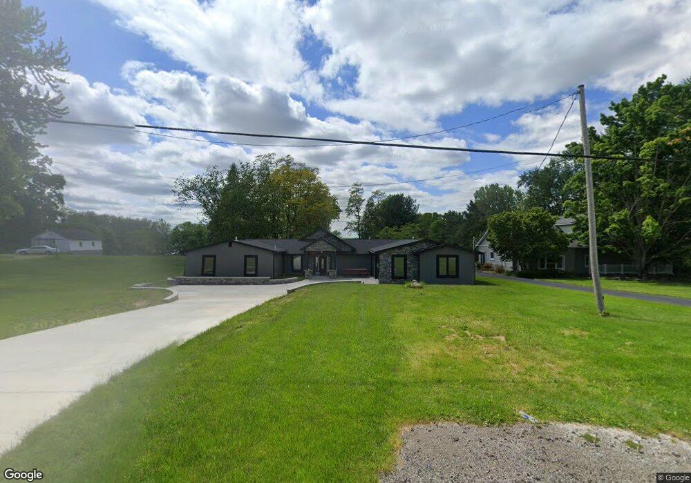
5675 State Route 46 Cortland, OH 44410
Estimated Value: $284,000 - $325,000
3
Beds
3
Baths
2,427
Sq Ft
$127/Sq Ft
Est. Value
About This Home
This home is located at 5675 State Route 46, Cortland, OH 44410 and is currently estimated at $307,573, approximately $126 per square foot. 5675 State Route 46 is a home located in Trumbull County with nearby schools including Maplewood Middle School, Maplewood Elementary School, and Maplewood High School.
Ownership History
Date
Name
Owned For
Owner Type
Purchase Details
Closed on
Nov 7, 2011
Sold by
Lewis Joy W and Turrell Wendy
Bought by
Bachinger Robert and Bachinger Susan
Current Estimated Value
Home Financials for this Owner
Home Financials are based on the most recent Mortgage that was taken out on this home.
Original Mortgage
$94,400
Outstanding Balance
$64,589
Interest Rate
4.09%
Mortgage Type
New Conventional
Estimated Equity
$242,984
Purchase Details
Closed on
Jan 1, 1990
Bought by
Joy W Turrell
Create a Home Valuation Report for This Property
The Home Valuation Report is an in-depth analysis detailing your home's value as well as a comparison with similar homes in the area
Home Values in the Area
Average Home Value in this Area
Purchase History
| Date | Buyer | Sale Price | Title Company |
|---|---|---|---|
| Bachinger Robert | $122,500 | None Available | |
| Joy W Turrell | -- | -- |
Source: Public Records
Mortgage History
| Date | Status | Borrower | Loan Amount |
|---|---|---|---|
| Open | Bachinger Robert | $94,400 |
Source: Public Records
Tax History Compared to Growth
Tax History
| Year | Tax Paid | Tax Assessment Tax Assessment Total Assessment is a certain percentage of the fair market value that is determined by local assessors to be the total taxable value of land and additions on the property. | Land | Improvement |
|---|---|---|---|---|
| 2024 | $3,105 | $78,650 | $10,430 | $68,220 |
| 2023 | $3,105 | $78,650 | $10,430 | $68,220 |
| 2022 | $2,637 | $59,400 | $9,630 | $49,770 |
| 2021 | $2,165 | $46,240 | $9,630 | $36,610 |
| 2020 | $1,821 | $39,700 | $9,630 | $30,070 |
| 2019 | $1,745 | $36,270 | $8,930 | $27,340 |
| 2018 | $1,735 | $36,270 | $8,930 | $27,340 |
| 2017 | $1,731 | $36,270 | $8,930 | $27,340 |
| 2016 | $1,702 | $35,740 | $8,090 | $27,650 |
| 2015 | $1,652 | $35,740 | $8,090 | $27,650 |
| 2014 | $1,646 | $35,740 | $8,090 | $27,650 |
| 2013 | $1,688 | $35,740 | $8,090 | $27,650 |
Source: Public Records
Map
Nearby Homes
- 2684 Griffith Dr
- 6101 Private
- 4869 Phillips Rice Rd
- 6247 Love Warner Rd
- 5294 Cottage Dr
- 6555 Love Warner Rd
- 507 Tournament Trail
- 121 Fairway Dr
- 400 Tournament Trail Unit 400
- 525 Sycamore Trail
- 428 Cherry Hill Ln
- 101 Elizabeth Ct
- 404 Cherry Hill Ln
- 0 N High St
- 0 St Andrews Unit 5113795
- 884 Housel Craft Rd
- 160 Saint Andrews
- 155 Heritage Ln
- 163 N Mecca St Unit 167
- 124 Saint Andrews
- 5683 State Route 46
- 5651 State Route 46
- 5637 State Route 46
- 5700 State Route 46
- 5629 State Route 46
- 5721 State Route 46
- 5623 State Route 46
- 5705 State Route 46
- 5705 State Route 46
- 5611 State Route 46
- 0 State Route 46 Unit 4355205
- 5730 State Route 46
- 5602 State Route 46
- 5595 State Route 46
- 5746 State Route 46
- 5755 State Route 46
- 5765 State Route 46
- 5756 State Route 46
- 5768 State Route 46
- 5768 State Route 46