Estimated Value: $480,000 - $682,000
--
Bed
--
Bath
2,450
Sq Ft
$242/Sq Ft
Est. Value
About This Home
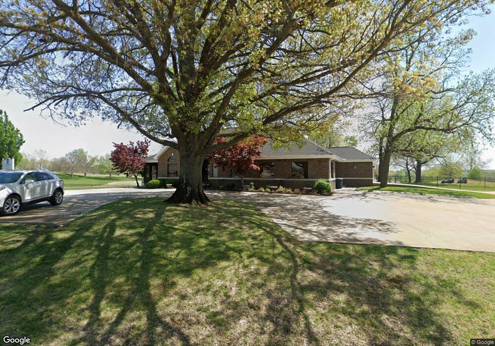
This home is located at 56751 E 307 Rd, Afton, OK 74331 and is currently estimated at $594,095, approximately $242 per square foot. 56751 E 307 Rd is a home located in Delaware County with nearby schools including Grove Lower Elementary School, Grove Upper Elementary School, and Grove Middle School.
Ownership History
Date
Name
Owned For
Owner Type
Purchase Details
Closed on
May 6, 2021
Sold by
Long Corlett Llc
Bought by
St Andrew S Harbor Community Assn Inc
Current Estimated Value
Purchase Details
Closed on
Jun 17, 2008
Sold by
Corlett Willaim R and Corlett Linda K
Bought by
Masri Rami J and Benee Masri S
Home Financials for this Owner
Home Financials are based on the most recent Mortgage that was taken out on this home.
Original Mortgage
$534,483
Interest Rate
6.08%
Mortgage Type
Future Advance Clause Open End Mortgage
Purchase Details
Closed on
Aug 8, 1997
Sold by
Island Park Limited
Create a Home Valuation Report for This Property
The Home Valuation Report is an in-depth analysis detailing your home's value as well as a comparison with similar homes in the area
Home Values in the Area
Average Home Value in this Area
Purchase History
| Date | Buyer | Sale Price | Title Company |
|---|---|---|---|
| St Andrew S Harbor Community Assn Inc | $10,000 | None Available | |
| Masri Rami J | $594,000 | None Available | |
| -- | $60,000 | -- |
Source: Public Records
Mortgage History
| Date | Status | Borrower | Loan Amount |
|---|---|---|---|
| Previous Owner | Masri Rami J | $534,483 |
Source: Public Records
Tax History Compared to Growth
Tax History
| Year | Tax Paid | Tax Assessment Tax Assessment Total Assessment is a certain percentage of the fair market value that is determined by local assessors to be the total taxable value of land and additions on the property. | Land | Improvement |
|---|---|---|---|---|
| 2025 | $5,520 | $61,478 | $0 | $61,478 |
| 2024 | $5,520 | $59,687 | $0 | $59,687 |
| 2023 | $5,520 | $57,949 | $0 | $57,949 |
| 2022 | $5,271 | $57,949 | $0 | $57,949 |
| 2021 | $5,123 | $56,261 | $0 | $56,261 |
| 2020 | $5,135 | $54,622 | $0 | $54,622 |
| 2019 | $5,101 | $51,487 | $0 | $51,487 |
| 2018 | $4,507 | $51,487 | $0 | $51,487 |
| 2017 | $4,387 | $49,987 | $0 | $49,987 |
| 2016 | $4,254 | $48,531 | $0 | $48,531 |
| 2015 | $4,176 | $45,746 | $0 | $45,746 |
| 2014 | $4,194 | $45,746 | $0 | $45,746 |
Source: Public Records
Map
Nearby Homes
- 96 Circle Dr
- TBD Lots 33 & 34 Circle Dr
- 29 Circle Dr
- 31 Circle Dr
- 1 Port Duncan Blvd
- 7 Port Duncan Blvd
- 0 Kansas Dr
- 11 Port Duncan Blvd
- 0 Port Duncan Blvd
- 0 Vinita Cir Unit 2530907
- 0 Vinita Cir Unit 24-1384
- 19 Privateer Dr
- 4 Tulsa Dr
- 2 Dogwood Ln
- Lot #9 Airport Rd
- Lot#4 Airport Rd
- Lot #8 Airport Rd
- Lot #7 Airport Rd
- Lot #6 Airport Rd
- Lot #5 Airport Rd
- e 307 Firebird Rd
- 29410 S 563 Rd
- 29461 S 563 Rd
- 29452 S 563 Rd
- 56310 E 295 Rd
- 56310 E 295 Rd Unit 9
- 56310 E 295 Rd Unit 10
- 32 Circle Dr
- 21 Circle Dr
- #4 Circle Place
- 0 Circle Place
- 5050 Port Duncan Blvd
- 1802 Port Duncan Blvd
- 127 Circle Dr
- 3 Circle Dr
- 18 Circle Dr
- 53 Pheasant Cir
- 504 Port Duncan Blvd
- 22 Bridgeport Rd
- 29 Missouri Dr