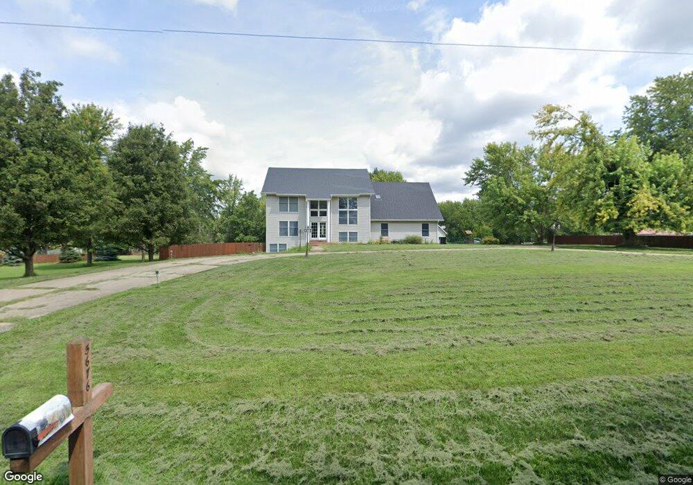
5676 N Bender Rd Decatur, IL 62521
Estimated Value: $330,000 - $427,000
3
Beds
3
Baths
3,820
Sq Ft
$97/Sq Ft
Est. Value
About This Home
This home is located at 5676 N Bender Rd, Decatur, IL 62521 and is currently estimated at $370,366, approximately $96 per square foot. 5676 N Bender Rd is a home located in Macon County with nearby schools including Michael E. Baum Elementary School, Stephen Decatur Middle School, and Robertson Charter School.
Ownership History
Date
Name
Owned For
Owner Type
Purchase Details
Closed on
Dec 10, 2021
Sold by
Hale David G and Hale Elizabeth
Bought by
Harris Jamaal
Current Estimated Value
Home Financials for this Owner
Home Financials are based on the most recent Mortgage that was taken out on this home.
Original Mortgage
$211,000
Outstanding Balance
$193,718
Interest Rate
3.13%
Mortgage Type
New Conventional
Estimated Equity
$176,648
Purchase Details
Closed on
Mar 1, 1997
Create a Home Valuation Report for This Property
The Home Valuation Report is an in-depth analysis detailing your home's value as well as a comparison with similar homes in the area
Home Values in the Area
Average Home Value in this Area
Purchase History
| Date | Buyer | Sale Price | Title Company |
|---|---|---|---|
| Harris Jamaal | $295,500 | None Listed On Document | |
| -- | $9,500 | -- |
Source: Public Records
Mortgage History
| Date | Status | Borrower | Loan Amount |
|---|---|---|---|
| Open | Harris Jamaal | $211,000 |
Source: Public Records
Tax History Compared to Growth
Tax History
| Year | Tax Paid | Tax Assessment Tax Assessment Total Assessment is a certain percentage of the fair market value that is determined by local assessors to be the total taxable value of land and additions on the property. | Land | Improvement |
|---|---|---|---|---|
| 2024 | $6,144 | $92,402 | $7,434 | $84,968 |
| 2023 | $5,850 | $85,860 | $6,908 | $78,952 |
| 2022 | $5,556 | $80,729 | $6,495 | $74,234 |
| 2021 | $4,831 | $76,534 | $6,158 | $70,376 |
| 2020 | $4,753 | $73,147 | $5,886 | $67,261 |
| 2019 | $4,753 | $73,147 | $5,886 | $67,261 |
| 2018 | $4,596 | $71,544 | $5,757 | $65,787 |
| 2017 | $4,551 | $70,661 | $5,686 | $64,975 |
| 2016 | $4,935 | $70,619 | $5,683 | $64,936 |
| 2015 | $4,664 | $69,713 | $5,610 | $64,103 |
| 2014 | $4,395 | $69,713 | $5,610 | $64,103 |
| 2013 | $4,396 | $69,713 | $5,610 | $64,103 |
Source: Public Records
Map
Nearby Homes
- 5265 E Harbour
- Lot 4 Harbour Ct
- Lot 3 Harbour Ct
- 5527 Melwood Ave
- (Lot 2) 410 N Excelsior St
- 5135 Swashbuckler Ct
- 5120 Swashbuckler Ct
- Lot 19 N Timberlake Ct
- (Lot 16) 320 N Timberlake Ct
- (Lot 17) 305 N Timberlake Ct
- (Lot 18) 325 N Timberlake Ct
- 690 N Cove Ct
- 317 N Country Club Rd
- 4504 E Spruce St
- 384 Greenway Ln
- 707 S Airport Rd
- 3948 E Grand Ave
- 92 N Country Club Rd
- 4606 Jamestown Ct
- 4468 Mount Vernon Place
- 5676 Mill Rd
- 5640 Mill Rd
- 5710 Mill Rd
- 5727 N Bender Rd
- 5655 Mill Rd
- 5640 N Bender Rd
- 5740 Mill Rd
- 5685 E Sleepy Hollow Ln
- 5727 Mill Rd
- 5745 E Sleepy Hollow Ln
- 5620 Mill Rd
- 975 N Bender Rd
- 985 N Bender Rd
- 925 N Bender Rd
- 895 N Bender Rd
- 1005 N Branch Rd
- 1025 N Branch Rd
- 825 N Bender Rd
- 770 N Excelsior St
- 770 N Excelsior St