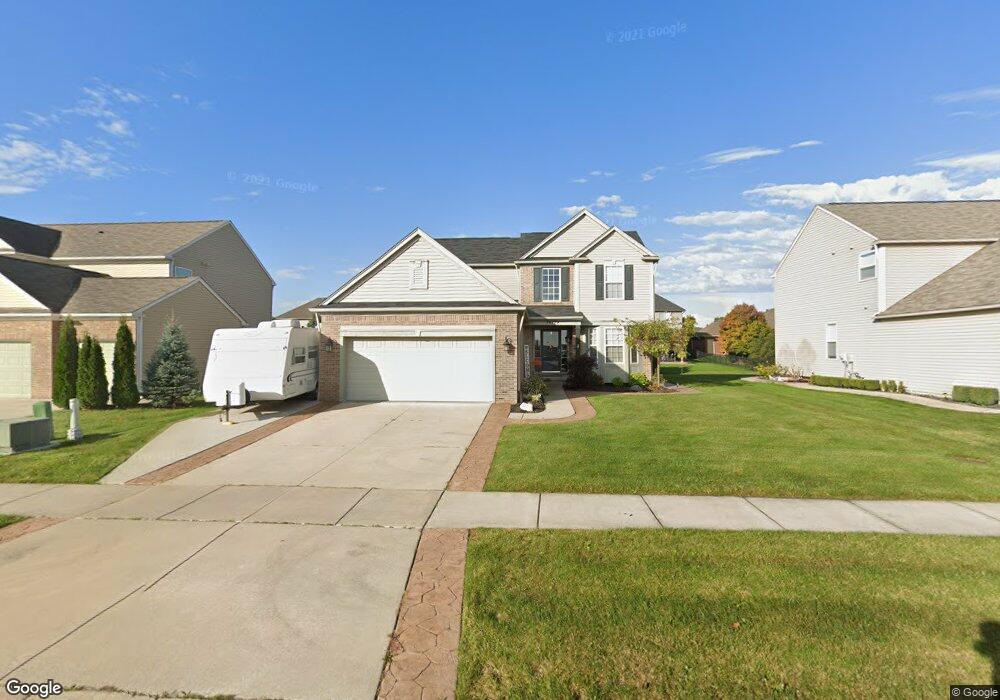
56779 Lindale Ave Unit Bldg-Unit Macomb, MI 48042
Estimated Value: $463,000 - $506,000
Studio
4
Baths
2,088
Sq Ft
$232/Sq Ft
Est. Value
About This Home
This home is located at 56779 Lindale Ave Unit Bldg-Unit, Macomb, MI 48042 and is currently estimated at $483,590, approximately $231 per square foot. 56779 Lindale Ave Unit Bldg-Unit is a home located in Macomb County with nearby schools including New Haven High School, St. Peter Lutheran School, and Lutheran North High School.
Ownership History
Date
Name
Owned For
Owner Type
Purchase Details
Closed on
Jul 13, 2018
Sold by
Stumpf Catherine M and Stumpf Edward Kyle
Bought by
Manzella Kari
Current Estimated Value
Purchase Details
Closed on
Aug 10, 2017
Sold by
Stumpf Catherine M and Stumpf Kyle Edward
Bought by
Stumpf Catherine M and Stumpf Edward Kyle
Purchase Details
Closed on
Sep 23, 2009
Sold by
Pulte Land Company Llc
Bought by
Stumpf Catherine M
Home Financials for this Owner
Home Financials are based on the most recent Mortgage that was taken out on this home.
Original Mortgage
$217,979
Interest Rate
5.1%
Mortgage Type
FHA
Create a Home Valuation Report for This Property
The Home Valuation Report is an in-depth analysis detailing your home's value as well as a comparison with similar homes in the area
Home Values in the Area
Average Home Value in this Area
Purchase History
| Date | Buyer | Sale Price | Title Company |
|---|---|---|---|
| Manzella Kari | $314,000 | None Available | |
| Stumpf Catherine M | -- | None Available | |
| Stumpf Catherine M | $38,500 | None Available |
Source: Public Records
Mortgage History
| Date | Status | Borrower | Loan Amount |
|---|---|---|---|
| Previous Owner | Stumpf Catherine M | $217,979 |
Source: Public Records
Tax History
| Year | Tax Paid | Tax Assessment Tax Assessment Total Assessment is a certain percentage of the fair market value that is determined by local assessors to be the total taxable value of land and additions on the property. | Land | Improvement |
|---|---|---|---|---|
| 2025 | $3,424 | $223,700 | $0 | $0 |
| 2024 | $33 | $202,100 | $0 | $0 |
| 2023 | $3,157 | $180,100 | $0 | $0 |
| 2022 | $5,421 | $153,400 | $0 | $0 |
| 2021 | $6,105 | $146,800 | $0 | $0 |
| 2020 | $4,163 | $144,700 | $0 | $0 |
| 2019 | $7,439 | $137,500 | $0 | $0 |
| 2018 | $3,415 | $130,600 | $0 | $0 |
| 2017 | $3,371 | $123,070 | $30,000 | $93,070 |
| 2016 | $3,194 | $123,040 | $0 | $0 |
| 2015 | $3,202 | $113,250 | $0 | $0 |
| 2014 | $3,202 | $105,710 | $17,000 | $88,710 |
| 2011 | $1,058 | $108,740 | $15,000 | $93,740 |
Source: Public Records
Map
Nearby Homes
- 19164 Hazelton Dr Unit 80
- 56452 Scotland
- 56844 Topaz Dr
- 56508 Topaz Dr
- 18620 Stallmann Dr
- 56386 Desert Ct
- 55649 Faldo Dr Unit 141
- 18064 Stallman Dr
- 17836 Country Club Dr
- 18005 Player Dr
- 17829 Stallman Dr
- 18213 Stallman Dr Unit 137
- 55203 Saint Paul Dr
- 18582 Stallmann Dr
- 55144 Saint Paul Dr
- 55802 Jones Dr
- 17835 Player Dr
- 55809 Jones Dr
- 55809 Jones Dr Unit 113
- 55777 Jones Dr
- 56779 Lindale Ave Unit 53
- 56805 Lindale Ave Unit 52
- 56753 Lindale Ave
- 56824 Holiday Pine Dr
- 56802 Holiday Pine Dr
- 56831 Lindale Ave Unit 51
- 56831 Lindale Ave
- 56727 Lindale Ave Unit 55
- 56780 Holiday Pine Dr
- 56846 Holiday Pine Dr
- 19038 Hazelton Dr
- 19047 Hazelton Dr Unit 57
- 56857 Lindale Ave Unit 50
- 56868 Holiday Pine Dr
- 18949 Pembridge St
- 19021 Pembridge St Unit 88
- 19056 Hazelton Dr Unit 86
- 18931 Pembridge St
- 19065 Hazelton Dr Unit 58
- 56890 Holiday Pine Dr