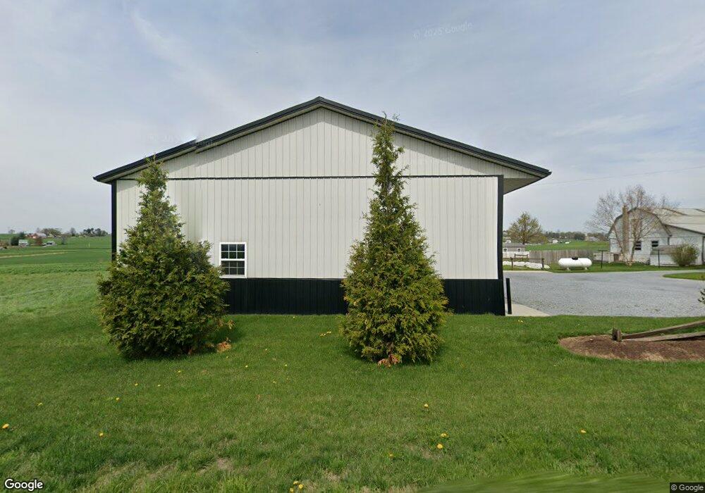
568 Blue Rock Rd New Holland, PA 17557
Estimated Value: $362,000 - $549,000
3
Beds
1
Bath
1,840
Sq Ft
$253/Sq Ft
Est. Value
About This Home
This home is located at 568 Blue Rock Rd, New Holland, PA 17557 and is currently estimated at $465,475, approximately $252 per square foot. 568 Blue Rock Rd is a home with nearby schools including Garden Spot Middle School, Garden Spot Senior High School, and Hinkletown Mennonite School.
Ownership History
Date
Name
Owned For
Owner Type
Purchase Details
Closed on
Jul 28, 2020
Sold by
Martin Michael M
Bought by
Martin Lloyd H and Martin Lucy M
Current Estimated Value
Purchase Details
Closed on
Apr 18, 2017
Sold by
Reiff John D and Reiff Mary Louise
Bought by
Martin Michael M and Reiff Mary Louise
Purchase Details
Closed on
Oct 8, 2012
Sold by
Hoover Jones H and Hoover Katie H
Bought by
Reiff John D
Purchase Details
Closed on
Feb 13, 2006
Sold by
Hoover Ivan W and Hoover Lydia B
Bought by
Hoover Jonas H and Hoover Katie H
Purchase Details
Closed on
Jun 5, 2000
Sold by
Fultz Victoria S
Bought by
Hoover Ivan W and Hoover Lydia B
Create a Home Valuation Report for This Property
The Home Valuation Report is an in-depth analysis detailing your home's value as well as a comparison with similar homes in the area
Home Values in the Area
Average Home Value in this Area
Purchase History
| Date | Buyer | Sale Price | Title Company |
|---|---|---|---|
| Martin Lloyd H | $400,000 | None Available | |
| Martin Michael M | $350,000 | None Available | |
| Reiff John D | $285,000 | None Available | |
| Hoover Jonas H | $255,000 | None Available | |
| Hoover Ivan W | $205,000 | -- |
Source: Public Records
Tax History Compared to Growth
Tax History
| Year | Tax Paid | Tax Assessment Tax Assessment Total Assessment is a certain percentage of the fair market value that is determined by local assessors to be the total taxable value of land and additions on the property. | Land | Improvement |
|---|---|---|---|---|
| 2025 | $3,890 | $217,200 | $84,300 | $132,900 |
| 2024 | $3,890 | $217,200 | $84,300 | $132,900 |
| 2023 | $3,834 | $217,200 | $84,300 | $132,900 |
| 2022 | $3,793 | $217,200 | $84,300 | $132,900 |
| 2021 | $3,732 | $217,200 | $84,300 | $132,900 |
| 2020 | $3,732 | $217,200 | $84,300 | $132,900 |
| 2019 | $3,391 | $199,500 | $84,300 | $115,200 |
| 2018 | $4,814 | $199,500 | $84,300 | $115,200 |
| 2017 | $3,572 | $171,500 | $53,400 | $118,100 |
| 2016 | $3,571 | $171,500 | $53,400 | $118,100 |
| 2015 | $992 | $171,500 | $53,400 | $118,100 |
| 2014 | $2,407 | $171,500 | $53,400 | $118,100 |
Source: Public Records
Map
Nearby Homes
- 575 Red Run Rd
- 205 E Main St
- 61 Gentle Dr
- 200 E Main St
- 232 New St
- 412 Linden St
- 420 Linden St
- 133 Millstone Dr
- 111 Oatfield Dr
- 1258 Main St
- 210 Musser Rd
- 20 N Kinzer Ave
- 148 E Broad St
- 391 E Jackson St
- 385 Valley View Dr
- 144 W Conestoga St
- 220 Sycamore Ln
- 529 Ranck Rd Unit 1
- 529 Ranck Rd Unit 2
- 529 Ranck Rd Unit 3
- 564 Blue Rock Rd
- 558 Blue Rock Rd
- 576 Blue Rock Rd
- 541 Blue Rock Rd
- 511 Blue Rock Rd
- 515 White Oak Rd
- 517 White Oak Rd
- 525 White Oak Rd
- 992 Lancaster Ave
- 528 White Oak Rd
- 684 Lancaster Ave
- 680 Lancaster Ave
- 670 Lancaster Ave
- 687 Lancaster Ave
- 668 Lancaster Ave
- 674 Lancaster Ave
- 672 Lancaster Ave
- 681 Lancaster Ave
- 685 Lancaster Ave
- 675 Lancaster Ave