Estimated Value: $307,000 - $443,000
4
Beds
2
Baths
3,069
Sq Ft
$131/Sq Ft
Est. Value
About This Home
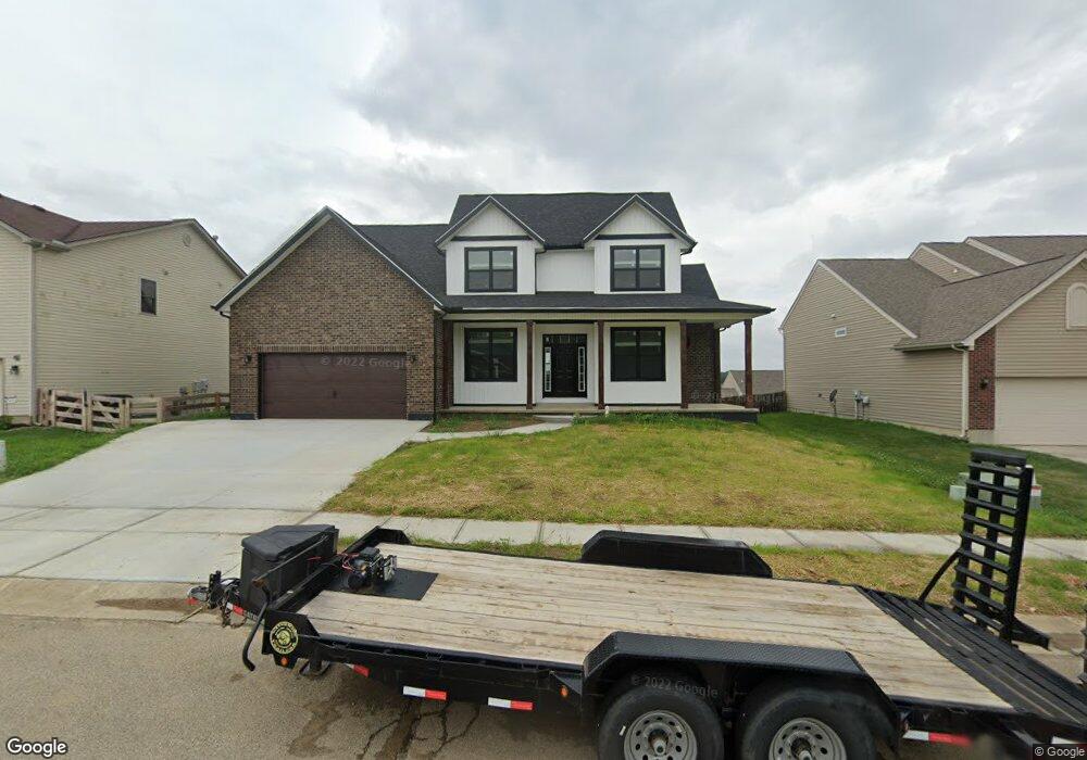
This home is located at 568 Concord Way, Xenia, OH 45385 and is currently estimated at $402,924, approximately $131 per square foot. 568 Concord Way is a home located in Greene County with nearby schools including Xenia High School and Summit Academy Community School for Alternative Learners - Xenia.
Ownership History
Date
Name
Owned For
Owner Type
Purchase Details
Closed on
Apr 23, 2020
Sold by
Solis Construction Llc
Bought by
Solis Jose A
Current Estimated Value
Purchase Details
Closed on
Jan 30, 2012
Sold by
Sheehan Michael E and Sheehan Nancy S
Bought by
Solis Construction Llc
Purchase Details
Closed on
Sep 6, 2007
Sold by
Sheehan Michael E and Sheehan Nancy S
Bought by
Sheehan Michael E and Sheehan Nancy S
Purchase Details
Closed on
Jan 4, 2006
Sold by
Shriner Building Co
Bought by
Sheehan Michael E and Sheehan Nancy S
Create a Home Valuation Report for This Property
The Home Valuation Report is an in-depth analysis detailing your home's value as well as a comparison with similar homes in the area
Home Values in the Area
Average Home Value in this Area
Purchase History
| Date | Buyer | Sale Price | Title Company |
|---|---|---|---|
| Solis Jose A | -- | None Available | |
| Solis Construction Llc | $25,000 | Attorney | |
| Sheehan Michael E | -- | Attorney | |
| Sheehan Michael E | $32,900 | None Available | |
| Shriner Building Co | $32,900 | None Available |
Source: Public Records
Tax History Compared to Growth
Tax History
| Year | Tax Paid | Tax Assessment Tax Assessment Total Assessment is a certain percentage of the fair market value that is determined by local assessors to be the total taxable value of land and additions on the property. | Land | Improvement |
|---|---|---|---|---|
| 2024 | $5,334 | $127,940 | $17,730 | $110,210 |
| 2023 | $5,334 | $127,940 | $17,730 | $110,210 |
| 2022 | $4,771 | $97,560 | $11,820 | $85,740 |
| 2021 | $601 | $11,820 | $11,820 | $0 |
| 2020 | $576 | $11,820 | $11,820 | $0 |
| 2019 | $467 | $9,020 | $9,020 | $0 |
| 2018 | $469 | $9,020 | $9,020 | $0 |
| 2017 | $477 | $9,020 | $9,020 | $0 |
| 2016 | $478 | $9,020 | $9,020 | $0 |
| 2015 | $239 | $9,020 | $9,020 | $0 |
| 2014 | $229 | $9,020 | $9,020 | $0 |
Source: Public Records
Map
Nearby Homes
- 2142 Michigan Dr
- 414 Whisper Ln
- 1874 Pennsylvania Dr
- 219 Kansas Dr
- 1829 Gayhart Dr
- 2758 Wyoming Dr
- 161 Montana Dr
- 1255 Colorado Dr
- 1403 Texas Dr
- 2499 Jenny Marie Dr
- 2421 Louisiana Dr
- 1750 Roxbury Dr
- 0 Berkshire Dr Unit 949217
- 1161 Shannon Ln
- 1778 Arapaho Dr
- 1248 Prem Place
- 1348 Berkshire Dr
- 1568 Cheyenne Dr
- 1318 Prem Place
- 2784 Greystoke Dr