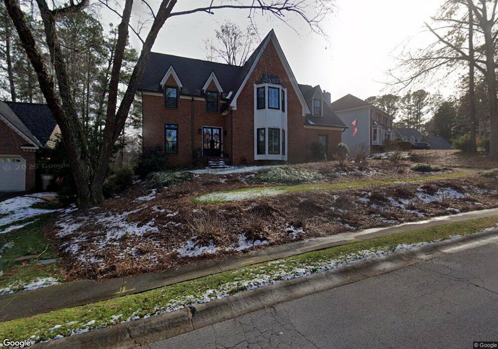
5683 Brookstone Walk NW Unit 2 Acworth, GA 30101
Estimated Value: $519,784 - $632,000
4
Beds
3
Baths
3,140
Sq Ft
$182/Sq Ft
Est. Value
About This Home
This home is located at 5683 Brookstone Walk NW Unit 2, Acworth, GA 30101 and is currently estimated at $571,696, approximately $182 per square foot. 5683 Brookstone Walk NW Unit 2 is a home located in Cobb County with nearby schools including Pickett's Mill Elementary School, Durham Middle School, and Allatoona High School.
Ownership History
Date
Name
Owned For
Owner Type
Purchase Details
Closed on
Aug 17, 2023
Sold by
Smith Raymond Edward and Smith Diane B
Bought by
Smith Raymond Edward and Smith Diane B
Current Estimated Value
Home Financials for this Owner
Home Financials are based on the most recent Mortgage that was taken out on this home.
Original Mortgage
$423,750
Outstanding Balance
$414,360
Interest Rate
6.96%
Mortgage Type
New Conventional
Estimated Equity
$157,336
Purchase Details
Closed on
Apr 30, 1999
Sold by
Mossman Robert Edward L and Mossman Cheryl B
Bought by
Smith Raymond E and Smith Diane B
Home Financials for this Owner
Home Financials are based on the most recent Mortgage that was taken out on this home.
Original Mortgage
$192,350
Interest Rate
7%
Mortgage Type
New Conventional
Create a Home Valuation Report for This Property
The Home Valuation Report is an in-depth analysis detailing your home's value as well as a comparison with similar homes in the area
Home Values in the Area
Average Home Value in this Area
Purchase History
| Date | Buyer | Sale Price | Title Company |
|---|---|---|---|
| Smith Raymond Edward | -- | None Listed On Document | |
| Smith Raymond E | $202,500 | -- |
Source: Public Records
Mortgage History
| Date | Status | Borrower | Loan Amount |
|---|---|---|---|
| Open | Smith Raymond Edward | $423,750 | |
| Previous Owner | Smith Raymond E | $192,350 |
Source: Public Records
Tax History Compared to Growth
Tax History
| Year | Tax Paid | Tax Assessment Tax Assessment Total Assessment is a certain percentage of the fair market value that is determined by local assessors to be the total taxable value of land and additions on the property. | Land | Improvement |
|---|---|---|---|---|
| 2024 | $1,297 | $227,688 | $52,000 | $175,688 |
| 2023 | $938 | $176,620 | $34,000 | $142,620 |
| 2022 | $1,144 | $176,620 | $34,000 | $142,620 |
| 2021 | $1,021 | $135,376 | $34,000 | $101,376 |
| 2020 | $997 | $127,376 | $26,000 | $101,376 |
| 2019 | $997 | $127,376 | $26,000 | $101,376 |
| 2018 | $935 | $106,896 | $24,000 | $82,896 |
| 2017 | $2,654 | $106,896 | $24,000 | $82,896 |
| 2016 | $2,665 | $107,260 | $24,000 | $83,260 |
| 2015 | $2,652 | $103,968 | $24,000 | $79,968 |
| 2014 | $2,671 | $103,968 | $0 | $0 |
Source: Public Records
Map
Nearby Homes
- 1496 Fallsbrook Ct NW
- 1474 Fallsbrook Ct NW Unit 3
- 5711 Brynwood Cir NW
- 5719 Brookstone Walk NW
- 1314 Fallsbrook Terrace NW
- 5396 Turnbill Point NW
- 1313 Fallsbrook Terrace NW
- 5485 Brookstone Dr NW
- 5256 Middleton Place NW
- 1377 Downington Ln NW
- 1799 Mclain Rd NW
- 1390 Downington View NW Unit VI
- 5362 Manor View Dr NW Unit 12
- 5208 Stone Village Cir NW Unit 16
- 5654 Brookstone Dr NW
- The Ashburn Plan at Woodford
- The Rebecca Plan at Woodford
- The Dillard Plan at Woodford
- The Oxford Plan at Woodford
- 5681 Brookstone Walk NW
- 5685 Brookstone Walk NW
- 5684 Brookstone Walk NW Unit II
- 1595 Brynwood Ct NW
- 5687 Brookstone Walk NW
- 5682 Brookstone Walk NW Unit 2
- 5686 Brookstone Walk NW
- 5689 Brookstone Walk NW
- 5680 Brookstone Walk NW
- 5074 Brookstone Walk NW
- 5691 Brookstone Walk NW
- 5688 Brookstone Walk NW Unit 2
- 1591 Brynwood Ct NW Unit 2
- 0 Brynwood Ct Unit 8494706
- 0 Brynwood Ct Unit 7515772
- 0 Brynwood Ct Unit 7372808
- 0 Brynwood Ct Unit 7294156
- 0 Brynwood Ct
- 5678 Brookstone Walk NW Unit II
- 1594 Brynwood Ct NW Unit 2