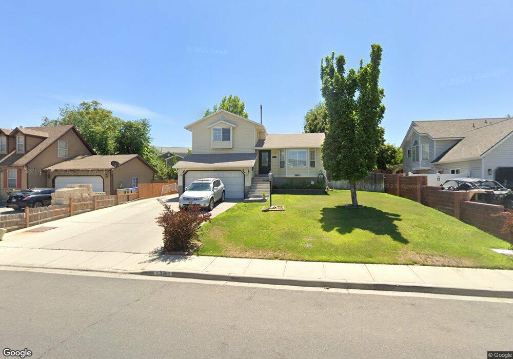
5683 Cape Cod Dr Salt Lake City, UT 84128
Hunter NeighborhoodEstimated Value: $444,000 - $483,000
3
Beds
2
Baths
1,662
Sq Ft
$279/Sq Ft
Est. Value
About This Home
This home is located at 5683 Cape Cod Dr, Salt Lake City, UT 84128 and is currently estimated at $462,896, approximately $278 per square foot. 5683 Cape Cod Dr is a home located in Salt Lake County with nearby schools including Hillside Elementary School, Hunter Jr High School, and Hunter High School.
Ownership History
Date
Name
Owned For
Owner Type
Purchase Details
Closed on
Jul 16, 2007
Sold by
Alvarez Ana Ruth
Bought by
Anderson Brett A and Anderson Ruth M
Current Estimated Value
Home Financials for this Owner
Home Financials are based on the most recent Mortgage that was taken out on this home.
Original Mortgage
$208,000
Outstanding Balance
$129,394
Interest Rate
6.41%
Mortgage Type
Purchase Money Mortgage
Estimated Equity
$333,502
Purchase Details
Closed on
Mar 1, 2004
Sold by
Baker Jerry Darwin
Bought by
Alvarez Ana Ruth
Home Financials for this Owner
Home Financials are based on the most recent Mortgage that was taken out on this home.
Original Mortgage
$137,837
Interest Rate
5.61%
Mortgage Type
FHA
Purchase Details
Closed on
Apr 25, 1995
Sold by
Johnson Harold Grant and Johnson Alexandra
Bought by
Baker Jerry Darwin
Create a Home Valuation Report for This Property
The Home Valuation Report is an in-depth analysis detailing your home's value as well as a comparison with similar homes in the area
Home Values in the Area
Average Home Value in this Area
Purchase History
| Date | Buyer | Sale Price | Title Company |
|---|---|---|---|
| Anderson Brett A | -- | Us Title Of Utah | |
| Alvarez Ana Ruth | -- | Backman Stewart Title Svcs | |
| Baker Jerry Darwin | -- | -- |
Source: Public Records
Mortgage History
| Date | Status | Borrower | Loan Amount |
|---|---|---|---|
| Open | Anderson Brett A | $208,000 | |
| Previous Owner | Alvarez Ana Ruth | $137,837 |
Source: Public Records
Tax History Compared to Growth
Tax History
| Year | Tax Paid | Tax Assessment Tax Assessment Total Assessment is a certain percentage of the fair market value that is determined by local assessors to be the total taxable value of land and additions on the property. | Land | Improvement |
|---|---|---|---|---|
| 2025 | $2,464 | $414,500 | $133,600 | $280,900 |
| 2024 | $2,464 | $376,100 | $123,700 | $252,400 |
| 2023 | $2,362 | $345,200 | $118,900 | $226,300 |
| 2022 | $2,404 | $352,300 | $116,600 | $235,700 |
| 2021 | $2,214 | $291,600 | $89,700 | $201,900 |
| 2020 | $2,012 | $250,000 | $85,000 | $165,000 |
| 2019 | $2,027 | $243,000 | $70,000 | $173,000 |
| 2018 | $1,931 | $223,500 | $70,000 | $153,500 |
| 2017 | $1,752 | $206,200 | $70,000 | $136,200 |
| 2016 | $1,562 | $184,200 | $70,000 | $114,200 |
| 2015 | $1,557 | $174,800 | $72,100 | $102,700 |
| 2014 | $1,526 | $167,900 | $70,000 | $97,900 |
Source: Public Records
Map
Nearby Homes
- 5758 W 4510 S
- 5644 W 4360 S
- 4521 S Tarlton Cir
- 4509 Greystock Cir
- 5944 W Vistas Haven Way Unit 34
- 5950 W 4700 S
- 5936 W Juniper Vista Dr
- 5960 W 4385 S
- 5905 W 4300 S
- 4345 S Long Valley Dr
- 6081 W Haven Ridge Way
- 5335 W Woodstep Ave
- 6104 W Peach Ridge Way
- 5269 W Cherrywood Ln
- 5496 W Peggy Ln
- 6085 W Autumn Vistas Dr
- 6165 W Haven Ridge Way
- 4197 S 6115 W
- 4483 Rodonda Linda Place
- 6278 W Anders Ridge Way
- 5693 Cape Cod Dr
- 5671 Cape Cod Dr
- 5671 W Cape Cod Dr
- 5690 W 4480 S
- 4470 S 5665 W
- 5701 Cape Cod Dr
- 5704 W 4480 S
- 5670 Cape Cod Dr
- 5670 W Cape Cod Dr
- 5658 Cape Cod Dr
- 5682 W Cape Cod Dr
- 5682 Cape Cod Dr
- 4455 S 5720 W
- 4463 S 5720 W
- 4465 S 5665 W
- 5648 Cape Cod Dr
- 5713 Cape Cod Dr
- 4445 S 5720 W
- 5720 W 4480 S
- 5692 Cape Cod Dr