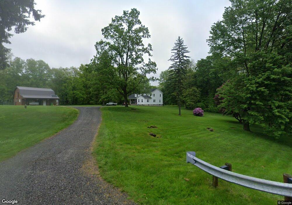
5683 State Route 86 Windsor, OH 44099
Estimated Value: $293,000 - $371,000
3
Beds
1
Bath
2,824
Sq Ft
$118/Sq Ft
Est. Value
About This Home
This home is located at 5683 State Route 86, Windsor, OH 44099 and is currently estimated at $333,052, approximately $117 per square foot. 5683 State Route 86 is a home located in Ashtabula County with nearby schools including Grand Valley Elementary School, Grand Valley Middle School, and Grand Valley High School.
Ownership History
Date
Name
Owned For
Owner Type
Purchase Details
Closed on
Dec 14, 2016
Sold by
Miller Rebecca E and Melburn Miller J
Bought by
Detweiler Kathryn J and Detweiler Daniel A
Current Estimated Value
Home Financials for this Owner
Home Financials are based on the most recent Mortgage that was taken out on this home.
Original Mortgage
$170,000
Outstanding Balance
$137,357
Interest Rate
3.54%
Mortgage Type
New Conventional
Estimated Equity
$195,695
Purchase Details
Closed on
Jan 15, 2003
Sold by
Miller Martin E and Miller Elizabeth M
Bought by
Miller Melburn E
Home Financials for this Owner
Home Financials are based on the most recent Mortgage that was taken out on this home.
Original Mortgage
$115,000
Interest Rate
6.06%
Create a Home Valuation Report for This Property
The Home Valuation Report is an in-depth analysis detailing your home's value as well as a comparison with similar homes in the area
Home Values in the Area
Average Home Value in this Area
Purchase History
| Date | Buyer | Sale Price | Title Company |
|---|---|---|---|
| Detweiler Kathryn J | $155,000 | -- | |
| Miller Melburn E | $115,000 | Continental Title Agency |
Source: Public Records
Mortgage History
| Date | Status | Borrower | Loan Amount |
|---|---|---|---|
| Open | Detweiler Kathryn J | $170,000 | |
| Previous Owner | Miller Melburn E | $115,000 |
Source: Public Records
Tax History Compared to Growth
Tax History
| Year | Tax Paid | Tax Assessment Tax Assessment Total Assessment is a certain percentage of the fair market value that is determined by local assessors to be the total taxable value of land and additions on the property. | Land | Improvement |
|---|---|---|---|---|
| 2024 | $6,990 | $89,250 | $12,670 | $76,580 |
| 2023 | $3,561 | $84,040 | $12,670 | $71,370 |
| 2022 | $1,698 | $34,410 | $9,770 | $24,640 |
| 2021 | $1,714 | $34,410 | $9,770 | $24,640 |
| 2020 | $1,650 | $34,410 | $9,770 | $24,640 |
| 2019 | $1,347 | $27,090 | $8,750 | $18,340 |
| 2018 | $1,275 | $27,090 | $8,750 | $18,340 |
| 2017 | $1,214 | $27,090 | $8,750 | $18,340 |
| 2016 | $1,177 | $23,140 | $7,490 | $15,650 |
| 2015 | $1,154 | $23,140 | $7,490 | $15,650 |
| 2014 | $1,124 | $23,140 | $7,490 | $15,650 |
| 2013 | $1,279 | $25,380 | $7,040 | $18,340 |
Source: Public Records
Map
Nearby Homes
- 5723 Stoneville Rd
- 5834 U S 322
- 0 New Hudson Rd
- 6563 Hyde Rd
- 5769 Hurlburt Rd
- 5700 State Route 534
- V/L Windsor-Mechanicsville Rd
- 12175 Hunt Rd
- 5484 State Route 534
- 26 Grand Valley
- 0 Vl Sunset St
- 10714 Plank Rd
- V/L Eddy Ct
- 4976 Ireland Rd
- 75 Leffingwell Dr
- 0 Laskey Rd Unit 5117810
- 12342 Madison Rd
- 63 Janet Ave
- 13105 Madison Rd
- 16270 Mayfield Rd
- 5689 State Route 86
- 5700 State Route 86
- 5721 State Route 86
- 5619 State Route 86
- 5650 State Route 86
- 5742 State Route 86
- 5672 State Route 86
- 5585 State Route 86
- 5748 State Route 86
- 7301 State Route 534
- 5785 State Route 86
- 5608 State Route 86
- 5614 State Route 86
- 5812 State Route 86
- 7349 State Route 534
- 7373 State Route 534
- 5831 State Route 86
- 7192 State Route 534
- 7218 State Route 534
- 7141 State Route 534