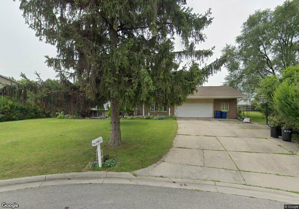
5685 Noel Ct Saginaw, MI 48603
Estimated Value: $246,000 - $277,000
4
Beds
3
Baths
2,443
Sq Ft
$107/Sq Ft
Est. Value
About This Home
This home is located at 5685 Noel Ct, Saginaw, MI 48603 and is currently estimated at $262,209, approximately $107 per square foot. 5685 Noel Ct is a home located in Saginaw County with nearby schools including Weiss Elementary School, Sherwood Elementary School, and White Pine Middle School.
Ownership History
Date
Name
Owned For
Owner Type
Purchase Details
Closed on
Mar 17, 2010
Sold by
Wildfire Credit Union
Bought by
Wheeler Melanie
Current Estimated Value
Home Financials for this Owner
Home Financials are based on the most recent Mortgage that was taken out on this home.
Original Mortgage
$103,098
Outstanding Balance
$70,083
Interest Rate
5.5%
Mortgage Type
FHA
Estimated Equity
$192,126
Purchase Details
Closed on
Sep 30, 2009
Sold by
Short Carl D and Short Nancy J
Bought by
Communications Family Credit Union
Purchase Details
Closed on
Mar 29, 1999
Sold by
Vagnarelli Jane
Bought by
Short Carl David and Short Nancy J
Home Financials for this Owner
Home Financials are based on the most recent Mortgage that was taken out on this home.
Original Mortgage
$107,100
Interest Rate
6.94%
Mortgage Type
VA
Create a Home Valuation Report for This Property
The Home Valuation Report is an in-depth analysis detailing your home's value as well as a comparison with similar homes in the area
Home Values in the Area
Average Home Value in this Area
Purchase History
| Date | Buyer | Sale Price | Title Company |
|---|---|---|---|
| Wheeler Melanie | $105,000 | -- | |
| Communications Family Credit Union | -- | -- | |
| Short Carl David | $105,000 | -- |
Source: Public Records
Mortgage History
| Date | Status | Borrower | Loan Amount |
|---|---|---|---|
| Open | Wheeler Melanie | $103,098 | |
| Previous Owner | Short Carl David | $107,100 |
Source: Public Records
Tax History Compared to Growth
Tax History
| Year | Tax Paid | Tax Assessment Tax Assessment Total Assessment is a certain percentage of the fair market value that is determined by local assessors to be the total taxable value of land and additions on the property. | Land | Improvement |
|---|---|---|---|---|
| 2025 | $3,366 | $133,300 | $0 | $0 |
| 2024 | $1,760 | $116,600 | $0 | $0 |
| 2023 | $1,675 | $99,500 | $0 | $0 |
| 2022 | $2,912 | $87,700 | $0 | $0 |
| 2021 | $2,687 | $76,600 | $0 | $0 |
| 2020 | $2,624 | $71,600 | $0 | $0 |
| 2019 | $2,510 | $70,400 | $8,900 | $61,500 |
| 2018 | $1,320 | $73,100 | $0 | $0 |
| 2017 | $2,328 | $73,600 | $0 | $0 |
| 2016 | $2,301 | $71,800 | $0 | $0 |
| 2014 | $2,216 | $76,500 | $0 | $65,100 |
| 2013 | -- | $74,500 | $0 | $0 |
Source: Public Records
Map
Nearby Homes
- 5568 Mary Ct
- 5564 Katherine Ct
- 5475 George St
- 1839 Kingston Dr
- 1900 Bunny Trail
- 2201 Augsburg Dr
- 2611 Chapel Dr E
- 70 Bunny Trail
- 80 Deer Trail
- 76 Foxwood Dr
- 74 Foxwood Dr
- 72 Bunny Trail
- 71 Bunny Trail
- 69 Bunny Trail
- 68 Bunny Trail
- 67 Bunny Trail
- 2105 Marlou Ct
- 75 Foxwood Dr
- 73 Foxwood Dr
- 79 Deer Trail
- 5663 Noel Ct
- 0 Noel Ct
- 5661 Noel Ct
- 5696 George St
- 5680 George St
- 5682 Noel Ct
- 2099 Fabian Dr
- 5662 Noel Ct
- 2175 Fabian Dr
- 2130 Fabian Dr
- 15 Commons West Ct
- 16 Commons West Ct
- 5630 George St
- 14 Commons West Ct
- 2100 Wieneke Rd
- 17 Commons West Ct Unit 17
- 13 Commons West Ct
- 5614 Adrian St
- 5610 George St
- 5603 Adrian St