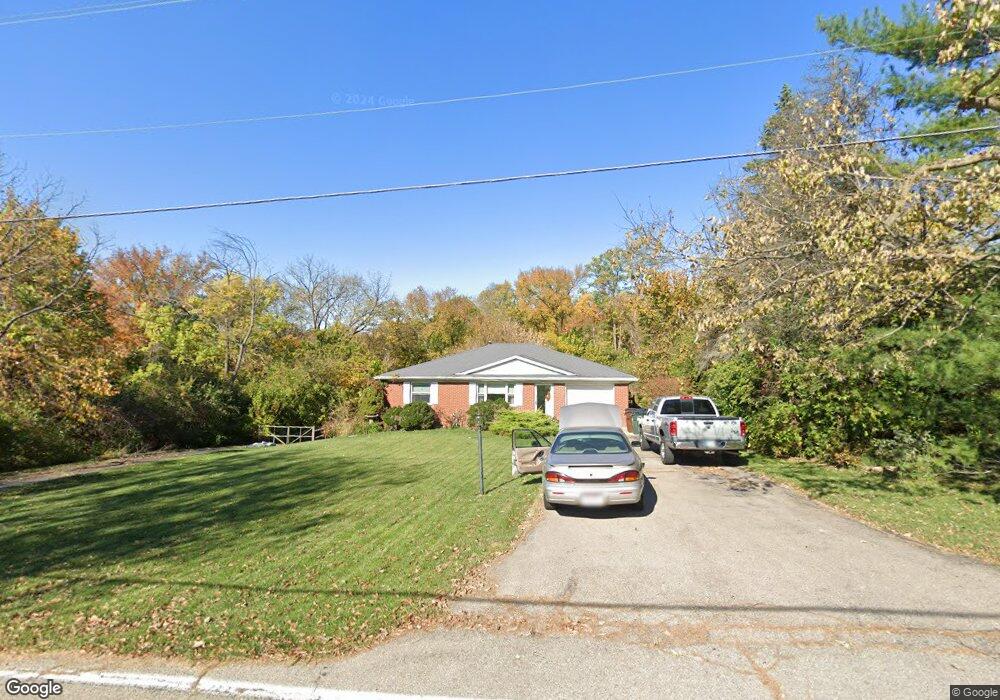
5686 Dunlap Rd Cincinnati, OH 45252
Estimated Value: $300,000 - $424,000
4
Beds
3
Baths
1,758
Sq Ft
$197/Sq Ft
Est. Value
About This Home
This home is located at 5686 Dunlap Rd, Cincinnati, OH 45252 and is currently estimated at $346,387, approximately $197 per square foot. 5686 Dunlap Rd is a home located in Hamilton County with nearby schools including Colerain Elementary School, Colerain Middle School, and Colerain High School.
Ownership History
Date
Name
Owned For
Owner Type
Purchase Details
Closed on
Sep 26, 2019
Sold by
Pfankuch Sandra J and Pfankuch James E
Bought by
Pfankuch Sandra J and Pfankuch James E
Current Estimated Value
Purchase Details
Closed on
Aug 12, 2019
Sold by
Estate Of Dolores J Pfankuch
Bought by
Pfankuch Sandra J and Pfankuch James E
Purchase Details
Closed on
Sep 1, 1998
Sold by
Pfankuch James E and Pkankuch Dolores
Bought by
Pfankuch James E and Pfankuch Dolores
Create a Home Valuation Report for This Property
The Home Valuation Report is an in-depth analysis detailing your home's value as well as a comparison with similar homes in the area
Home Values in the Area
Average Home Value in this Area
Purchase History
| Date | Buyer | Sale Price | Title Company |
|---|---|---|---|
| Pfankuch Sandra J | -- | None Available | |
| Pfankuch Sandra J | $53,000 | None Available | |
| Pfankuch Sandra J | -- | None Available | |
| Pfankuch James E | -- | -- |
Source: Public Records
Tax History
| Year | Tax Paid | Tax Assessment Tax Assessment Total Assessment is a certain percentage of the fair market value that is determined by local assessors to be the total taxable value of land and additions on the property. | Land | Improvement |
|---|---|---|---|---|
| 2025 | $4,878 | $82,548 | $20,276 | $62,272 |
| 2023 | $4,591 | $82,548 | $20,276 | $62,272 |
| 2022 | $4,268 | $62,763 | $20,465 | $42,298 |
| 2021 | $4,309 | $62,763 | $20,465 | $42,298 |
| 2020 | $4,258 | $62,763 | $20,465 | $42,298 |
| 2019 | $4,326 | $59,210 | $19,306 | $39,904 |
| 2018 | $3,892 | $59,210 | $19,306 | $39,904 |
| 2017 | $3,740 | $59,210 | $19,306 | $39,904 |
| 2016 | $3,408 | $55,633 | $18,921 | $36,712 |
| 2015 | $3,437 | $55,633 | $18,921 | $36,712 |
| 2014 | $3,443 | $55,633 | $18,921 | $36,712 |
| 2013 | $3,345 | $56,767 | $19,306 | $37,461 |
Source: Public Records
Map
Nearby Homes
- 4255 Miamitrail Ln
- 0 Miamitrail Ln Unit 1852362
- 5285 Yeatman Rd
- 0 Stone Mill Rd Unit 1866794
- 0 Stone Mill Rd Unit 1846428
- 1 Stone Mill Rd
- 5250 Yeatman Rd
- 11961 Stonequarry Ct
- 5560 Birch Dr
- 2781 Logan Ln Vc103
- 2379 Elda Dr
- 340 River Valley Dt
- 3330 Celedon Ct
- 4201 Dry Run Dr
- 30 Trappist Walk
- 2834 Wyatt Way
- 2800 Venice Crossing
- 2811 Wyatt Way
- 3978 Lukas Ln
- 3985 Lukas Ln
- 5680 Dunlap Rd
- 5673 Dunlap Rd
- 5704 Squirrelsnest Ln
- 5705 Dunlap Rd
- 5672 Dunlap Rd
- 5698 Dunlap Rd
- 5664 Dunlap Rd
- 5702 Dunlap Rd
- 5712 Squirrelsnest Ln
- 5708 Dunlap Rd
- 5665 Dunlap Rd
- 5665 Dunlap Rd Unit 1
- 5715 Dunlap Rd
- 5661 Dunlap Rd
- 11639 Colerain Ave
- 5730 Squirrelsnest Ln
- 5708 Squirrelsnest Ln
- 11643 Colerain Ave
- 5714 Dunlap Rd
- 11601 Colerain Ave
Your Personal Tour Guide
Ask me questions while you tour the home.