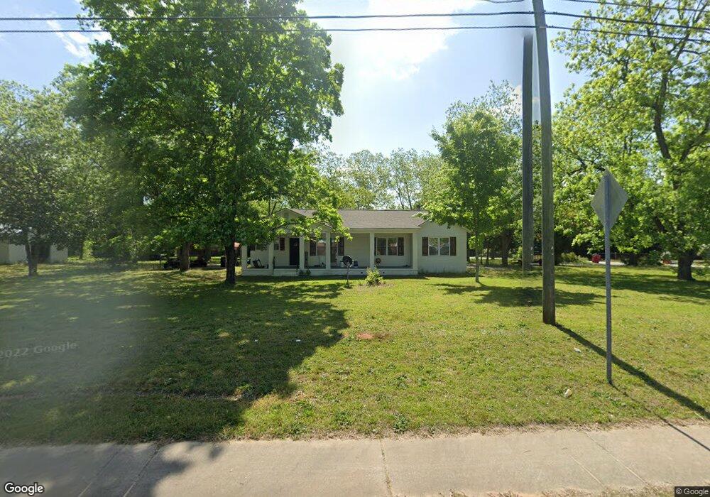
5688 Houston Rd Macon, GA 31216
Estimated Value: $140,000 - $190,000
2
Beds
1
Bath
1,286
Sq Ft
$127/Sq Ft
Est. Value
About This Home
This home is located at 5688 Houston Rd, Macon, GA 31216 and is currently estimated at $162,871, approximately $126 per square foot. 5688 Houston Rd is a home located in Bibb County with nearby schools including Porter Elementary School, Rutland Middle School, and Rutland High School.
Ownership History
Date
Name
Owned For
Owner Type
Purchase Details
Closed on
Dec 30, 2024
Sold by
Forsyth Investment Properties Llc
Bought by
Rum Creek Holdings Llc
Current Estimated Value
Purchase Details
Closed on
Aug 4, 2021
Sold by
Gavel Francis X
Bought by
Forsyth Investment Properties Llc
Purchase Details
Closed on
Nov 30, 1998
Sold by
Defore Bertha C
Bought by
Nipper Robert D
Create a Home Valuation Report for This Property
The Home Valuation Report is an in-depth analysis detailing your home's value as well as a comparison with similar homes in the area
Home Values in the Area
Average Home Value in this Area
Purchase History
| Date | Buyer | Sale Price | Title Company |
|---|---|---|---|
| Rum Creek Holdings Llc | $175,000 | None Listed On Document | |
| Rum Creek Holdings Llc | $175,000 | None Listed On Document | |
| Forsyth Investment Properties Llc | $21,250 | None Available | |
| Forsyth Investment Properties Llc | $21,250 | None Available | |
| Nipper Robert D | -- | -- |
Source: Public Records
Tax History Compared to Growth
Tax History
| Year | Tax Paid | Tax Assessment Tax Assessment Total Assessment is a certain percentage of the fair market value that is determined by local assessors to be the total taxable value of land and additions on the property. | Land | Improvement |
|---|---|---|---|---|
| 2025 | $1,080 | $43,929 | $4,798 | $39,131 |
| 2024 | $1,103 | $43,432 | $4,798 | $38,634 |
| 2023 | $1,103 | $43,432 | $4,798 | $38,634 |
| 2022 | $1,300 | $37,543 | $10,286 | $27,257 |
| 2021 | $828 | $35,647 | $10,286 | $25,361 |
| 2020 | $846 | $35,647 | $10,286 | $25,361 |
| 2019 | $852 | $35,647 | $10,286 | $25,361 |
| 2018 | $1,484 | $35,647 | $10,286 | $25,361 |
| 2017 | $805 | $35,647 | $10,286 | $25,361 |
| 2016 | $733 | $35,647 | $10,286 | $25,361 |
| 2015 | $1,034 | $35,455 | $10,286 | $25,169 |
| 2014 | $345 | $35,455 | $10,286 | $25,169 |
Source: Public Records
Map
Nearby Homes
- 2931 Martha Ann Blvd
- 5706 Houston Rd
- 2934 Martha Ann Blvd
- 0 Martha Ann Blvd Unit 3204582
- 0 Martha Ann Blvd
- 5718 Houston Rd
- 2929 Martha Ann Blvd
- 5712 Knowles Dr
- 5730 Houston Rd
- 5718 Knowles Dr
- 5683 Houston Rd
- 5731 Knowles Dr
- 5644 Houston Rd
- 5730 Knowles Dr
- 3045 Marie Cir
- 3044 Hartley Bridge Rd
- 2850 Pearson Cir
- 3027 Marie Cir
- 2840 Pearson Cir
- 2840 Pear Cir