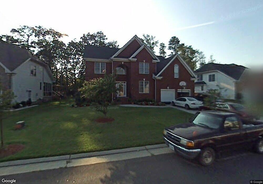
569 Hunts Pointe Dr Virginia Beach, VA 23464
Estimated Value: $667,961 - $770,000
6
Beds
4
Baths
3,849
Sq Ft
$188/Sq Ft
Est. Value
About This Home
This home is located at 569 Hunts Pointe Dr, Virginia Beach, VA 23464 and is currently estimated at $722,490, approximately $187 per square foot. 569 Hunts Pointe Dr is a home located in Virginia Beach City with nearby schools including Woodstock Elementary School, Kempsville Middle School, and Kempsville High School.
Ownership History
Date
Name
Owned For
Owner Type
Purchase Details
Closed on
Apr 7, 2023
Sold by
Jones Frederick O and Jones Sylvia C
Bought by
Dunbar-Harris Kia
Current Estimated Value
Home Financials for this Owner
Home Financials are based on the most recent Mortgage that was taken out on this home.
Original Mortgage
$668,019
Outstanding Balance
$638,764
Interest Rate
4%
Mortgage Type
VA
Estimated Equity
$83,726
Create a Home Valuation Report for This Property
The Home Valuation Report is an in-depth analysis detailing your home's value as well as a comparison with similar homes in the area
Home Values in the Area
Average Home Value in this Area
Purchase History
| Date | Buyer | Sale Price | Title Company |
|---|---|---|---|
| Dunbar-Harris Kia | $653,000 | Fidelity National Title |
Source: Public Records
Mortgage History
| Date | Status | Borrower | Loan Amount |
|---|---|---|---|
| Open | Dunbar-Harris Kia | $668,019 |
Source: Public Records
Tax History Compared to Growth
Tax History
| Year | Tax Paid | Tax Assessment Tax Assessment Total Assessment is a certain percentage of the fair market value that is determined by local assessors to be the total taxable value of land and additions on the property. | Land | Improvement |
|---|---|---|---|---|
| 2025 | $5,841 | $680,100 | $140,000 | $540,100 |
| 2024 | $5,841 | $602,200 | $140,000 | $462,200 |
| 2023 | $5,913 | $597,300 | $138,000 | $459,300 |
| 2022 | $5,503 | $555,900 | $120,000 | $435,900 |
| 2021 | $4,585 | $463,100 | $128,400 | $334,700 |
| 2020 | $4,527 | $444,900 | $127,200 | $317,700 |
| 2019 | $4,408 | $422,300 | $123,600 | $298,700 |
| 2018 | $4,234 | $422,300 | $123,600 | $298,700 |
| 2017 | $4,141 | $413,100 | $108,000 | $305,100 |
| 2016 | $4,090 | $413,100 | $108,000 | $305,100 |
| 2015 | $4,047 | $408,800 | $108,000 | $300,800 |
| 2014 | $3,453 | $409,500 | $114,000 | $295,500 |
Source: Public Records
Map
Nearby Homes
- 1017 Sunnyside Dr
- 605 S Military Hwy
- 969 Sunnyside Dr
- 877 Whistling Swan Dr
- 952 Redwood Cir
- 897 Whistling Swan Dr
- 1037 Pebblewood Dr
- 940 Westerly Trail
- 928 Redwood Cir
- 801 Kings Creek Dr
- 5926 Mcginnis Cir
- 540 Sterling Rd
- 808 Raymond Ct
- 568 Sterling Rd
- 729 Howell St
- 3396 Monticello Dr
- 5833 Sherman Ct
- 5805 Sherman Ct
- 5809 Sherman Ct
- 5817 Sherman Ct
- 573 Hunts Pointe Dr
- 565 Hunts Pointe Dr
- 577 Hunts Pointe Dr
- 561 Hunts Pointe Dr
- 568 Hunts Pointe Dr
- 564 Hunts Pointe Dr
- 572 Hunts Pointe Dr
- 560 Hunts Pointe Dr
- 576 Hunts Pointe Dr
- 581 Hunts Pointe Dr
- 557 Hunts Pointe Dr
- 580 Hunts Pointe Dr
- 6205 Sunnyside Dr
- 613 Cardamon Dr
- 609 Cardamon Dr
- 585 Hunts Pointe Dr
- 617 Cardamon Dr
- 605 Cardamon Dr
- 584 Hunts Pointe Dr
- 621 Cardamon Dr