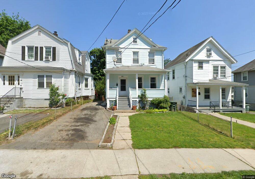
569 Locust Ave Port Chester, NY 10573
Estimated Value: $618,338 - $724,000
3
Beds
2
Baths
1,404
Sq Ft
$477/Sq Ft
Est. Value
About This Home
This home is located at 569 Locust Ave, Port Chester, NY 10573 and is currently estimated at $669,085, approximately $476 per square foot. 569 Locust Ave is a home located in Westchester County with nearby schools including Port Chester Middle School, Port Chester Senior High School, and Westchester Fairfield Hebrew A.
Ownership History
Date
Name
Owned For
Owner Type
Purchase Details
Closed on
Nov 13, 2001
Sold by
Ciosek Andrzej and Ciosek Marzanna
Bought by
Espichan Pedro
Current Estimated Value
Home Financials for this Owner
Home Financials are based on the most recent Mortgage that was taken out on this home.
Original Mortgage
$286,000
Interest Rate
7.08%
Mortgage Type
Unknown
Create a Home Valuation Report for This Property
The Home Valuation Report is an in-depth analysis detailing your home's value as well as a comparison with similar homes in the area
Home Values in the Area
Average Home Value in this Area
Purchase History
| Date | Buyer | Sale Price | Title Company |
|---|---|---|---|
| Espichan Pedro | $318,000 | The Judicial Title Ins Agenc |
Source: Public Records
Mortgage History
| Date | Status | Borrower | Loan Amount |
|---|---|---|---|
| Previous Owner | Espichan Pedro | $286,000 |
Source: Public Records
Tax History Compared to Growth
Tax History
| Year | Tax Paid | Tax Assessment Tax Assessment Total Assessment is a certain percentage of the fair market value that is determined by local assessors to be the total taxable value of land and additions on the property. | Land | Improvement |
|---|---|---|---|---|
| 2024 | $11,320 | $484,000 | $115,900 | $368,100 |
| 2023 | $10,733 | $452,300 | $110,400 | $341,900 |
| 2022 | $9,744 | $426,700 | $110,400 | $316,300 |
| 2021 | $10,665 | $381,000 | $110,400 | $270,600 |
| 2020 | $12,700 | $373,500 | $110,400 | $263,100 |
| 2019 | $16,461 | $418,100 | $139,400 | $278,700 |
| 2018 | $8,818 | $409,100 | $137,000 | $272,100 |
| 2017 | $1,477 | $405,600 | $135,700 | $269,900 |
| 2016 | $13,278 | $335,500 | $98,300 | $237,200 |
| 2015 | -- | $347,300 | $108,100 | $239,200 |
| 2014 | -- | $279,000 | $82,800 | $196,200 |
| 2013 | -- | $279,000 | $82,800 | $196,200 |
Source: Public Records
Map
Nearby Homes
- 558 Locust Ave
- 238 Madison Ave
- 38 Riverdale Ave
- 531 1/2 Willett Ave
- 180 Madison Ave
- 518 Locust Ave
- 53 Linden St
- 26 Homestead Ln Unit A
- 340 Locust Ave
- 23 Pemberwick Rd
- 412 Orchard St
- 17 Austin Place
- 14 Sherman Ave
- 95 Byram Rd
- 18 Sherman Ave
- 28 1/2 Pilgrim Dr
- 484 King St
- 220 Chestnut St Unit 2K
- 70 Byram Terrace Dr
- 16 Rollhaus Place
- 571 Locust Ave
- 565 Locust Ave
- 573 Locust Ave
- 563 Locust Ave
- 561 Locust Ave
- 254 Madison Ave Unit 2
- 254 Madison Ave
- 242 Madison Ave
- 559 Locust Ave
- 240 Madison Ave
- 252 Madison Ave
- 568 Locust Ave
- 579 Locust Ave
- 570 Locust Ave
- 566 Locust Ave
- 572 Locust Ave
- 234 Madison Ave
- 562 Locust Ave
- 557 Locust Ave
- 258 Madison Ave