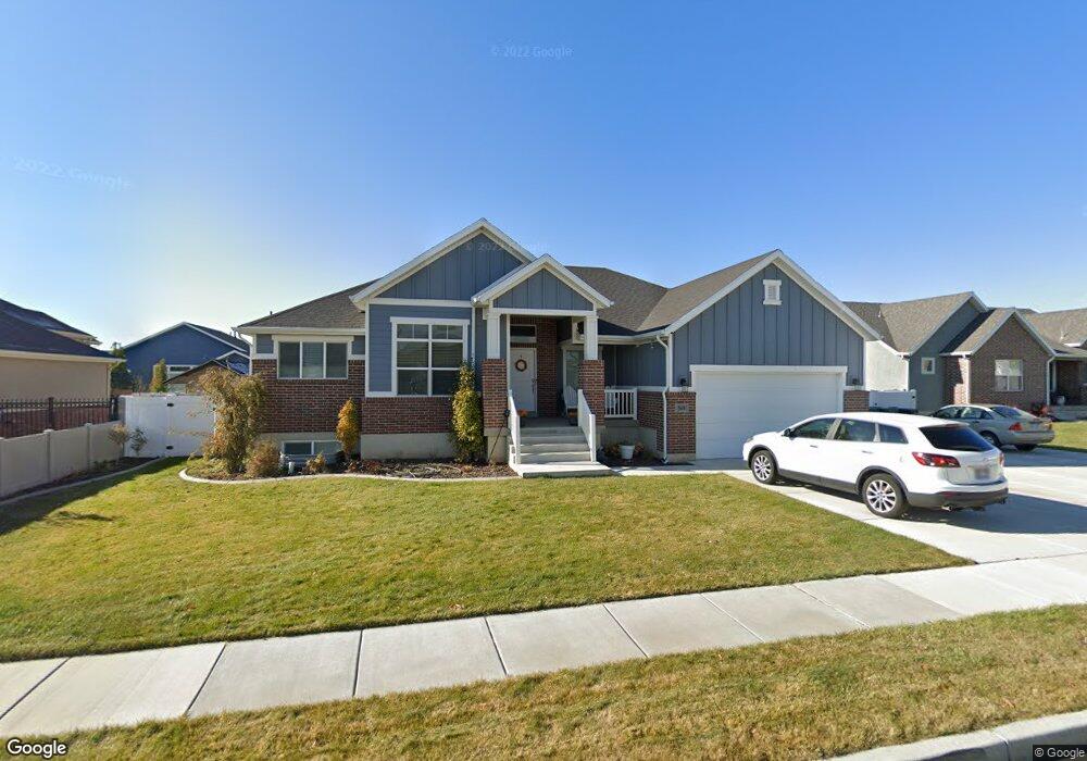
569 N 3500 W Unit 112 Layton, UT 84041
Estimated Value: $772,000 - $841,919
5
Beds
3
Baths
3,866
Sq Ft
$209/Sq Ft
Est. Value
About This Home
This home is located at 569 N 3500 W Unit 112, Layton, UT 84041 and is currently estimated at $806,730, approximately $208 per square foot. 569 N 3500 W Unit 112 is a home located in Davis County with nearby schools including Sand Springs Elementary School, Legacy Junior High School, and Layton High School.
Ownership History
Date
Name
Owned For
Owner Type
Purchase Details
Closed on
Jul 19, 2017
Sold by
Rollins Thor Sheldon
Bought by
Rollins Thor Sheldon and Rollins Jennifer
Current Estimated Value
Home Financials for this Owner
Home Financials are based on the most recent Mortgage that was taken out on this home.
Original Mortgage
$375,500
Outstanding Balance
$312,063
Interest Rate
3.9%
Mortgage Type
New Conventional
Estimated Equity
$494,667
Purchase Details
Closed on
Feb 13, 2017
Sold by
Nilson & Co Inc
Bought by
Rollins Thor Sheldon
Home Financials for this Owner
Home Financials are based on the most recent Mortgage that was taken out on this home.
Original Mortgage
$348,796
Interest Rate
4.2%
Mortgage Type
Commercial
Create a Home Valuation Report for This Property
The Home Valuation Report is an in-depth analysis detailing your home's value as well as a comparison with similar homes in the area
Home Values in the Area
Average Home Value in this Area
Purchase History
| Date | Buyer | Sale Price | Title Company |
|---|---|---|---|
| Rollins Thor Sheldon | -- | Stewart Title | |
| Rollins Thor Sheldon | -- | -- | |
| Nilson & Co Inc | -- | -- |
Source: Public Records
Mortgage History
| Date | Status | Borrower | Loan Amount |
|---|---|---|---|
| Open | Rollins Thor Sheldon | $375,500 | |
| Closed | Rollins Thor Sheldon | $348,796 |
Source: Public Records
Tax History Compared to Growth
Tax History
| Year | Tax Paid | Tax Assessment Tax Assessment Total Assessment is a certain percentage of the fair market value that is determined by local assessors to be the total taxable value of land and additions on the property. | Land | Improvement |
|---|---|---|---|---|
| 2025 | $4,417 | $463,650 | $125,517 | $338,133 |
| 2024 | $4,177 | $441,649 | $135,658 | $305,991 |
| 2023 | $4,029 | $413,050 | $77,378 | $335,671 |
| 2022 | $4,315 | $794,000 | $152,070 | $641,930 |
| 2021 | $4,034 | $609,000 | $125,453 | $483,547 |
| 2020 | $3,660 | $530,000 | $106,693 | $423,307 |
| 2019 | $3,680 | $522,000 | $106,704 | $415,296 |
| 2018 | $3,329 | $474,000 | $93,892 | $380,108 |
| 2016 | $948 | $69,645 | $69,645 | $0 |
Source: Public Records
Map
Nearby Homes
- 555 N 3500 W
- 591 N 3500 W Unit 111
- 590 N 3550 W Unit 116
- 552 N 3550 W
- 568 N 3500 W Unit 107
- 556 N 3500 W Unit 106
- 592 N 3500 W Unit 108
- 605 N 3500 W Unit 110
- 605 N 3500 W
- 610 N 3550 W Unit 117
- 3527 W 550 N Unit 103
- 602 N 3500 W
- 3509 W 550 N Unit 104
- 3509 W 550 N
- 575 N 3550 W Unit 120
- 3468 W 550 N
- 3547 W 550 N Unit 102
- 553 N 3550 W Unit 121
- 585 N 3450 W
- 3578 W 550 N Unit 121