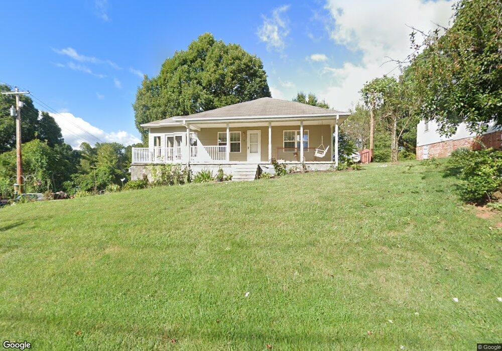
569 N Main St Mars Hill, NC 28754
Estimated Value: $227,037 - $354,000
--
Bed
--
Bath
1,085
Sq Ft
$267/Sq Ft
Est. Value
About This Home
This home is located at 569 N Main St, Mars Hill, NC 28754 and is currently estimated at $290,009, approximately $267 per square foot. 569 N Main St is a home located in Madison County with nearby schools including Madison Middle School.
Ownership History
Date
Name
Owned For
Owner Type
Purchase Details
Closed on
Nov 28, 2017
Sold by
Henson Matthew R and Henson Emily Fawcett
Bought by
Herrelson Rodney W
Current Estimated Value
Home Financials for this Owner
Home Financials are based on the most recent Mortgage that was taken out on this home.
Original Mortgage
$120,650
Outstanding Balance
$101,498
Interest Rate
3.91%
Mortgage Type
New Conventional
Estimated Equity
$188,511
Purchase Details
Closed on
Dec 16, 2014
Sold by
Cole Sara and Cole Scott
Bought by
Henson Matthew R
Home Financials for this Owner
Home Financials are based on the most recent Mortgage that was taken out on this home.
Original Mortgage
$104,081
Interest Rate
4.03%
Mortgage Type
New Conventional
Create a Home Valuation Report for This Property
The Home Valuation Report is an in-depth analysis detailing your home's value as well as a comparison with similar homes in the area
Home Values in the Area
Average Home Value in this Area
Purchase History
| Date | Buyer | Sale Price | Title Company |
|---|---|---|---|
| Herrelson Rodney W | $127,000 | None Available | |
| Henson Matthew R | $102,000 | None Available |
Source: Public Records
Mortgage History
| Date | Status | Borrower | Loan Amount |
|---|---|---|---|
| Open | Herrelson Rodney W | $120,650 | |
| Previous Owner | Henson Matthew R | $104,081 |
Source: Public Records
Tax History Compared to Growth
Tax History
| Year | Tax Paid | Tax Assessment Tax Assessment Total Assessment is a certain percentage of the fair market value that is determined by local assessors to be the total taxable value of land and additions on the property. | Land | Improvement |
|---|---|---|---|---|
| 2024 | $475 | $81,837 | $26,066 | $55,771 |
| 2023 | $471 | $58,130 | $26,444 | $31,686 |
| 2022 | $471 | $58,130 | $26,444 | $31,686 |
| 2021 | $471 | $58,130 | $26,444 | $31,686 |
| 2020 | $471 | $58,130 | $26,444 | $31,686 |
| 2019 | $443 | $51,432 | $25,990 | $25,442 |
| 2018 | $267 | $0 | $0 | $0 |
| 2017 | $176 | $0 | $0 | $0 |
| 2016 | $176 | $0 | $0 | $0 |
| 2015 | -- | $0 | $0 | $0 |
| 2014 | -- | $17,743 | $17,743 | $0 |
| 2013 | -- | $51,432 | $25,990 | $25,442 |
Source: Public Records
Map
Nearby Homes
- 29 Ponder St
- 85 Pine Ridge Rd
- 96 Chestnut Ln Unit 96
- 00 Parkway View Rd
- 224 Country Dr
- Lot 15 Mountain Gait Dr
- 135 Quinn Hill Ln Unit 101
- 169 Quinn Hill Ln Unit 76
- 244 Country Dr
- 217 Quinn Hill Ln Unit 94
- 275 Quinn Hill Ln Unit 90
- 261 Quinn Hill Ln Unit 91
- 321 Quinn Hill Ln Unit 86
- 380 Quinn Hill Ln Unit 51
- 692 Oak Ridge Ln Unit 61-Lot-A
- 999B Sams Dr
- 1672 Crossroads Pkwy
- 1475 Crossroads Pkwy
- 299 Ridgeview Ln
- 99999 Little Pond Pass Unit E21