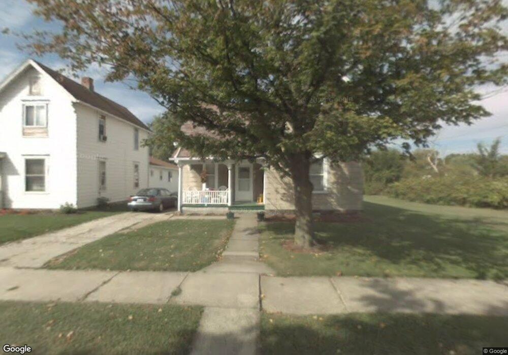
569 N Mulberry St Mansfield, OH 44902
Estimated Value: $93,646 - $110,000
3
Beds
2
Baths
1,684
Sq Ft
$59/Sq Ft
Est. Value
About This Home
This home is located at 569 N Mulberry St, Mansfield, OH 44902 and is currently estimated at $100,162, approximately $59 per square foot. 569 N Mulberry St is a home located in Richland County with nearby schools including Goal Digital Academy, St. Peter's Elementary/Montessori School, and St. Peter's High School/Junior High.
Ownership History
Date
Name
Owned For
Owner Type
Purchase Details
Closed on
Jun 30, 2016
Sold by
Holt Barbara A
Bought by
Smith Henry
Current Estimated Value
Purchase Details
Closed on
Apr 29, 2014
Sold by
Holt Barbara A
Bought by
Holt Barbara A
Purchase Details
Closed on
Aug 13, 1996
Sold by
Deley Mary E
Bought by
Holt Barbara A
Create a Home Valuation Report for This Property
The Home Valuation Report is an in-depth analysis detailing your home's value as well as a comparison with similar homes in the area
Home Values in the Area
Average Home Value in this Area
Purchase History
| Date | Buyer | Sale Price | Title Company |
|---|---|---|---|
| Smith Henry | $8,400 | None Available | |
| Holt Barbara A | -- | Attorney | |
| Holt Barbara A | $15,500 | -- |
Source: Public Records
Tax History Compared to Growth
Tax History
| Year | Tax Paid | Tax Assessment Tax Assessment Total Assessment is a certain percentage of the fair market value that is determined by local assessors to be the total taxable value of land and additions on the property. | Land | Improvement |
|---|---|---|---|---|
| 2024 | $90 | $11,630 | $1,720 | $9,910 |
| 2023 | $86 | $11,630 | $1,720 | $9,910 |
| 2022 | $180 | $11,970 | $1,560 | $10,410 |
| 2021 | $181 | $11,970 | $1,560 | $10,410 |
| 2020 | $689 | $11,970 | $1,560 | $10,410 |
| 2019 | $763 | $11,970 | $1,560 | $10,410 |
| 2018 | $753 | $11,970 | $1,560 | $10,410 |
| 2017 | $687 | $11,970 | $1,560 | $10,410 |
| 2016 | $642 | $10,170 | $2,470 | $7,700 |
| 2015 | $627 | $10,170 | $2,470 | $7,700 |
| 2014 | $619 | $10,170 | $2,470 | $7,700 |
| 2012 | $573 | $10,170 | $2,600 | $7,570 |
Source: Public Records
Map
Nearby Homes
- 526 Bowman St
- 156 Buckingham Ave Unit 158
- 452 Daisy St
- 283 Bulkley Ave
- 743 Bowman St
- 371 Bell St
- 0 Voegele Ave Unit Lot 6048, 6049, 6
- 426 Mcpherson St
- 0 Highway 30
- 512 Burns St
- 458 Wayne St
- 362-364 W 6th St
- 346 Newman St
- 169 W 5th St
- 282 W 5th St
- 219 W 5th St
- 311 Auburn St
- 0 State Route 314 Unit 9067316
- 0 State Route 314 Unit 225021979
- 237 Helen Ave
- 563 N Mulberry St
- 577 N Mulberry St
- 559 N Mulberry St
- 581 N Mulberry St
- 555 N Mulberry St
- 552 Lida St
- 556 Lida St
- 546 Lida St
- 564 N Mulberry St
- 570 N Mulberry St
- 560 Lida St
- 556 N Mulberry St
- 538 Lida St
- 534 Lida St
- 580 N Mulberry St
- 543 N Mulberry St
- 572 Lida St
- 584 N Mulberry St
- 548 N Mulberry St
- 537 N Mulberry St