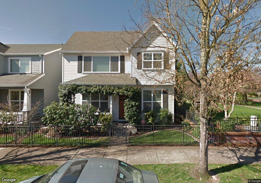
569 NE 63rd Ave Hillsboro, OR 97124
Orenco Station NeighborhoodEstimated Value: $567,370 - $602,000
3
Beds
3
Baths
1,830
Sq Ft
$316/Sq Ft
Est. Value
About This Home
This home is located at 569 NE 63rd Ave, Hillsboro, OR 97124 and is currently estimated at $578,843, approximately $316 per square foot. 569 NE 63rd Ave is a home located in Washington County with nearby schools including Quatama Elementary School, J.W. Poynter Middle School, and Liberty High School.
Ownership History
Date
Name
Owned For
Owner Type
Purchase Details
Closed on
Dec 5, 2003
Sold by
West Hills Development Co
Bought by
Tankersley Jerry D and Tankersley Frances L
Current Estimated Value
Home Financials for this Owner
Home Financials are based on the most recent Mortgage that was taken out on this home.
Original Mortgage
$137,000
Interest Rate
5.92%
Mortgage Type
Unknown
Create a Home Valuation Report for This Property
The Home Valuation Report is an in-depth analysis detailing your home's value as well as a comparison with similar homes in the area
Home Values in the Area
Average Home Value in this Area
Purchase History
| Date | Buyer | Sale Price | Title Company |
|---|---|---|---|
| Tankersley Jerry D | $228,418 | Chicago Title Insurance Comp |
Source: Public Records
Mortgage History
| Date | Status | Borrower | Loan Amount |
|---|---|---|---|
| Previous Owner | Tankersley Jerry D | $137,000 |
Source: Public Records
Tax History Compared to Growth
Tax History
| Year | Tax Paid | Tax Assessment Tax Assessment Total Assessment is a certain percentage of the fair market value that is determined by local assessors to be the total taxable value of land and additions on the property. | Land | Improvement |
|---|---|---|---|---|
| 2026 | $5,516 | $347,570 | -- | -- |
| 2025 | $5,516 | $337,450 | -- | -- |
| 2024 | $5,177 | $337,150 | -- | -- |
| 2023 | $5,177 | $307,290 | $0 | $0 |
| 2022 | $5,037 | $307,290 | $0 | $0 |
| 2021 | $4,936 | $289,660 | $0 | $0 |
| 2020 | $4,829 | $281,230 | $0 | $0 |
| 2019 | $4,690 | $273,040 | $0 | $0 |
| 2018 | $4,490 | $265,090 | $0 | $0 |
| 2017 | $4,327 | $257,370 | $0 | $0 |
| 2016 | $4,208 | $249,880 | $0 | $0 |
| 2015 | $4,039 | $242,610 | $0 | $0 |
| 2014 | $4,016 | $235,550 | $0 | $0 |
Source: Public Records
Map
Nearby Homes
- 6195 NE Sherborne St
- 782 NE 61st Ave
- 845 NE 67th Ave
- 6342 NE Oelrich St
- 858 NE Caden Ave
- 6723 NE Dogwood St
- 5898 NE Saida Ln
- 6614 NE Alder St
- 6650 NE Alder St
- 248 NE 66th Ave
- 6055 NE Alder St
- 6007 NE Maidstone St
- 5912 NE Mcbride Ln
- 6023 NE Alder St
- 5836 NE Farnham St
- 5782 NE Canard Ct
- 1110 NE 63rd Way Unit 2007
- 1110 NE 63rd Way Unit 2003
- 1150 NE Horizon Loop Unit 1501
- 1145 NE Horizon Loop Unit 1704
- 557 NE 63rd Ave
- 533 NE 63rd Ave
- 572 NE 62nd Ave
- 550 NE 62nd Ave
- 534 NE 62nd Ave
- 521 NE 63rd Ave
- 572 NE 63rd Ave
- 556 NE 63rd Ave
- 530 NE 63rd Ave
- 522 NE 62nd Ave
- 6350 NE Chestnut St
- 505 NE 63rd Ave
- 518 NE 63rd Ave
- 506 NE 62nd Ave
- 6364 NE Chestnut St
- 571 NE 64th Ct
- 553 NE 64th Ct
- 504 NE 63rd Ave
- 1012 NE Chestnut St
- 23030 NE Chestnut St