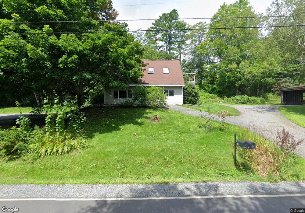
569 River Rd Newcastle, ME 04553
Estimated Value: $487,372 - $757,000
Studio
--
Bath
2,895
Sq Ft
$205/Sq Ft
Est. Value
About This Home
This home is located at 569 River Rd, Newcastle, ME 04553 and is currently estimated at $592,343, approximately $204 per square foot. 569 River Rd is a home with nearby schools including Great Salt Bay Community School and Lincoln Academy.
Ownership History
Date
Name
Owned For
Owner Type
Purchase Details
Closed on
Jun 29, 2017
Sold by
Brehm Jeffrey P
Bought by
River 567-9 Llc
Current Estimated Value
Home Financials for this Owner
Home Financials are based on the most recent Mortgage that was taken out on this home.
Original Mortgage
$184,000
Outstanding Balance
$151,942
Interest Rate
4.02%
Mortgage Type
New Conventional
Estimated Equity
$440,401
Purchase Details
Closed on
Jun 30, 2016
Sold by
Brehm Jeffrey P
Bought by
567-9 River Road Llc
Purchase Details
Closed on
Oct 14, 2015
Sold by
Vanabshoven M
Bought by
Brehm Jeffrey P
Home Financials for this Owner
Home Financials are based on the most recent Mortgage that was taken out on this home.
Original Mortgage
$154,850
Interest Rate
3.88%
Mortgage Type
New Conventional
Purchase Details
Closed on
Dec 16, 2013
Sold by
Roberts Cynthia J
Bought by
Vanabshoven Michelle
Home Financials for this Owner
Home Financials are based on the most recent Mortgage that was taken out on this home.
Original Mortgage
$123,500
Interest Rate
4.14%
Mortgage Type
New Conventional
Create a Home Valuation Report for This Property
The Home Valuation Report is an in-depth analysis detailing your home's value as well as a comparison with similar homes in the area
Home Values in the Area
Average Home Value in this Area
Purchase History
| Date | Buyer | Sale Price | Title Company |
|---|---|---|---|
| River 567-9 Llc | -- | -- | |
| 567-9 River Road Llc | -- | -- | |
| Brehm Jeffrey P | -- | -- | |
| Brehm Jeffrey P | -- | -- | |
| Vanabshoven Michelle | -- | -- | |
| Vanabshoven Michelle | -- | -- |
Source: Public Records
Mortgage History
| Date | Status | Borrower | Loan Amount |
|---|---|---|---|
| Open | River 567-9 Llc | $184,000 | |
| Closed | Vanabshoven Michelle | $184,000 | |
| Previous Owner | Brehm Jeffrey P | $154,850 | |
| Previous Owner | Vanabshoven Michelle | $123,500 |
Source: Public Records
Tax History
| Year | Tax Paid | Tax Assessment Tax Assessment Total Assessment is a certain percentage of the fair market value that is determined by local assessors to be the total taxable value of land and additions on the property. | Land | Improvement |
|---|---|---|---|---|
| 2025 | $5,800 | $405,600 | $72,200 | $333,400 |
| 2024 | $5,516 | $405,600 | $72,200 | $333,400 |
| 2023 | $2,914 | $182,100 | $55,500 | $126,600 |
| 2022 | $2,895 | $182,100 | $55,500 | $126,600 |
| 2021 | $2,786 | $182,100 | $55,500 | $126,600 |
| 2020 | $2,767 | $154,600 | $55,500 | $99,100 |
| 2019 | $2,767 | $154,600 | $55,500 | $99,100 |
| 2018 | $2,767 | $154,600 | $55,500 | $99,100 |
| 2017 | $2,791 | $154,600 | $55,500 | $99,100 |
| 2016 | $2,791 | $154,600 | $55,500 | $99,100 |
| 2015 | $2,791 | $154,600 | $55,500 | $99,100 |
| 2013 | $3,403 | $214,000 | $55,500 | $158,500 |
Source: Public Records
Map
Nearby Homes
- Lot# Route 1
- 322 Bristol Rd
- 130 Lewis Hill Rd
- Lots 4,5,6 Lewis Hill Rd
- LOT #4 Lewis Hill Rd
- 6 Stonewyck Ln
- 150 Mount Hunger Rd W
- 0 Hopkins Hill Rd
- 27 Dodge Rd
- 41 Indian Trail Rd
- 15 Bristol Rd Unit 1
- 80 Academy Hill Rd
- 72 Glidden St
- M10L40E4 Christian Hill Rd
- Map10 L39B Christian Hill Rd
- 128 Mills Rd
- 688 Benner Rd
- Map10Lot5 Benner Rd
- Lot 60 Heater Rd
- 003-D Lakeview Dr
- 567 River Rd
- 572 River Rd
- 553 River Rd
- 558 River Rd
- Lot 7 Perkins Point Rd
- 0 Perkins Point Rd Unit 615693
- 0 Perkins Point Rd Unit 588689
- 0 Perkins Point Rd Unit 346889
- 0 Perkins Point Rd Unit 882169
- 5 Long Wharf Rd
- 543 River Rd
- 600 River Rd
- 19 Long Wharf Rd
- 608 River Rd
- 100 Perkins Point Rd
- 526 River Rd
- Lot 65-C Perkins Point
- 510 River Rd
- 505 River Rd
- 638 River Rd
Your Personal Tour Guide
Ask me questions while you tour the home.