Estimated Value: $367,000 - $645,000
Studio
--
Bath
1,134
Sq Ft
$408/Sq Ft
Est. Value
About This Home
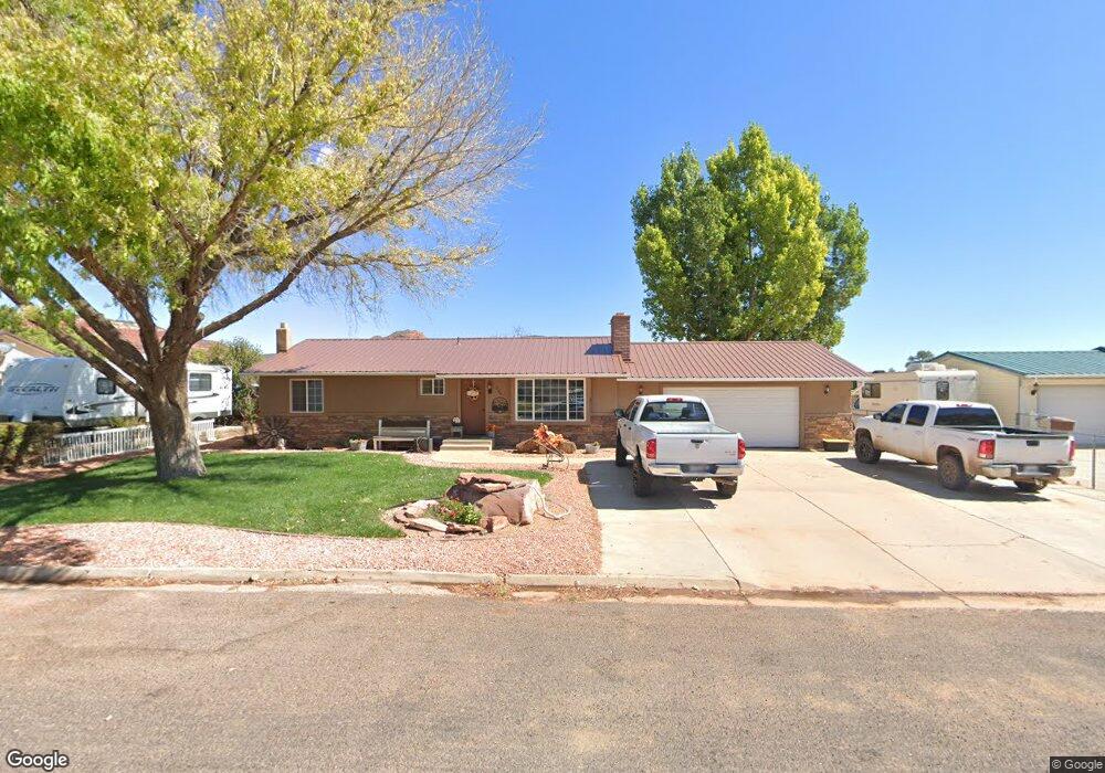
This home is located at 569 S 475 E, Kanab, UT 84741 and is currently estimated at $463,169, approximately $408 per square foot. 569 S 475 E is a home located in Kane County with nearby schools including Kanab Elementary School, Kanab Middle School, and Kanab High School.
Ownership History
Date
Name
Owned For
Owner Type
Purchase Details
Closed on
Jul 25, 2014
Sold by
Mandy Jo Mandy Jo and Barnard Theodore F
Bought by
Lathim Rick and Lathim Audrey
Current Estimated Value
Home Financials for this Owner
Home Financials are based on the most recent Mortgage that was taken out on this home.
Original Mortgage
$135,850
Outstanding Balance
$103,322
Interest Rate
4.12%
Mortgage Type
Purchase Money Mortgage
Estimated Equity
$359,847
Purchase Details
Closed on
Sep 18, 2013
Sold by
Barnard Theodore F and Barnard Mandy Jo
Bought by
Barnard Mandy Jo
Purchase Details
Closed on
Dec 20, 2012
Sold by
Barnard Theodore F and Barnard Ted F
Bought by
Barnard Theodore F and Barnard Mandy Jo
Home Financials for this Owner
Home Financials are based on the most recent Mortgage that was taken out on this home.
Original Mortgage
$199,556
Interest Rate
3.37%
Create a Home Valuation Report for This Property
The Home Valuation Report is an in-depth analysis detailing your home's value as well as a comparison with similar homes in the area
Home Values in the Area
Average Home Value in this Area
Purchase History
| Date | Buyer | Sale Price | Title Company |
|---|---|---|---|
| Lathim Rick | -- | -- | |
| Barnard Mandy Jo | -- | -- | |
| Barnard Mandy Jo | -- | -- | |
| Barnard Theodore F | -- | -- |
Source: Public Records
Mortgage History
| Date | Status | Borrower | Loan Amount |
|---|---|---|---|
| Open | Barnard Mandy Jo | $135,850 | |
| Closed | Lathim Rick | $135,850 | |
| Previous Owner | Barnard Theodore F | $199,556 |
Source: Public Records
Tax History
| Year | Tax Paid | Tax Assessment Tax Assessment Total Assessment is a certain percentage of the fair market value that is determined by local assessors to be the total taxable value of land and additions on the property. | Land | Improvement |
|---|---|---|---|---|
| 2025 | $1,793 | $380,000 | $97,117 | $282,883 |
| 2024 | $2,113 | $245,497 | $48,203 | $197,294 |
| 2023 | $1,892 | $225,266 | $45,908 | $179,358 |
| 2022 | $1,682 | $198,367 | $35,314 | $163,053 |
| 2021 | $1,520 | $268,990 | $49,390 | $219,600 |
| 2020 | $1,474 | $253,127 | $44,900 | $208,227 |
| 2019 | $1,336 | $223,515 | $45,012 | $178,503 |
| 2018 | $1,302 | $216,013 | $37,510 | $178,503 |
| 2017 | $1,230 | $194,776 | $34,100 | $160,676 |
| 2016 | $1,093 | $167,997 | $34,100 | $133,897 |
| 2015 | $911 | $159,967 | $34,100 | $125,867 |
| 2014 | $911 | $139,312 | $36,581 | $102,731 |
| 2013 | -- | $76,622 | $0 | $0 |
Source: Public Records
Map
Nearby Homes
- 528 S 410 E
- 275 E 650 S Unit 5
- 818 S Highway 89a
- 1117 S Terrel Dr
- 588 Cedar Cir
- 611 S 175 E
- 931 S Hillside Dr
- 300 S 300 E Unit A5
- 0 Chinle Dr
- 632 S Hillside Dr
- 380 E 200 S
- 0 U S Highway 89
- 476 S 100 E
- 852 E Rocky Rd
- 80 E Red Shadow Cir
- 0 100 Unit 1409231
- 442 100 South - Casita
- 442 E 100 S
- 782 Country Club Dr
- 325 S Main St
Your Personal Tour Guide
Ask me questions while you tour the home.