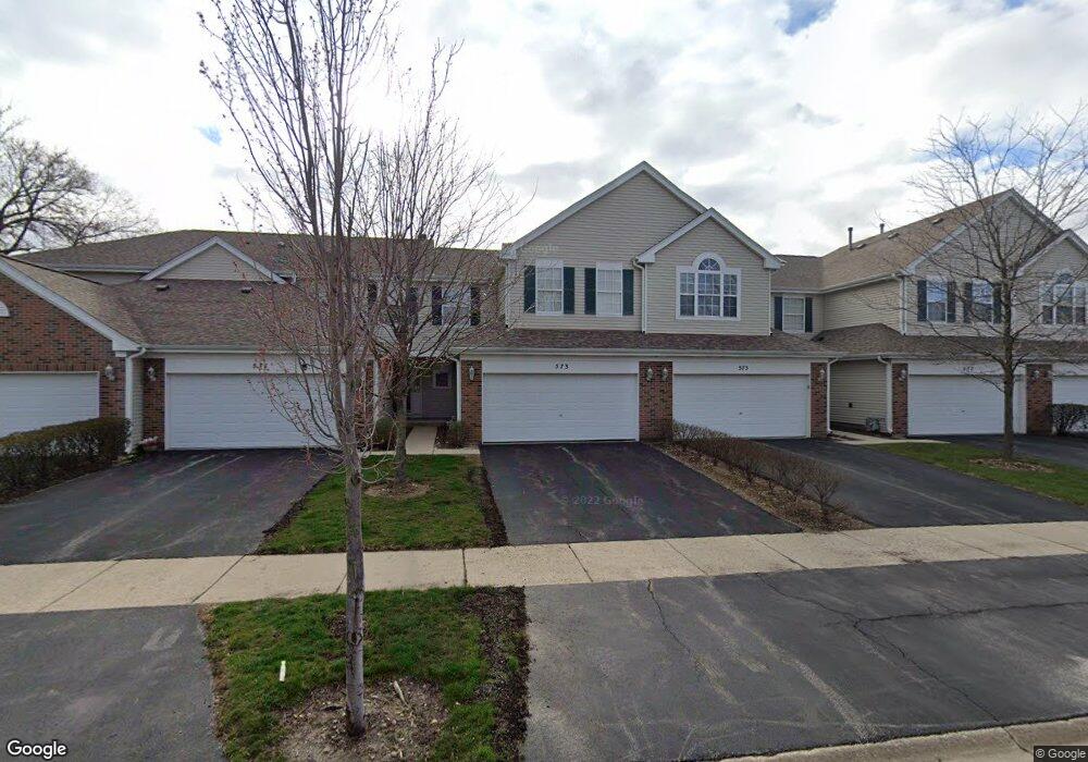
569 Springwood Ct Unit 31 East Dundee, IL 60118
Estimated Value: $248,083 - $291,000
2
Beds
--
Bath
1,286
Sq Ft
$208/Sq Ft
Est. Value
About This Home
This home is located at 569 Springwood Ct Unit 31, East Dundee, IL 60118 and is currently estimated at $267,521, approximately $208 per square foot. 569 Springwood Ct Unit 31 is a home located in Kane County with nearby schools including Parkview Elementary School, Crescent City Grade School, and Carpentersville Middle School.
Ownership History
Date
Name
Owned For
Owner Type
Purchase Details
Closed on
Jul 3, 1996
Sold by
The Reserve Of East Dundee Ltd Partnersh
Bought by
Lehner Wayne A and Lehner Tara B
Current Estimated Value
Home Financials for this Owner
Home Financials are based on the most recent Mortgage that was taken out on this home.
Original Mortgage
$124,850
Outstanding Balance
$9,083
Interest Rate
8.31%
Mortgage Type
FHA
Estimated Equity
$258,438
Create a Home Valuation Report for This Property
The Home Valuation Report is an in-depth analysis detailing your home's value as well as a comparison with similar homes in the area
Home Values in the Area
Average Home Value in this Area
Purchase History
| Date | Buyer | Sale Price | Title Company |
|---|---|---|---|
| Lehner Wayne A | $126,000 | -- |
Source: Public Records
Mortgage History
| Date | Status | Borrower | Loan Amount |
|---|---|---|---|
| Open | Lehner Wayne A | $124,850 |
Source: Public Records
Tax History Compared to Growth
Tax History
| Year | Tax Paid | Tax Assessment Tax Assessment Total Assessment is a certain percentage of the fair market value that is determined by local assessors to be the total taxable value of land and additions on the property. | Land | Improvement |
|---|---|---|---|---|
| 2024 | $5,581 | $70,931 | $8,371 | $62,560 |
| 2023 | $5,304 | $63,821 | $7,532 | $56,289 |
| 2022 | $4,549 | $53,049 | $7,532 | $45,517 |
| 2021 | $4,387 | $50,089 | $7,112 | $42,977 |
| 2020 | $4,294 | $48,963 | $6,952 | $42,011 |
| 2019 | $4,208 | $46,481 | $6,600 | $39,881 |
| 2018 | $3,999 | $42,831 | $6,469 | $36,362 |
| 2017 | $3,814 | $40,066 | $6,051 | $34,015 |
| 2016 | $3,920 | $38,794 | $5,859 | $32,935 |
| 2015 | -- | $34,086 | $5,490 | $28,596 |
| 2014 | -- | $33,144 | $5,338 | $27,806 |
| 2013 | -- | $34,158 | $5,501 | $28,657 |
Source: Public Records
Map
Nearby Homes
- 710 Timothy Ct Unit 221
- 152 King Ave
- 431 Dunridge Ct Unit 12B
- 174 Dunbar Ln
- 436 Barrington Ave
- 605 Barrington Ave Unit 350
- 605 Barrington Ave Unit 140
- 605 Barrington Ave Unit 216
- Lot 1 View St
- 827 Balmoral Dr
- 305 Oregon Ave
- 7 King William St
- 2 Adams St
- 512 Lisa Rd
- 560 S 5th St
- 730 Council Hill Rd
- 606 Edwards Ave
- 222 Harrison St
- Lot 6B Ravine Rd
- Lot 6A Ravine Rd
- 571 Springwood Ct Unit 32
- 577 Springwood Ct Unit 35
- 575 Springwood Ct Unit 34
- 573 Springwood Ct Unit 33
- 579 Springwood Ct Unit 36
- 579 Springwood Ct Unit 579
- 576 Springwood Ct Unit 41
- 572 Springwood Ct
- 570 Springwood Ct Unit 44
- 608 Howard Ave
- 600 Howard Ave Unit 136
- 605 Howard Ave Unit 143
- 619 Howard Ave Unit 156
- 603 Howard Ave Unit 142
- 607 Howard Ave Unit 144
- 619 Howard Ave Unit N
- 613 Howard Ave Unit 153
- 606 Howard Ave Unit 133
- 527 King Ave Unit 114
- 517 King Ave Unit 103