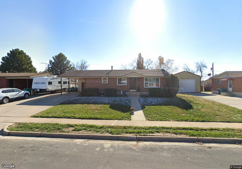
569 W 1800 N Layton, UT 84041
Estimated Value: $388,000 - $446,000
4
Beds
2
Baths
1,188
Sq Ft
$351/Sq Ft
Est. Value
About This Home
This home is located at 569 W 1800 N, Layton, UT 84041 and is currently estimated at $416,854, approximately $350 per square foot. 569 W 1800 N is a home located in Davis County with nearby schools including Lincoln Elementary School, North Layton Junior High School, and Northridge High School.
Ownership History
Date
Name
Owned For
Owner Type
Purchase Details
Closed on
Nov 5, 2021
Sold by
Hernandez Marcine
Bought by
Hernandez Marcine L
Current Estimated Value
Home Financials for this Owner
Home Financials are based on the most recent Mortgage that was taken out on this home.
Original Mortgage
$261,050
Outstanding Balance
$238,772
Interest Rate
3.01%
Mortgage Type
New Conventional
Estimated Equity
$178,082
Purchase Details
Closed on
Jan 8, 2020
Sold by
Anderson Jon Randall and Anderson Charles C
Bought by
Hernendez Marcine
Home Financials for this Owner
Home Financials are based on the most recent Mortgage that was taken out on this home.
Original Mortgage
$216,320
Interest Rate
3.75%
Mortgage Type
FHA
Purchase Details
Closed on
Dec 4, 2001
Sold by
Anderson Charles Chris and Anderson Jacqueline
Bought by
Anderson Charles C and Anderson Jackie
Create a Home Valuation Report for This Property
The Home Valuation Report is an in-depth analysis detailing your home's value as well as a comparison with similar homes in the area
Home Values in the Area
Average Home Value in this Area
Purchase History
| Date | Buyer | Sale Price | Title Company |
|---|---|---|---|
| Hernandez Marcine L | -- | Us Title Company Of Utah | |
| Hernendez Marcine | -- | Us Title Company | |
| Anderson Charles C | -- | None Available |
Source: Public Records
Mortgage History
| Date | Status | Borrower | Loan Amount |
|---|---|---|---|
| Open | Hernandez Marcine L | $261,050 | |
| Closed | Hernendez Marcine | $216,320 |
Source: Public Records
Tax History Compared to Growth
Tax History
| Year | Tax Paid | Tax Assessment Tax Assessment Total Assessment is a certain percentage of the fair market value that is determined by local assessors to be the total taxable value of land and additions on the property. | Land | Improvement |
|---|---|---|---|---|
| 2025 | $1,965 | $206,250 | $101,220 | $105,030 |
| 2024 | $1,888 | $199,650 | $117,989 | $81,661 |
| 2023 | $1,824 | $340,000 | $140,713 | $199,287 |
| 2022 | $1,831 | $185,350 | $74,266 | $111,084 |
| 2021 | $1,689 | $255,000 | $103,826 | $151,174 |
| 2020 | $1,540 | $223,000 | $87,509 | $135,491 |
| 2019 | $1,544 | $219,000 | $83,247 | $135,753 |
| 2018 | $1,369 | $195,000 | $83,247 | $111,753 |
| 2016 | $1,213 | $89,100 | $26,501 | $62,599 |
| 2015 | $1,131 | $78,870 | $26,501 | $52,369 |
| 2014 | $1,114 | $79,418 | $26,501 | $52,917 |
| 2013 | -- | $81,101 | $24,816 | $56,285 |
Source: Public Records
Map
Nearby Homes
- 538 W 1875 N
- 398 Paul Ave
- 1715 N Alder St
- 1908 N 200 W
- 506 W 2200 N
- 2211 N 525 W
- 2149 N 750 W
- 2233 N 475 W
- 2248 N 500 W
- 2053 Evans Cove Loop Unit 39
- 1490 N 175 W
- 2048 Evans Cove Loop
- 1583 N 25 E
- 1500 N Angel St Unit 12
- 1500 N Angel St Unit 22
- 1094 N Angel St W
- 1036 N Angel St W
- 2402 N 725 W
- 1615 N Angel St W
- 1155 W 2200 N