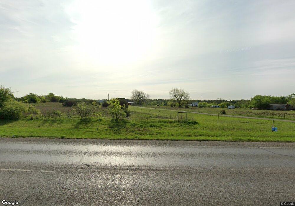
5690 N Fm 51 Weatherford, TX 76085
Estimated Value: $558,194 - $1,075,000
--
Bed
--
Bath
3,349
Sq Ft
$231/Sq Ft
Est. Value
About This Home
This home is located at 5690 N Fm 51, Weatherford, TX 76085 and is currently estimated at $773,049, approximately $230 per square foot. 5690 N Fm 51 is a home located in Parker County with nearby schools including Crockett Elementary School, Tison Middle School, and Weatherford High School.
Ownership History
Date
Name
Owned For
Owner Type
Purchase Details
Closed on
Sep 23, 2013
Sold by
Aggas James and Aggas Julia
Bought by
Aggas Julia A
Current Estimated Value
Purchase Details
Closed on
Mar 20, 2000
Sold by
Dobbs Margaret
Bought by
Aggas Julia A
Purchase Details
Closed on
Jan 1, 1901
Bought by
Aggas Julia A
Create a Home Valuation Report for This Property
The Home Valuation Report is an in-depth analysis detailing your home's value as well as a comparison with similar homes in the area
Home Values in the Area
Average Home Value in this Area
Purchase History
| Date | Buyer | Sale Price | Title Company |
|---|---|---|---|
| Aggas Julia A | -- | -- | |
| Aggas Julia Ann | -- | None Available | |
| Aggas Julia A | -- | -- | |
| Aggas Julia A | -- | -- |
Source: Public Records
Mortgage History
| Date | Status | Borrower | Loan Amount |
|---|---|---|---|
| Closed | Aggas Julia Ann | $0 |
Source: Public Records
Tax History Compared to Growth
Tax History
| Year | Tax Paid | Tax Assessment Tax Assessment Total Assessment is a certain percentage of the fair market value that is determined by local assessors to be the total taxable value of land and additions on the property. | Land | Improvement |
|---|---|---|---|---|
| 2025 | $7,044 | $444,120 | $26,850 | $417,270 |
| 2024 | $7,044 | $495,979 | -- | -- |
| 2023 | $7,044 | $450,890 | $0 | $0 |
| 2022 | $7,631 | $409,900 | $17,790 | $392,110 |
| 2021 | $8,256 | $409,900 | $17,790 | $392,110 |
| 2020 | $7,194 | $354,670 | $10,960 | $343,710 |
| 2019 | $7,674 | $354,670 | $10,960 | $343,710 |
| 2018 | $6,454 | $296,710 | $8,680 | $288,030 |
| 2017 | $6,586 | $296,710 | $8,680 | $288,030 |
| 2016 | $6,135 | $276,380 | $8,680 | $267,700 |
| 2015 | $5,658 | $276,380 | $8,680 | $267,700 |
| 2014 | $5,222 | $255,630 | $8,370 | $247,260 |
Source: Public Records
Map
Nearby Homes
- 332 Water View Ln
- TBD Murray Rd
- 342 Rising View Ct
- 143 Carter Hills Ln
- 151 Kriston Ln
- 1040 Ray's Way
- 265 Dill Rd
- 514 Blue Sky Ct
- 113 Draper Dr
- 134 Blue Valley Ct
- 5885-A Old Springtown Rd
- 5885-B Old Springtown Rd
- 5885-C Old Springtown Rd
- 5885-E Old Springtown Rd
- 5885-D Old Springtown Rd
- 1024 Sunny Ct
- 2000 Collin St
- 178 Valley Lake Ln
- 1009 Sabrina Ct
- 319 Denton Heights Ln
- 5680 N Fm 51
- 5600 N Fm 51
- 5600 N Fm 51
- 7085 Farm To Market 51
- 5840 N Fm 51
- 5860 N Fm 51
- 5701 N Fm 51
- 1221 Oak Ridge Estate
- 1025 Oak Ridge Estate
- 1501 Oak Ridge Estate
- 5525 N Fm 51
- 1220 Oak Ridge Estate
- TBD 5 Oak Ridge Estates
- TBD 4 Oak Ridge Estates
- 413 Water View Ct
- 1799 Oak Ridge Estate
- 401 Dill Rd
- 1300 Oak Ridge Estate
- 1020 Oak Ridge Estate
- 5920 N Fm 51
