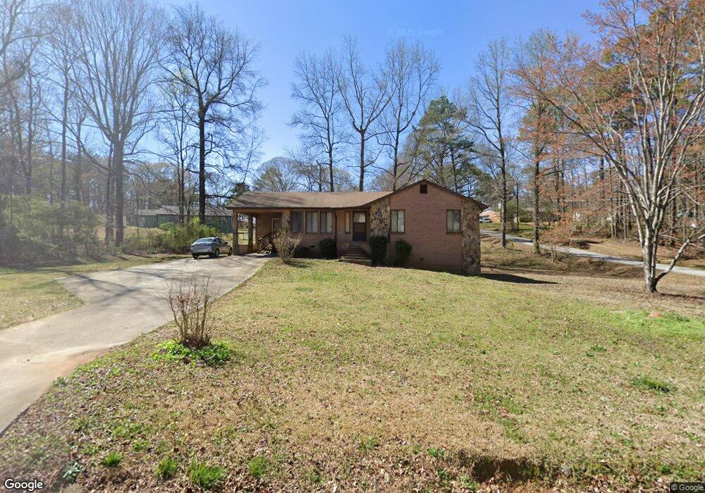
5691 Denson Blvd Morrow, GA 30260
Estimated Value: $182,000 - $227,000
3
Beds
2
Baths
1,297
Sq Ft
$155/Sq Ft
Est. Value
About This Home
This home is located at 5691 Denson Blvd, Morrow, GA 30260 and is currently estimated at $201,638, approximately $155 per square foot. 5691 Denson Blvd is a home located in Clayton County with nearby schools including Thurgood Marshall Elementary School, Morrow Middle School, and Morrow High School.
Ownership History
Date
Name
Owned For
Owner Type
Purchase Details
Closed on
Oct 25, 2016
Sold by
Castle Atlanta Holding Lp
Bought by
Tah 2016 1 Borrower Llc
Current Estimated Value
Purchase Details
Closed on
Dec 3, 2013
Sold by
Carter Estell
Bought by
Castle Atlanta Holding Lp
Purchase Details
Closed on
Jan 17, 2006
Sold by
Craig Parker E
Bought by
Carter Estell
Home Financials for this Owner
Home Financials are based on the most recent Mortgage that was taken out on this home.
Original Mortgage
$134,000
Interest Rate
8.88%
Mortgage Type
New Conventional
Purchase Details
Closed on
Jun 14, 2000
Sold by
Richardson Carolyn R and Richardson Curtis A
Bought by
Craig Parker E
Home Financials for this Owner
Home Financials are based on the most recent Mortgage that was taken out on this home.
Original Mortgage
$79,475
Interest Rate
11.7%
Mortgage Type
New Conventional
Create a Home Valuation Report for This Property
The Home Valuation Report is an in-depth analysis detailing your home's value as well as a comparison with similar homes in the area
Purchase History
| Date | Buyer | Sale Price | Title Company |
|---|---|---|---|
| Tah 2016 1 Borrower Llc | -- | -- | |
| Castle Atlanta Holding Lp | -- | -- | |
| Carter Estell | $134,000 | -- | |
| Craig Parker E | $93,500 | -- |
Source: Public Records
Mortgage History
| Date | Status | Borrower | Loan Amount |
|---|---|---|---|
| Previous Owner | Carter Estell | $134,000 | |
| Previous Owner | Craig Parker E | $79,475 |
Source: Public Records
Tax History
| Year | Tax Paid | Tax Assessment Tax Assessment Total Assessment is a certain percentage of the fair market value that is determined by local assessors to be the total taxable value of land and additions on the property. | Land | Improvement |
|---|---|---|---|---|
| 2025 | $2,141 | $88,000 | $2,000 | $86,000 |
| 2024 | $2,181 | $54,800 | $2,000 | $52,800 |
| 2023 | $2,021 | $54,800 | $2,000 | $52,800 |
| 2022 | $2,193 | $54,800 | $2,000 | $52,800 |
| 2021 | $1,275 | $31,200 | $1,800 | $29,400 |
| 2020 | $1,291 | $31,200 | $1,800 | $29,400 |
| 2019 | $1,309 | $32,402 | $1,800 | $30,602 |
| 2018 | $1,236 | $29,392 | $1,800 | $27,592 |
| 2017 | $1,157 | $27,381 | $1,800 | $25,581 |
| 2016 | $987 | $27,302 | $1,800 | $25,502 |
| 2015 | $1,147 | $0 | $0 | $0 |
| 2014 | $790 | $18,800 | $1,800 | $17,000 |
Source: Public Records
Map
Nearby Homes
- 0 Denson Blvd Unit 1527338
- 0 Poplar Ave Unit 10481115
- 0 Poplar Ave Unit 7543163
- 5651 Handley Blvd
- 2272 Santa fe St Unit 21
- 2276 Santa fe St Unit 19
- 2316 Santa fe St Unit 5
- 2271 Santa fe St Unit 23
- 2247 Cypress Ave
- 0 Herndon Blvd Unit 10625476
- 0 Herndon Blvd Unit 7686770
- 0 Herndon Blvd Unit 10699259
- 5778 Northfield Dr
- 5420 Herndon Blvd
- 5774 Springfield Place Unit 2
- 6012 Danbury Ct
- 2510 Brenston Dr
- 2540 Hartford Dr
- 0 Maddox Rd Unit 10674000
- 0 Maddox Rd Unit 183163
- 5705 Denson Blvd
- 5690 Attucks Blvd
- 5702 Attucks Blvd
- 2239 Bethune Cir
- 5682 Attucks Blvd
- 5717 Denson Blvd
- 5712 Attucks Blvd
- 2251 Bethune Cir
- 5659 Denson Blvd Unit 15
- 5724 Attucks Blvd
- 5727 Denson Blvd
- 2261 Hammond Ct Unit 11
- 5701 Attucks Blvd
- 2265 Hammond Ct Unit 36
- 5677 Attucks Blvd
- 2263 Bethune Cir
- 5645 Denson Blvd
- 5652 Attucks Blvd
- 13 Bethune Cir
- 5734 Attucks Blvd
Your Personal Tour Guide
Ask me questions while you tour the home.