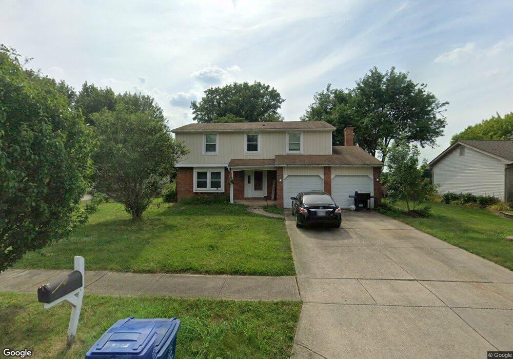
5691 Moorgate Dr Columbus, OH 43235
The Gables NeighborhoodEstimated Value: $406,000 - $442,000
4
Beds
3
Baths
1,968
Sq Ft
$213/Sq Ft
Est. Value
About This Home
This home is located at 5691 Moorgate Dr, Columbus, OH 43235 and is currently estimated at $418,262, approximately $212 per square foot. 5691 Moorgate Dr is a home located in Franklin County with nearby schools including Daniel Wright Elementary School, Ann Simpson Davis Middle School, and Dublin Scioto High School.
Ownership History
Date
Name
Owned For
Owner Type
Purchase Details
Closed on
May 17, 2024
Sold by
Horton Mary Ann
Bought by
Mary Ann Horton Revocable Trust and Horton
Current Estimated Value
Purchase Details
Closed on
Jan 24, 2020
Sold by
Kleinhenz Beverly Anne and Hill Vivian Marie
Bought by
Horton Mary Ann
Home Financials for this Owner
Home Financials are based on the most recent Mortgage that was taken out on this home.
Original Mortgage
$200,800
Interest Rate
3.72%
Mortgage Type
New Conventional
Purchase Details
Closed on
Aug 4, 2011
Sold by
Kleinhenz James F and Kleinhenz James Francis
Bought by
Kleinhenz Beverly Anne and Hill Vivian Marie
Purchase Details
Closed on
Apr 23, 1984
Bought by
Kleinhenz James F
Create a Home Valuation Report for This Property
The Home Valuation Report is an in-depth analysis detailing your home's value as well as a comparison with similar homes in the area
Home Values in the Area
Average Home Value in this Area
Purchase History
| Date | Buyer | Sale Price | Title Company |
|---|---|---|---|
| Mary Ann Horton Revocable Trust | -- | None Listed On Document | |
| Horton Mary Ann | $251,000 | First Ohio Title Insurance | |
| Kleinhenz Beverly Anne | -- | None Available | |
| Kleinhenz James F | $16,000 | -- |
Source: Public Records
Mortgage History
| Date | Status | Borrower | Loan Amount |
|---|---|---|---|
| Previous Owner | Horton Mary Ann | $200,800 |
Source: Public Records
Tax History Compared to Growth
Tax History
| Year | Tax Paid | Tax Assessment Tax Assessment Total Assessment is a certain percentage of the fair market value that is determined by local assessors to be the total taxable value of land and additions on the property. | Land | Improvement |
|---|---|---|---|---|
| 2024 | $6,984 | $113,120 | $38,640 | $74,480 |
| 2023 | $6,905 | $113,120 | $38,640 | $74,480 |
| 2022 | $5,523 | $84,040 | $27,300 | $56,740 |
| 2021 | $5,612 | $84,040 | $27,300 | $56,740 |
| 2020 | $5,354 | $80,640 | $27,300 | $53,340 |
| 2019 | $4,838 | $64,510 | $21,840 | $42,670 |
| 2018 | $4,836 | $64,510 | $21,840 | $42,670 |
| 2017 | $4,484 | $64,510 | $21,840 | $42,670 |
| 2016 | $4,780 | $64,580 | $17,610 | $46,970 |
| 2015 | $4,810 | $64,580 | $17,610 | $46,970 |
| 2014 | $4,814 | $64,580 | $17,610 | $46,970 |
| 2013 | $2,327 | $61,495 | $16,765 | $44,730 |
Source: Public Records
Map
Nearby Homes
- 5624 Wigmore Dr Unit 50B
- 2260 Lila Way Unit 62D
- 2229 Teardrop Ave Unit 35E
- 2265 Teardrop Ave Unit 39C
- 2179 Victoria Park Dr Unit 2179
- 2236 Victoria Park Dr Unit 2236
- 2172 Hedgerow Rd Unit 2172G
- 5268 Captains Ct
- 2527 Maxim Ln Unit 40D
- 1961 Ramble Branch Dr Unit 30
- 5283 Ruthton Rd Unit 19
- 2522 Gardenia Dr Unit 16C
- 2560 Trotterslane Dr
- 1540 Slade Ave Unit 303
- 5646 Dorsey Dr
- 5294 Brandy Oaks Ln
- 2622 Trottersway Dr
- 2585 Trottersway Dr Unit 2585
- 5111 Schuylkill St
- 5273 Brandy Oaks Ln
- 5683 Moorgate Dr
- 5699 Moorgate Dr
- 2027 West Case Rd
- 2029 West Case Rd
- 2031 West Case Rd
- 2033 West Case Rd
- 5680 Saverio Ct
- 5675 Moorgate Dr
- 2039 West Case Rd Unit 2039
- 5690 Moorgate Dr
- 2041 West Case Rd Unit 2039
- 5698 Moorgate Dr
- 5678 Moorgate Dr
- 2043 West Case Rd Unit 2039
- 5672 Saverio Ct
- 2045 West Case Rd Unit 2039
- 5663 Moorgate Dr
- 2049 W Case Rd
- 2049 West Case Rd Unit 2049
- 5666 Moorgate Dr