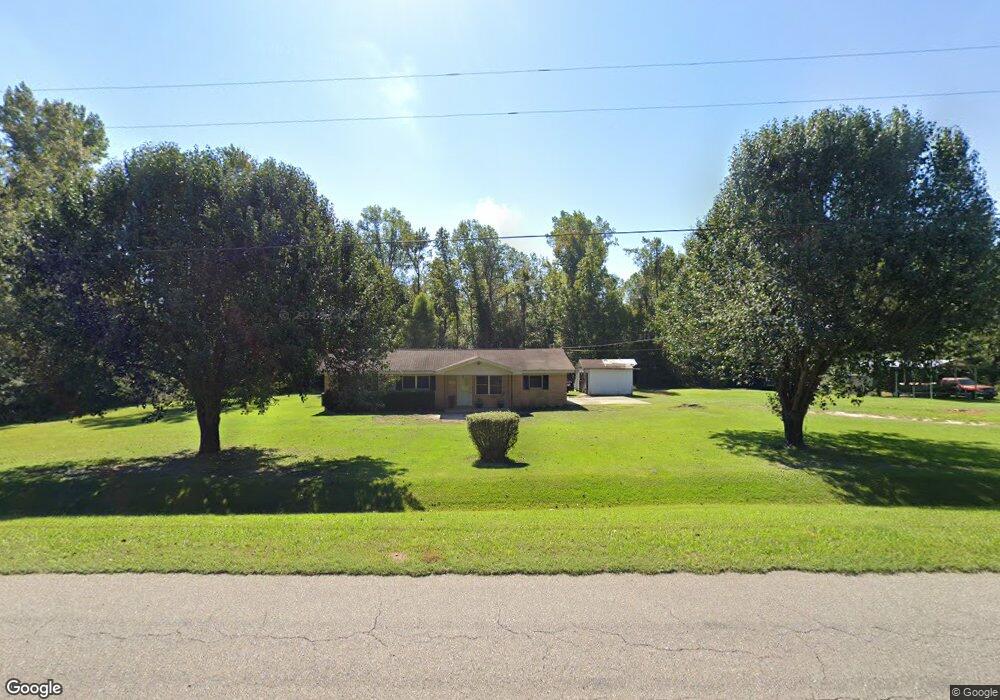
5692 State Line Rd Cottonwood, AL 36320
Estimated Value: $83,000 - $208,000
--
Bed
1
Bath
1,445
Sq Ft
$103/Sq Ft
Est. Value
About This Home
This home is located at 5692 State Line Rd, Cottonwood, AL 36320 and is currently estimated at $148,241, approximately $102 per square foot. 5692 State Line Rd is a home located in Houston County with nearby schools including Cottonwood High School.
Ownership History
Date
Name
Owned For
Owner Type
Purchase Details
Closed on
Jun 18, 2021
Sold by
Lowe Parnela J and Dillard Kimberly J
Bought by
Mccardle Cecelia
Current Estimated Value
Home Financials for this Owner
Home Financials are based on the most recent Mortgage that was taken out on this home.
Original Mortgage
$63,282
Outstanding Balance
$57,294
Interest Rate
2.9%
Mortgage Type
New Conventional
Estimated Equity
$90,947
Purchase Details
Closed on
Feb 27, 2019
Sold by
Mccardle Mary Jane and Lowe Pamela J
Bought by
Lowe Pamela J and Mccardle Christopher T
Create a Home Valuation Report for This Property
The Home Valuation Report is an in-depth analysis detailing your home's value as well as a comparison with similar homes in the area
Home Values in the Area
Average Home Value in this Area
Purchase History
| Date | Buyer | Sale Price | Title Company |
|---|---|---|---|
| Mccardle Cecelia | $60,000 | None Available | |
| Lowe Pamela J | -- | None Available |
Source: Public Records
Mortgage History
| Date | Status | Borrower | Loan Amount |
|---|---|---|---|
| Open | Mccardle Cecelia | $63,282 |
Source: Public Records
Tax History Compared to Growth
Tax History
| Year | Tax Paid | Tax Assessment Tax Assessment Total Assessment is a certain percentage of the fair market value that is determined by local assessors to be the total taxable value of land and additions on the property. | Land | Improvement |
|---|---|---|---|---|
| 2024 | $288 | $10,100 | $0 | $0 |
| 2023 | $288 | $9,840 | $0 | $0 |
| 2022 | $212 | $7,920 | $0 | $0 |
| 2021 | $441 | $7,660 | $0 | $0 |
| 2020 | $413 | $12,980 | $0 | $0 |
| 2018 | $413 | $12,980 | $0 | $0 |
| 2017 | $408 | $12,820 | $0 | $0 |
| 2016 | $408 | $0 | $0 | $0 |
| 2015 | -- | $0 | $0 | $0 |
| 2014 | -- | $0 | $0 | $0 |
Source: Public Records
Map
Nearby Homes
- Lot 7, 4.6+-ac D Hodge Rd
- 02 State Line Rd
- 01 State Line Rd
- 03 State Line Rd
- 433 Joe Cook St
- 003 Sealy Wells Rd
- Lot12,10.8+-ac Willie Varnum Rd D Hodge Rd
- Lot 10, 6.1+-ac Willie Varnum Rd
- Lot 9, 7.6+-ac Willie Varnum Rd
- Lot 6, 7.2+-ac Willie Varnum Rd
- 101.12+-ac Houston St Metcalf St
- 69 Granger Alley
- 0 Cottonwood Rd
- 0 State Line Rd & Decatur Rd
- 49+/- Acres Mount Zion Rd
- 49 +/- Acres Mount Zion Rd
- 0 Mount Zion Rd
- 11.83+-ac Grove St
- 009 Mount Zion Rd
- 012 Mount Zion Rd
- 5629 State Line Rd
- 5781 State Line Rd
- 5811 State Line Rd
- 5535 State Line Rd
- 5895 State Line Rd
- 177 Ramer Loop
- 5964 State Line Rd
- 230 Ramer Loop
- 6038 State Line Rd
- 32 Hanging Moss Trail
- 6054 State Line Rd
- 8460 Willie Varnum Rd
- 425 Hanging Moss Trail
- 300 Ramer Loop
- 8442 Willie Varnum Rd
- 81 Hanging Moss Trail
- 321 Hanging Moss Trail
- 153 Hanging Moss Trail
- 440 Hanging Moss Trail
- 373 Hanging Moss Trail