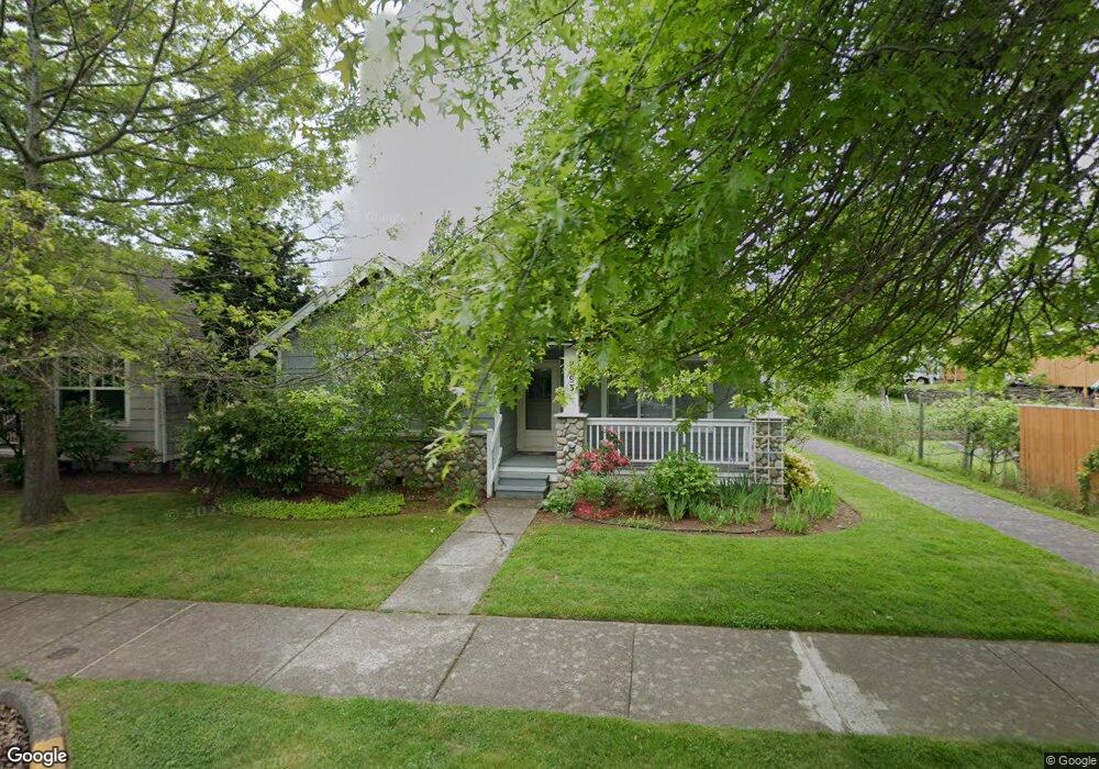
5693 Correll Dr Ferndale, WA 98248
Estimated Value: $465,000 - $562,000
2
Beds
2
Baths
1,554
Sq Ft
$333/Sq Ft
Est. Value
About This Home
This home is located at 5693 Correll Dr, Ferndale, WA 98248 and is currently estimated at $517,093, approximately $332 per square foot. 5693 Correll Dr is a home located in Whatcom County with nearby schools including Central Elementary School, Vista Middle School, and Ferndale High School.
Ownership History
Date
Name
Owned For
Owner Type
Purchase Details
Closed on
Jul 16, 2013
Sold by
Jacobson Leonard J and Preston Kathleen J
Bought by
Jacobson Clara L
Current Estimated Value
Purchase Details
Closed on
Feb 22, 2013
Sold by
Reynolds Dale and Reynolds Edith
Bought by
Jacobson Leonard and Jacobson Clara
Purchase Details
Closed on
Jun 12, 2009
Sold by
Simpson Everett M and Simpson Carol M
Bought by
Reynolds Dale and Reynolds Edith
Purchase Details
Closed on
Apr 20, 2006
Sold by
Estate Of Kenneth Bruland
Bought by
Simpson Everett M and Simpson Carol M
Home Financials for this Owner
Home Financials are based on the most recent Mortgage that was taken out on this home.
Original Mortgage
$65,000
Interest Rate
6.35%
Mortgage Type
Fannie Mae Freddie Mac
Purchase Details
Closed on
Jun 21, 1999
Sold by
Homestead Nw Dev Co
Bought by
Bruland Kenneth M and Bruland Frieda
Create a Home Valuation Report for This Property
The Home Valuation Report is an in-depth analysis detailing your home's value as well as a comparison with similar homes in the area
Home Values in the Area
Average Home Value in this Area
Purchase History
| Date | Buyer | Sale Price | Title Company |
|---|---|---|---|
| Jacobson Clara L | -- | None Available | |
| Jacobson Leonard | $225,280 | Chicago Title Insurance | |
| Reynolds Dale | $285,280 | Chicago Title Insurance | |
| Simpson Everett M | $280,280 | Whatcom Land Title | |
| Bruland Kenneth M | -- | Whatcom Land Title |
Source: Public Records
Mortgage History
| Date | Status | Borrower | Loan Amount |
|---|---|---|---|
| Previous Owner | Simpson Everett M | $65,000 |
Source: Public Records
Tax History
| Year | Tax Paid | Tax Assessment Tax Assessment Total Assessment is a certain percentage of the fair market value that is determined by local assessors to be the total taxable value of land and additions on the property. | Land | Improvement |
|---|---|---|---|---|
| 2025 | $361 | $505,450 | $183,330 | $322,120 |
| 2024 | $341 | $503,848 | $183,330 | $320,518 |
| 2023 | $341 | $497,190 | $189,000 | $308,190 |
| 2022 | $457 | $436,129 | $131,082 | $161,739 |
| 2021 | $494 | $360,436 | $108,332 | $161,739 |
| 2020 | $515 | $333,746 | $100,310 | $233,436 |
| 2019 | $516 | $290,682 | $87,367 | $203,315 |
| 2018 | $560 | $265,762 | $79,877 | $185,885 |
| 2017 | $563 | $232,900 | $70,000 | $162,900 |
| 2016 | $558 | $232,839 | $55,120 | $177,719 |
| 2015 | $573 | $218,970 | $52,185 | $166,785 |
| 2014 | -- | $214,518 | $51,000 | $163,518 |
| 2013 | -- | $211,739 | $50,000 | $161,739 |
Source: Public Records
Map
Nearby Homes
- 5682 Correll Dr Unit 102
- 5675 Rosemary Ave
- 5686 Correll Dr Unit 101
- 2234 Main St
- 5634 Applewood Dr
- 2273 Douglas Rd
- 2173 Sunnybrook Ln Unit 202
- 5660 Eagle Pkwy
- 5779 Legoe Ave
- 5683 Sunstone Place Unit 102
- 5803 Vista Dr
- 2071 Cherry St Unit 7
- 5838 Hawthorne Place
- 5604 3rd Ave
- 2344 Main St
- 5581 2nd Ave
- 2350 Douglas Rd Unit 17
- 2630 - 2638 Douglas Rd
- 5698 2nd Ave
- 2392 Douglas Rd Unit 39
- 5693 Rosemary St
- 5693 Rosemary Ave
- 5689 Correll Dr
- 5691 Rosemary Ave
- 5681 Correll Dr
- 5687 Rosemary Ave
- 5682 Correll Dr Unit 105
- 5682 Correll Dr Unit 104
- 5682 Correll Dr Unit 103
- 5682 Correll Dr Unit 101
- 2203 Main St
- 5677 Correll Dr
- 5680 Correll Dr Unit 103
- 5680 Correll Dr Unit 104
- 5683 Rosemary Ave
- 5688 Applewood Dr
Your Personal Tour Guide
Ask me questions while you tour the home.