Estimated Value: $430,000 - $490,000
3
Beds
3
Baths
1,848
Sq Ft
$247/Sq Ft
Est. Value
About This Home
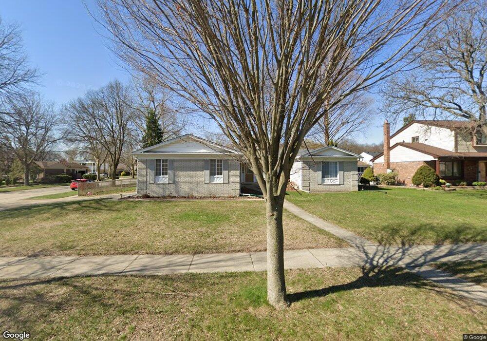
This home is located at 5693 Patterson Dr Unit Bldg-Unit, Troy, MI 48085 and is currently estimated at $456,808, approximately $247 per square foot. 5693 Patterson Dr Unit Bldg-Unit is a home located in Oakland County with nearby schools including Wass Elementary School, Larson Middle School, and Athens High School.
Ownership History
Date
Name
Owned For
Owner Type
Purchase Details
Closed on
Oct 27, 2021
Sold by
Alvord John L and Alvord Jin
Bought by
Vo Hoang and Nguyen Nga Thi
Current Estimated Value
Purchase Details
Closed on
Aug 17, 2018
Sold by
Kouza Vivian
Bought by
Alvord John L and Zhou Jin
Home Financials for this Owner
Home Financials are based on the most recent Mortgage that was taken out on this home.
Original Mortgage
$150,000
Interest Rate
4.5%
Mortgage Type
New Conventional
Purchase Details
Closed on
Mar 1, 2006
Sold by
Thrasher Kenneth C and Thrasher Linda J
Bought by
Kouza Vivian
Purchase Details
Closed on
Jul 5, 1995
Sold by
Hacker Connie E
Bought by
Thrasher Kenneth C and Thrasher Linda J
Home Financials for this Owner
Home Financials are based on the most recent Mortgage that was taken out on this home.
Original Mortgage
$125,000
Interest Rate
7.59%
Mortgage Type
New Conventional
Create a Home Valuation Report for This Property
The Home Valuation Report is an in-depth analysis detailing your home's value as well as a comparison with similar homes in the area
Home Values in the Area
Average Home Value in this Area
Purchase History
| Date | Buyer | Sale Price | Title Company |
|---|---|---|---|
| Vo Hoang | $375,000 | None Listed On Document | |
| Alvord John L | $287,000 | Fidelity National Title | |
| Kouza Vivian | $265,900 | Title One Inc | |
| Thrasher Kenneth C | $180,000 | -- |
Source: Public Records
Mortgage History
| Date | Status | Borrower | Loan Amount |
|---|---|---|---|
| Previous Owner | Alvord John L | $150,000 | |
| Previous Owner | Thrasher Kenneth C | $125,000 |
Source: Public Records
Tax History Compared to Growth
Tax History
| Year | Tax Paid | Tax Assessment Tax Assessment Total Assessment is a certain percentage of the fair market value that is determined by local assessors to be the total taxable value of land and additions on the property. | Land | Improvement |
|---|---|---|---|---|
| 2022 | $5,126 | $150,040 | $0 | $0 |
| 2015 | $5,094 | $109,580 | $0 | $0 |
| 2014 | -- | $98,810 | $0 | $0 |
| 2011 | -- | $87,150 | $0 | $0 |
Source: Public Records
Map
Nearby Homes
- 2684 Coral Dr
- 5761 Bingham Dr
- 2741 Denise Dr
- 2698 Willard Dr
- 5973 Stella
- 2403 E Square Lake Rd
- 42192 Dequindre Rd
- 2937 E Square Lake Rd
- 5587 Aster Dr
- 5982 Slate Dr
- 2410 Pondview Ln
- 6120 Evanswood Rd
- 5208 Crowfoot Dr
- 1917 Ravenhill Dr
- 2326 Pondview Ln
- 2298 Pondview Ln
- 2111 Beyer Ln
- 41659 Touchstone Dr
- 2089 Topaz Dr
- 2931 Briarwood Dr
- 5693 Patterson Dr
- 5711 Patterson Dr
- 5700 Larkins Dr
- 5725 Patterson Dr
- 5679 Patterson Dr
- 5700 Patterson Dr
- 5712 Larkins Dr
- 5678 Larkins Dr
- 5712 Patterson Dr
- 5676 Patterson Dr
- 5665 Patterson Dr
- 5724 Larkins Dr
- 5724 Patterson Dr
- 5737 Patterson Dr
- 5664 Larkins Dr
- 5664 Patterson Dr
- 5651 Patterson Dr
- 5736 Larkins Dr
- 5736 Patterson Dr
- 5699 Larkins Dr