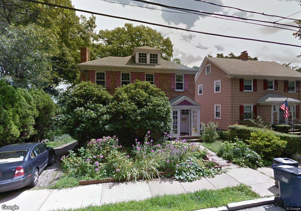
57 Arborough Rd Roslindale, MA 02131
Roslindale NeighborhoodEstimated Value: $834,000 - $1,155,000
4
Beds
3
Baths
2,214
Sq Ft
$461/Sq Ft
Est. Value
About This Home
This home is located at 57 Arborough Rd, Roslindale, MA 02131 and is currently estimated at $1,020,807, approximately $461 per square foot. 57 Arborough Rd is a home located in Suffolk County with nearby schools including Brooke Charter School Roslindale, Sacred Heart STEM School, and Holy Name Parish School.
Ownership History
Date
Name
Owned For
Owner Type
Purchase Details
Closed on
Apr 21, 2022
Sold by
Wright Alan and Dealy Katharine K
Bought by
Wright Alan and Dealy Katharine K
Current Estimated Value
Home Financials for this Owner
Home Financials are based on the most recent Mortgage that was taken out on this home.
Original Mortgage
$1,425,000
Outstanding Balance
$1,413,832
Interest Rate
3.81%
Mortgage Type
Reverse Mortgage Home Equity Conversion Mortgage
Estimated Equity
-$393,025
Purchase Details
Closed on
Aug 2, 1993
Sold by
Berman Joseph M and Mccormick Sheila P
Bought by
Wright Alan and Dealy Katharine K
Home Financials for this Owner
Home Financials are based on the most recent Mortgage that was taken out on this home.
Original Mortgage
$202,350
Interest Rate
7.32%
Mortgage Type
Purchase Money Mortgage
Create a Home Valuation Report for This Property
The Home Valuation Report is an in-depth analysis detailing your home's value as well as a comparison with similar homes in the area
Home Values in the Area
Average Home Value in this Area
Purchase History
| Date | Buyer | Sale Price | Title Company |
|---|---|---|---|
| Wright Alan | -- | None Available | |
| Wright Alan | $227,000 | -- | |
| Wright Alan | $227,000 | -- |
Source: Public Records
Mortgage History
| Date | Status | Borrower | Loan Amount |
|---|---|---|---|
| Open | Wright Alan | $1,425,000 | |
| Previous Owner | Wright Alan | $211,500 | |
| Previous Owner | Wright Alan | $200,000 | |
| Previous Owner | Wright Alan | $202,350 |
Source: Public Records
Tax History Compared to Growth
Tax History
| Year | Tax Paid | Tax Assessment Tax Assessment Total Assessment is a certain percentage of the fair market value that is determined by local assessors to be the total taxable value of land and additions on the property. | Land | Improvement |
|---|---|---|---|---|
| 2025 | $12,542 | $1,083,100 | $357,300 | $725,800 |
| 2024 | $10,792 | $990,100 | $304,200 | $685,900 |
| 2023 | $10,634 | $990,100 | $304,200 | $685,900 |
| 2022 | $9,879 | $908,000 | $279,000 | $629,000 |
| 2021 | $9,226 | $864,700 | $265,700 | $599,000 |
| 2020 | $8,365 | $792,100 | $234,700 | $557,400 |
| 2019 | $8,143 | $772,600 | $215,500 | $557,100 |
| 2018 | $7,567 | $722,000 | $215,500 | $506,500 |
| 2017 | $7,425 | $701,100 | $215,500 | $485,600 |
| 2016 | $7,417 | $674,300 | $215,500 | $458,800 |
| 2015 | $7,059 | $582,900 | $173,100 | $409,800 |
| 2014 | $6,377 | $506,900 | $173,100 | $333,800 |
Source: Public Records
Map
Nearby Homes
- 620 South St
- 46 Cotton St Unit 46
- 20 Taft Hill Park Unit 5
- 21 Bexley Rd
- 108 Florence St Unit 1
- 108 Florence St Unit 3
- 108 Florence St Unit 2
- 173 Brookway Rd
- 15 S Fairview St Unit 3
- 2 Weld Hill St Unit 301
- 2 Weld Hill St Unit PH2
- 2 Weld Hill St Unit 302
- 22 Walter St Unit 2
- 39 Harrison St Unit B
- 18 Robert St Unit 14
- 18 Robert St Unit 4
- 187 Florence St Unit 2L
- 27 Sheffield Rd Unit 3
- 74 Selwyn St Unit 2
- 25 Harrison St Unit C
- 55 Arborough Rd
- 55 Arborough Rd Unit 1
- 51 Arborough Rd
- 56 Arborough Rd
- 60 Arborough Rd
- 47 Arborough Rd
- 52 Arborough Rd
- 43 Arborough Rd
- 48 Arborough Rd
- 59 Fairview St
- 44 Arborough Rd
- 39 Arborough Rd
- 57 Fairview St
- 55 Fairview St
- 40 Arborough Rd
- 35 Arborough Rd
- 53 Fairview St
- 36 Arborough Rd
- 651 South St
- 51 Fairview St