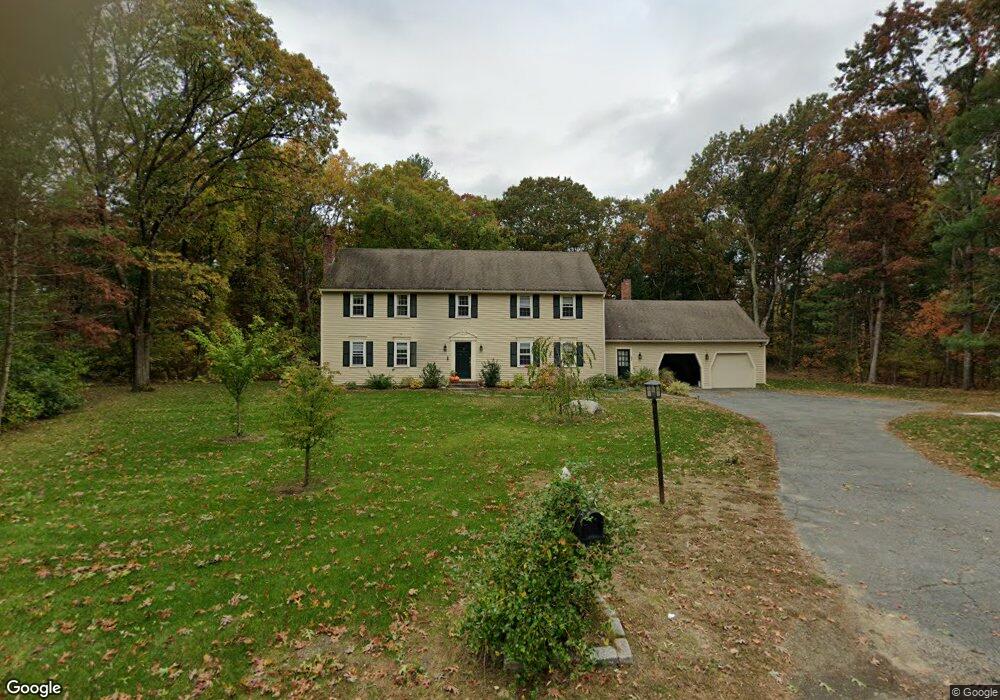
57 Austin Rd Sudbury, MA 01776
Estimated Value: $1,204,000 - $1,379,000
5
Beds
3
Baths
3,152
Sq Ft
$413/Sq Ft
Est. Value
About This Home
This home is located at 57 Austin Rd, Sudbury, MA 01776 and is currently estimated at $1,301,128, approximately $412 per square foot. 57 Austin Rd is a home located in Middlesex County with nearby schools including Peter Noyes Elementary School, Ephraim Curtis Middle School, and Lincoln-Sudbury Regional High School.
Ownership History
Date
Name
Owned For
Owner Type
Purchase Details
Closed on
Jun 16, 2003
Sold by
Macdonald Robert P and Macdonald Sharon J
Bought by
Nathan David E and Nathan Susan H
Current Estimated Value
Home Financials for this Owner
Home Financials are based on the most recent Mortgage that was taken out on this home.
Original Mortgage
$491,000
Interest Rate
5.77%
Mortgage Type
Purchase Money Mortgage
Purchase Details
Closed on
Jun 8, 2001
Sold by
Stacy Esther
Bought by
Macdonald Robert P and Sperazza Sharon J
Home Financials for this Owner
Home Financials are based on the most recent Mortgage that was taken out on this home.
Original Mortgage
$190,000
Interest Rate
7.08%
Mortgage Type
Purchase Money Mortgage
Create a Home Valuation Report for This Property
The Home Valuation Report is an in-depth analysis detailing your home's value as well as a comparison with similar homes in the area
Home Values in the Area
Average Home Value in this Area
Purchase History
| Date | Buyer | Sale Price | Title Company |
|---|---|---|---|
| Nathan David E | $715,000 | -- | |
| Nathan David E | $715,000 | -- | |
| Macdonald Robert P | $650,000 | -- |
Source: Public Records
Mortgage History
| Date | Status | Borrower | Loan Amount |
|---|---|---|---|
| Open | Macdonald Robert P | $433,000 | |
| Closed | Nathan David E | $491,000 | |
| Previous Owner | Macdonald Robert P | $190,000 |
Source: Public Records
Tax History Compared to Growth
Tax History
| Year | Tax Paid | Tax Assessment Tax Assessment Total Assessment is a certain percentage of the fair market value that is determined by local assessors to be the total taxable value of land and additions on the property. | Land | Improvement |
|---|---|---|---|---|
| 2025 | $16,852 | $1,151,100 | $461,800 | $689,300 |
| 2024 | $16,207 | $1,109,300 | $448,200 | $661,100 |
| 2023 | $15,259 | $967,600 | $415,000 | $552,600 |
| 2022 | $15,005 | $831,300 | $380,600 | $450,700 |
| 2021 | $14,277 | $758,200 | $380,600 | $377,600 |
| 2020 | $13,989 | $758,200 | $380,600 | $377,600 |
| 2019 | $13,579 | $758,200 | $380,600 | $377,600 |
| 2018 | $13,358 | $745,000 | $400,600 | $344,400 |
| 2017 | $12,372 | $697,400 | $395,800 | $301,600 |
| 2016 | $11,988 | $673,500 | $380,600 | $292,900 |
| 2015 | $11,489 | $652,800 | $365,800 | $287,000 |
| 2014 | $11,469 | $636,100 | $355,000 | $281,100 |
Source: Public Records
Map
Nearby Homes