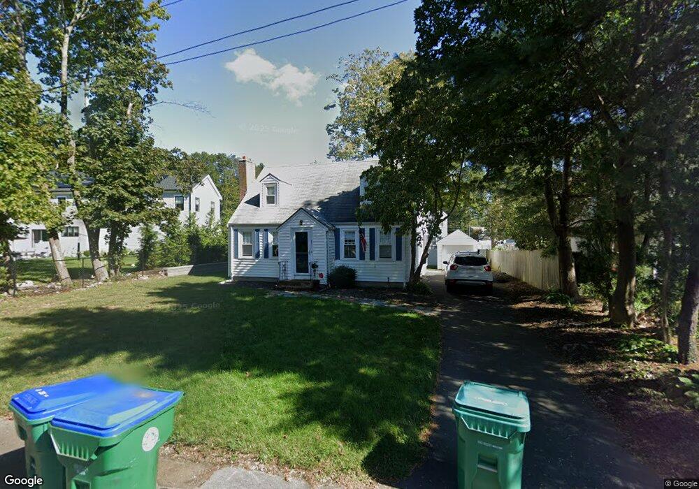
57 Buckmaster Rd Unit 57 Westwood, MA 02090
Estimated Value: $859,000 - $983,000
3
Beds
2
Baths
1,676
Sq Ft
$552/Sq Ft
Est. Value
About This Home
This home is located at 57 Buckmaster Rd Unit 57, Westwood, MA 02090 and is currently estimated at $925,003, approximately $551 per square foot. 57 Buckmaster Rd Unit 57 is a home located in Norfolk County with nearby schools including Westwood High School, St Catherine Of Siena School, and Xaverian Brothers High School.
Ownership History
Date
Name
Owned For
Owner Type
Purchase Details
Closed on
Jan 17, 2020
Sold by
Molloy Susan
Bought by
Boudreau Christopher J and Boudreau Alexandra N
Current Estimated Value
Home Financials for this Owner
Home Financials are based on the most recent Mortgage that was taken out on this home.
Original Mortgage
$450,000
Outstanding Balance
$398,586
Interest Rate
3.73%
Mortgage Type
New Conventional
Estimated Equity
$526,417
Purchase Details
Closed on
Feb 13, 2009
Sold by
Molloy Claire A
Bought by
Molloy Claire A and Molloy Susan
Create a Home Valuation Report for This Property
The Home Valuation Report is an in-depth analysis detailing your home's value as well as a comparison with similar homes in the area
Home Values in the Area
Average Home Value in this Area
Purchase History
| Date | Buyer | Sale Price | Title Company |
|---|---|---|---|
| Boudreau Christopher J | $562,500 | None Available | |
| Molloy Claire A | -- | -- |
Source: Public Records
Mortgage History
| Date | Status | Borrower | Loan Amount |
|---|---|---|---|
| Open | Boudreau Christopher J | $450,000 |
Source: Public Records
Tax History Compared to Growth
Tax History
| Year | Tax Paid | Tax Assessment Tax Assessment Total Assessment is a certain percentage of the fair market value that is determined by local assessors to be the total taxable value of land and additions on the property. | Land | Improvement |
|---|---|---|---|---|
| 2025 | $10,586 | $827,000 | $470,600 | $356,400 |
| 2024 | $10,125 | $790,400 | $448,200 | $342,200 |
| 2023 | $9,010 | $630,100 | $373,400 | $256,700 |
| 2022 | $8,492 | $572,600 | $315,850 | $256,750 |
| 2021 | $8,683 | $587,450 | $300,800 | $286,650 |
| 2020 | $8,193 | $564,650 | $300,800 | $263,850 |
| 2019 | $7,767 | $530,150 | $286,500 | $243,650 |
| 2018 | $7,396 | $490,100 | $286,500 | $203,600 |
| 2017 | $7,149 | $490,650 | $286,500 | $204,150 |
| 2016 | $7,054 | $481,150 | $286,500 | $194,650 |
| 2015 | $6,755 | $443,250 | $286,500 | $156,750 |
Source: Public Records
Map
Nearby Homes