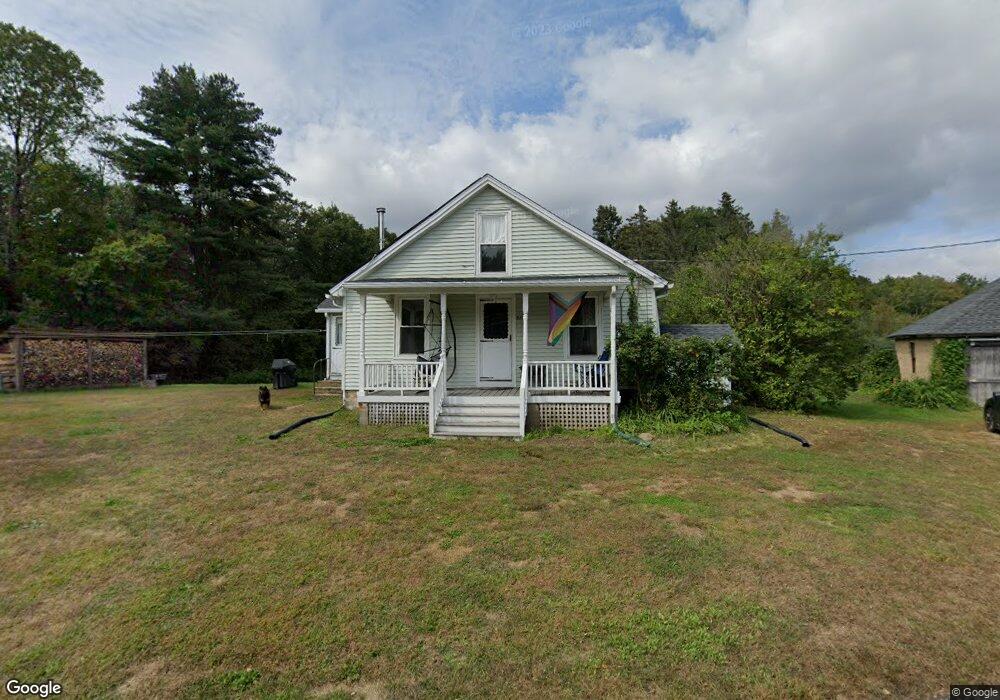
57 Cemetary Rd Willington, CT 06279
Estimated Value: $274,315 - $355,000
3
Beds
2
Baths
1,256
Sq Ft
$251/Sq Ft
Est. Value
About This Home
This home is located at 57 Cemetary Rd, Willington, CT 06279 and is currently estimated at $315,079, approximately $250 per square foot. 57 Cemetary Rd is a home located in Tolland County with nearby schools including Center Elementary School, Hall Memorial School, and E.O. Smith High School.
Ownership History
Date
Name
Owned For
Owner Type
Purchase Details
Closed on
Apr 12, 2024
Sold by
Thorpe Jennifer E
Bought by
Pallo Scott M
Current Estimated Value
Create a Home Valuation Report for This Property
The Home Valuation Report is an in-depth analysis detailing your home's value as well as a comparison with similar homes in the area
Home Values in the Area
Average Home Value in this Area
Purchase History
| Date | Buyer | Sale Price | Title Company |
|---|---|---|---|
| Pallo Scott M | -- | None Available | |
| Pallo Scott M | -- | None Available |
Source: Public Records
Tax History Compared to Growth
Tax History
| Year | Tax Paid | Tax Assessment Tax Assessment Total Assessment is a certain percentage of the fair market value that is determined by local assessors to be the total taxable value of land and additions on the property. | Land | Improvement |
|---|---|---|---|---|
| 2025 | $3,625 | $142,620 | $52,990 | $89,630 |
| 2024 | $3,865 | $114,050 | $34,030 | $80,020 |
| 2023 | $3,668 | $114,050 | $34,030 | $80,020 |
| 2022 | $3,566 | $114,050 | $34,030 | $80,020 |
| 2021 | $8,668 | $114,050 | $34,030 | $80,020 |
| 2020 | $8,668 | $114,050 | $34,030 | $80,020 |
| 2019 | $3,432 | $114,050 | $34,030 | $80,020 |
| 2018 | $3,146 | $104,550 | $43,590 | $60,960 |
| 2017 | $3,146 | $104,550 | $43,590 | $60,960 |
| 2015 | $2,858 | $104,550 | $43,590 | $60,960 |
| 2014 | $2,858 | $104,550 | $43,590 | $60,960 |
Source: Public Records
Map
Nearby Homes
- 28 Cemetery Rd
- 61 Lohse Rd
- 57 Lohse Rd
- 65 Blair Rd
- 21 Ashley Ln
- 184 Village Hill Rd
- 0 Lohse Rd Unit map 42 block 21
- 20 Grant Ave
- 23 East St
- 52 High St
- 30 Edgewood St
- 44 Tolland Ave Unit 37
- 44 Tolland Ave Unit 46
- 44 Tolland Ave Unit 64
- 4 Clinton St
- 71 W Main St
- 92 Furnace Ave Unit 68
- 336 East St
- 0 River Rd Unit 24120753
- 0 Tolland Turnpike