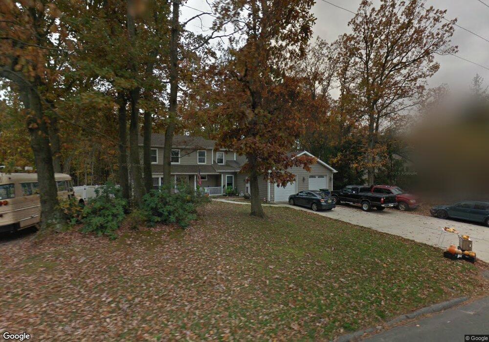
57 County Route 520 Englishtown, NJ 07726
Estimated Value: $732,000 - $993,909
5
Beds
4
Baths
3,000
Sq Ft
$266/Sq Ft
Est. Value
About This Home
This home is located at 57 County Route 520, Englishtown, NJ 07726 and is currently estimated at $799,227, approximately $266 per square foot. 57 County Route 520 is a home located in Monmouth County with nearby schools including Robertsville Elementary School, Marlboro Memorial Middle School, and Marlboro High School.
Ownership History
Date
Name
Owned For
Owner Type
Purchase Details
Closed on
Jun 30, 2025
Sold by
Gatto Domenic and Gatto Anne
Bought by
Waldman Alexander and Waldman Imani
Current Estimated Value
Home Financials for this Owner
Home Financials are based on the most recent Mortgage that was taken out on this home.
Original Mortgage
$580,000
Outstanding Balance
$579,018
Interest Rate
6.85%
Mortgage Type
New Conventional
Estimated Equity
$220,209
Create a Home Valuation Report for This Property
The Home Valuation Report is an in-depth analysis detailing your home's value as well as a comparison with similar homes in the area
Home Values in the Area
Average Home Value in this Area
Purchase History
| Date | Buyer | Sale Price | Title Company |
|---|---|---|---|
| Waldman Alexander | $725,000 | Guardian Title Services | |
| Waldman Alexander | $725,000 | Guardian Title Services |
Source: Public Records
Mortgage History
| Date | Status | Borrower | Loan Amount |
|---|---|---|---|
| Open | Waldman Alexander | $580,000 | |
| Closed | Waldman Alexander | $580,000 |
Source: Public Records
Tax History Compared to Growth
Tax History
| Year | Tax Paid | Tax Assessment Tax Assessment Total Assessment is a certain percentage of the fair market value that is determined by local assessors to be the total taxable value of land and additions on the property. | Land | Improvement |
|---|---|---|---|---|
| 2025 | $9,629 | $384,700 | $179,800 | $204,900 |
| 2024 | $9,229 | $384,700 | $179,800 | $204,900 |
| 2023 | $9,229 | $384,700 | $179,800 | $204,900 |
| 2022 | $9,006 | $384,700 | $179,800 | $204,900 |
| 2021 | $8,906 | $384,700 | $179,800 | $204,900 |
| 2020 | $8,906 | $384,700 | $179,800 | $204,900 |
| 2019 | $8,906 | $384,700 | $179,800 | $204,900 |
| 2018 | $8,756 | $384,700 | $179,800 | $204,900 |
| 2017 | $8,579 | $384,700 | $179,800 | $204,900 |
| 2016 | $8,548 | $384,700 | $179,800 | $204,900 |
| 2015 | $8,526 | $389,500 | $179,800 | $209,700 |
| 2014 | $8,090 | $327,300 | $179,800 | $147,500 |
Source: Public Records
Map
Nearby Homes
- 12 Hamilton Ave
- 22 Bartram Rd
- 24 Bartram Rd
- 20 W Francis Ave
- 125 County Road 520
- 40 Azalea Dr
- 65 Enclosure Dr
- 41 Guest Dr
- 51 Enclosure Dr
- 22 Enclosure Dr
- 22 Riley Rd
- 102 Parker Chase
- 182 Nathan Dr
- 171 Nathan Dr
- 158 Nathan Dr Unit 126
- 435 Hancock Place
- 455 Hawthorne Place
- 3 Riley Rd
- 291 Stratford Place
- 374 Hampton Place
- 57 County Road 520
- 55 County Road 520
- 59 County Route 520
- 59 County Road 520
- 59 County Road 520 Unit Ground Level
- 52 County Road 520
- 53 County Road 520
- 61 County Road 520
- 3 Bluffs Ct
- 4 Bluffs Ct
- 2 Chase Dr
- 49 County Road 520
- 65 County Road 520
- 7 Bluffs Ct
- 4 Chase Dr
- 8 Bluffs Ct
- 51 County Road 520
- 1 Chase Dr
- 6 Chase Dr
- 69 County Road 520