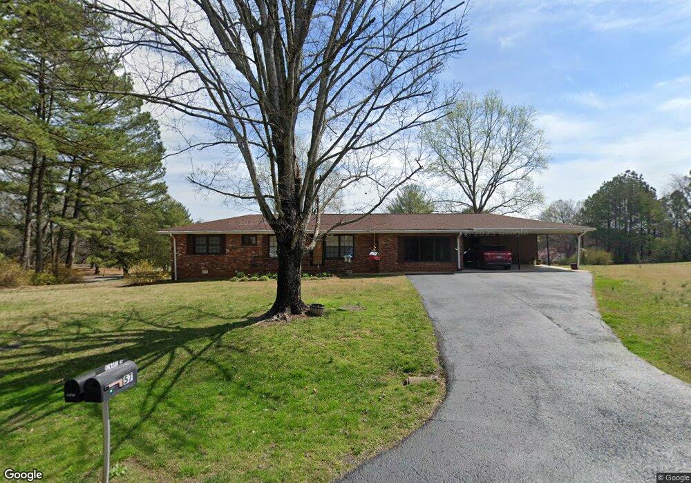
57 Crest Dr Rock Spring, GA 30739
Rock Spring NeighborhoodEstimated Value: $220,000 - $499,000
Studio
2
Baths
1,113
Sq Ft
$343/Sq Ft
Est. Value
About This Home
This home is located at 57 Crest Dr, Rock Spring, GA 30739 and is currently estimated at $381,890, approximately $343 per square foot. 57 Crest Dr is a home located in Walker County with nearby schools including Rock Spring Elementary School, Lafayette High School, and Alice M Daley Adventist School.
Ownership History
Date
Name
Owned For
Owner Type
Purchase Details
Closed on
Oct 29, 2025
Sold by
Howard Bernice Smith
Bought by
Howard Earl Clayton
Current Estimated Value
Purchase Details
Closed on
Nov 29, 2018
Sold by
Allen Howard Donald
Bought by
Howard Bernice S
Purchase Details
Closed on
Apr 24, 2015
Sold by
Howard Don
Bought by
Howard Don and Howard Bernice L
Purchase Details
Closed on
May 25, 2006
Sold by
Not Provided
Bought by
Howard Don A and Howard Bernice L
Purchase Details
Closed on
Aug 9, 2003
Sold by
Howard Don and Howard Bernice
Bought by
Kling Elizabeth V (Life Estate
Purchase Details
Closed on
Aug 20, 1991
Bought by
Howard D A
Purchase Details
Closed on
Dec 6, 1984
Sold by
Kling W L
Bought by
Howard Don A and Howard Bernice L
Purchase Details
Closed on
Aug 26, 1972
Sold by
Smith George G and Smith Mildred
Bought by
Howard Don A and Howard Bernice L
Create a Home Valuation Report for This Property
The Home Valuation Report is an in-depth analysis detailing your home's value as well as a comparison with similar homes in the area
Home Values in the Area
Average Home Value in this Area
Purchase History
| Date | Buyer | Sale Price | Title Company |
|---|---|---|---|
| Howard Earl Clayton | -- | -- | |
| Howard Bernice S | -- | -- | |
| Howard Don | -- | -- | |
| Howard Don A | -- | -- | |
| Kling Elizabeth V (Life Estate | -- | -- | |
| Howard D A | -- | -- | |
| Howard Don A | -- | -- | |
| Howard Don A | $4,000 | -- |
Source: Public Records
Tax History
| Year | Tax Paid | Tax Assessment Tax Assessment Total Assessment is a certain percentage of the fair market value that is determined by local assessors to be the total taxable value of land and additions on the property. | Land | Improvement |
|---|---|---|---|---|
| 2025 | $1,602 | $216,939 | $47,300 | $169,639 |
| 2024 | $1,699 | $202,622 | $43,000 | $159,622 |
| 2023 | $3,007 | $194,558 | $43,000 | $151,558 |
| 2022 | $642 | $84,542 | $43,000 | $41,542 |
| 2021 | $633 | $74,933 | $43,000 | $31,933 |
| 2020 | $650 | $72,873 | $43,000 | $29,873 |
| 2019 | $669 | $72,873 | $43,000 | $29,873 |
| 2018 | $1,928 | $72,873 | $43,000 | $29,873 |
| 2017 | $547 | $72,873 | $43,000 | $29,873 |
| 2016 | $547 | $72,873 | $43,000 | $29,873 |
| 2015 | $1,309 | $75,804 | $25,536 | $50,268 |
| 2014 | $383 | $43,214 | $6,620 | $36,594 |
| 2013 | $1,928 | $43,213 | $6,620 | $36,593 |
Source: Public Records
Map
Nearby Homes
- 00 Georgia 95
- 1003 Highway N Old 27
- 1909 Old Lafayette Rd
- 348 Straight Gut Rd
- 1985 Peavine Rd
- 40 Blessed Way
- 74 Hanshaw Dr
- 229 E Turnipseed Rd
- 53 Ginger Lake Dr
- 136 Ginger Lake Dr
- 788 Long Hollow Rd
- 109 Rory Dr
- 22 Willow Cir
- 130 Hankins Rd
- 488 Guy Williams Rd
- 498 Guy Williams Rd
- 532 Guy Williams Rd
- 918 Old Lafayette Rd
- 686 Bell Rd
- 449 W Watts Rd
- 57 Crest Dr
- 81 Crest Dr
- 3030 Peavine Rd
- 107 Crest Dr
- 3066 Peavine Rd
- 436 Kay Conley Rd
- 100 Crest Dr
- 3116 Peavine Rd
- 2910 Peavine Rd
- 139 Crest Dr
- 3142 Peavine Rd
- 464 Kay Conley Rd
- 406 Kay Conley Rd
- 130 Crest Dr
- 2892 Peavine Rd
- 3182 Peavine Rd
- 2987 Peavine Rd
- 368 Kay Conley Rd
- 486 Kay Conley Rd
- 498 Kay Conley Rd
Your Personal Tour Guide
Ask me questions while you tour the home.