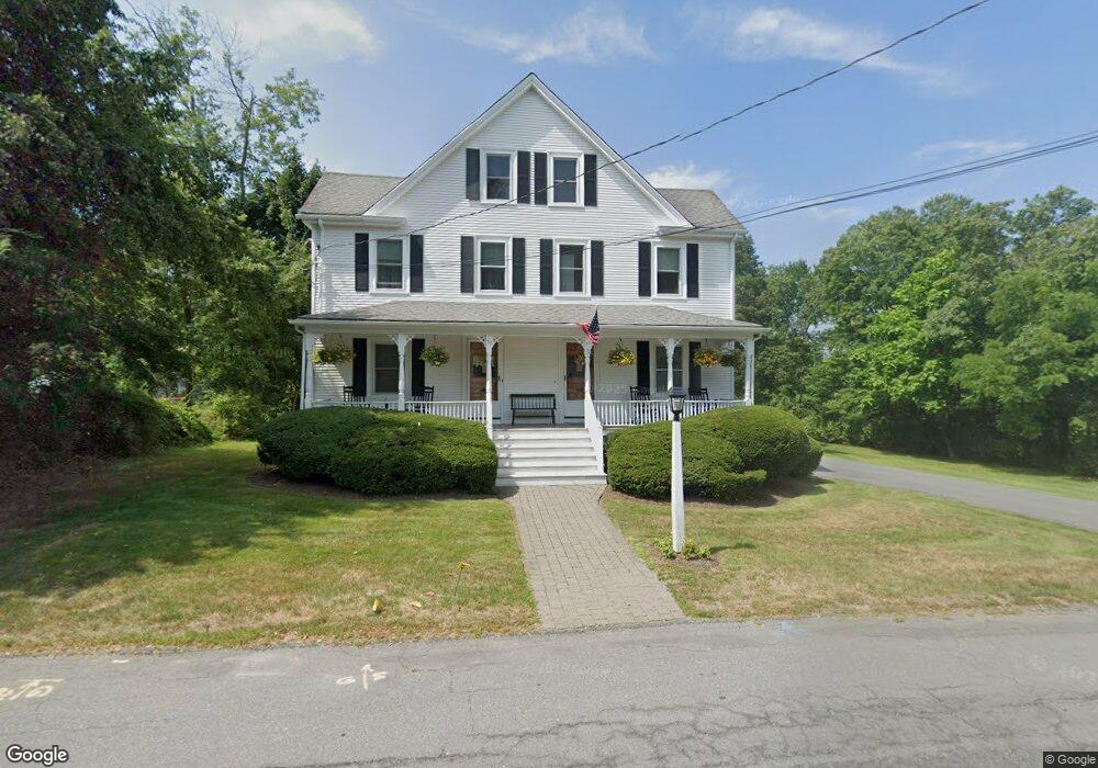
57 Diamond St Walpole, MA 02081
Estimated Value: $473,549 - $524,000
3
Beds
1
Bath
1,306
Sq Ft
$382/Sq Ft
Est. Value
About This Home
This home is located at 57 Diamond St, Walpole, MA 02081 and is currently estimated at $498,637, approximately $381 per square foot. 57 Diamond St is a home located in Norfolk County with nearby schools including Elm Street School, Eleanor N. Johnson Middle School, and Walpole High School.
Ownership History
Date
Name
Owned For
Owner Type
Purchase Details
Closed on
Oct 8, 2014
Sold by
A E Hazlett Ft
Bought by
Conley James M
Current Estimated Value
Home Financials for this Owner
Home Financials are based on the most recent Mortgage that was taken out on this home.
Original Mortgage
$150,500
Outstanding Balance
$115,380
Interest Rate
4.1%
Mortgage Type
New Conventional
Estimated Equity
$383,257
Purchase Details
Closed on
Jun 30, 2009
Sold by
Hazlett Ann E
Bought by
Hazlett Ann E and Boragine Mary
Create a Home Valuation Report for This Property
The Home Valuation Report is an in-depth analysis detailing your home's value as well as a comparison with similar homes in the area
Home Values in the Area
Average Home Value in this Area
Purchase History
| Date | Buyer | Sale Price | Title Company |
|---|---|---|---|
| Conley James M | $220,000 | -- | |
| Hazlett Ann E | -- | -- |
Source: Public Records
Mortgage History
| Date | Status | Borrower | Loan Amount |
|---|---|---|---|
| Open | Conley James M | $150,500 |
Source: Public Records
Tax History
| Year | Tax Paid | Tax Assessment Tax Assessment Total Assessment is a certain percentage of the fair market value that is determined by local assessors to be the total taxable value of land and additions on the property. | Land | Improvement |
|---|---|---|---|---|
| 2025 | $4,737 | $369,200 | $0 | $369,200 |
| 2024 | $4,561 | $345,000 | $0 | $345,000 |
| 2023 | $4,396 | $316,500 | $0 | $316,500 |
| 2022 | $4,160 | $287,700 | $0 | $287,700 |
| 2021 | $4,145 | $279,300 | $0 | $279,300 |
| 2020 | $3,759 | $250,800 | $0 | $250,800 |
| 2019 | $3,677 | $243,500 | $0 | $243,500 |
| 2018 | $3,508 | $229,700 | $0 | $229,700 |
| 2017 | $3,417 | $222,900 | $0 | $222,900 |
| 2016 | $3,400 | $218,500 | $0 | $218,500 |
| 2015 | $3,341 | $212,800 | $0 | $212,800 |
| 2014 | $3,289 | $208,700 | $0 | $208,700 |
Source: Public Records
Map
Nearby Homes
- 222 School St Unit 9
- 224 School St Unit 9
- 2 Kendall St
- 881 Main St Unit 9
- 1110 Main St
- 56 North St
- 145 South St Unit 5
- 41 Gill St Unit A
- 260 Elm St
- 37 Alice Ave
- 291 Plimpton St
- 486 Washington St
- 127 Clear Pond Dr
- 137 Clear Pond Dr
- 246 Pemberton St
- 1391 Main St Unit 308
- 1391 Main St Unit 306
- 1391 Main St Unit 304
- 6 Eleanor Rd
- 587 Common St
- 57 Diamond St Unit 57
- 65 Diamond St Unit 67
- 65 Diamond St Unit 1
- 67 Diamond St
- 65 Diamond St Unit 65
- 65-67 Diamond St
- 59 Diamond St
- 54 Diamond St
- 64 Diamond St Unit B
- 64 Diamond St Unit A
- 64 Diamond St
- 71 Diamond St
- 71 Diamond St Unit 1
- 45 Diamond St
- 3 Pond Ln
- 78 Diamond St
- 81 Diamond St
- 81 Diamond St Unit 2
- 35 Diamond St
- 8 Pond Ln
Your Personal Tour Guide
Ask me questions while you tour the home.