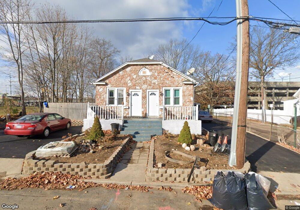
57 E 2nd St Huntington Station, NY 11746
Estimated Value: $488,000 - $640,900
5
Beds
2
Baths
--
Sq Ft
5,227
Sq Ft Lot
About This Home
This home is located at 57 E 2nd St, Huntington Station, NY 11746 and is currently estimated at $569,725. 57 E 2nd St is a home located in Suffolk County with nearby schools including Woodhull Intermediate School, Southdown Primary School, and J Taylor Finley Middle School.
Ownership History
Date
Name
Owned For
Owner Type
Purchase Details
Closed on
Mar 14, 2018
Sold by
Mtglq Investors Lp
Bought by
Cohen John A
Current Estimated Value
Purchase Details
Closed on
Sep 22, 2017
Sold by
Suffolk County Of
Bought by
Mtglq Investors Lp
Purchase Details
Closed on
Jan 26, 2001
Sold by
Manniello Robert
Bought by
Harvey Evelyn
Home Financials for this Owner
Home Financials are based on the most recent Mortgage that was taken out on this home.
Original Mortgage
$114,475
Interest Rate
7%
Mortgage Type
Stand Alone First
Create a Home Valuation Report for This Property
The Home Valuation Report is an in-depth analysis detailing your home's value as well as a comparison with similar homes in the area
Home Values in the Area
Average Home Value in this Area
Purchase History
| Date | Buyer | Sale Price | Title Company |
|---|---|---|---|
| Cohen John A | -- | -- | |
| Mtglq Investors Lp | $520,983 | -- | |
| Mtglq Investors Lp | $520,983 | -- | |
| Harvey Evelyn | $120,500 | Chicago Title Insurance Co |
Source: Public Records
Mortgage History
| Date | Status | Borrower | Loan Amount |
|---|---|---|---|
| Previous Owner | Harvey Evelyn | $114,475 |
Source: Public Records
Tax History Compared to Growth
Tax History
| Year | Tax Paid | Tax Assessment Tax Assessment Total Assessment is a certain percentage of the fair market value that is determined by local assessors to be the total taxable value of land and additions on the property. | Land | Improvement |
|---|---|---|---|---|
| 2024 | $9,120 | $2,300 | $150 | $2,150 |
| 2023 | $4,560 | $2,300 | $150 | $2,150 |
| 2022 | $9,065 | $2,300 | $150 | $2,150 |
| 2021 | $8,977 | $2,300 | $150 | $2,150 |
| 2020 | $8,872 | $2,300 | $150 | $2,150 |
| 2019 | $17,744 | $0 | $0 | $0 |
| 2018 | $0 | $2,300 | $150 | $2,150 |
| 2017 | $8,431 | $2,300 | $150 | $2,150 |
| 2016 | $8,328 | $2,300 | $150 | $2,150 |
| 2015 | -- | $2,300 | $150 | $2,150 |
| 2014 | -- | $2,300 | $150 | $2,150 |
Source: Public Records
Map
Nearby Homes
- 71 Biltmore Cir
- 57 E Pulaski Rd
- 280 Lowndes Ave Unit 208
- 280 Lowndes Ave Unit 305G
- 280 Lowndes Ave Unit 111G
- 148 Lenox Rd
- 95 E Pulaski Rd
- 26 Townhouse Rd S Unit 26
- 200 Lowndes Ave Unit A
- 24 Columbia St
- 84 E 9th St
- 107 E 9th St
- 1 Varney Ave
- 92 Columbia St
- 128 Winding St
- 217 Broadway
- 0 Tower St
- 30 3rd Ave
- 49 Tower St
- 62 Lowndes Ave