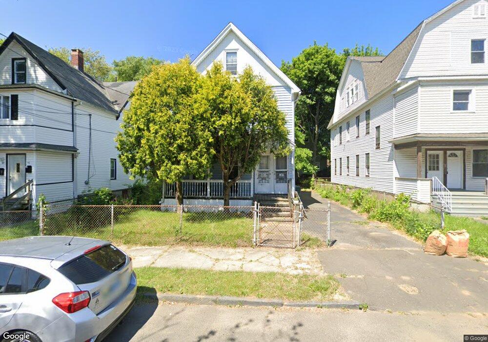
57 Freeman St Unit 59 Bridgeport, CT 06607
East End NeighborhoodEstimated Value: $329,907 - $423,000
4
Beds
2
Baths
2,288
Sq Ft
$173/Sq Ft
Est. Value
About This Home
This home is located at 57 Freeman St Unit 59, Bridgeport, CT 06607 and is currently estimated at $394,727, approximately $172 per square foot. 57 Freeman St Unit 59 is a home located in Fairfield County with nearby schools including Jettie S. Tisdale School and Harding High School.
Ownership History
Date
Name
Owned For
Owner Type
Purchase Details
Closed on
Apr 28, 2003
Sold by
Stubbs Paul and Gamache John
Bought by
Rodriguez Fabrian
Current Estimated Value
Home Financials for this Owner
Home Financials are based on the most recent Mortgage that was taken out on this home.
Original Mortgage
$173,600
Outstanding Balance
$74,625
Interest Rate
5.64%
Estimated Equity
$320,102
Create a Home Valuation Report for This Property
The Home Valuation Report is an in-depth analysis detailing your home's value as well as a comparison with similar homes in the area
Home Values in the Area
Average Home Value in this Area
Purchase History
| Date | Buyer | Sale Price | Title Company |
|---|---|---|---|
| Rodriguez Fabrian | $175,000 | -- | |
| Rodriguez Fabrian | $175,000 | -- |
Source: Public Records
Mortgage History
| Date | Status | Borrower | Loan Amount |
|---|---|---|---|
| Open | Rodriguez Fabrian | $173,600 | |
| Closed | Rodriguez Fabrian | $10,200 | |
| Closed | Rodriguez Fabrian | $173,600 |
Source: Public Records
Tax History
| Year | Tax Paid | Tax Assessment Tax Assessment Total Assessment is a certain percentage of the fair market value that is determined by local assessors to be the total taxable value of land and additions on the property. | Land | Improvement |
|---|---|---|---|---|
| 2025 | $5,448 | $125,380 | $30,720 | $94,660 |
| 2024 | $5,448 | $125,380 | $30,720 | $94,660 |
| 2023 | $5,448 | $125,380 | $30,720 | $94,660 |
| 2022 | $5,448 | $125,380 | $30,720 | $94,660 |
| 2021 | $5,448 | $125,380 | $30,720 | $94,660 |
| 2020 | $5,121 | $94,850 | $17,190 | $77,660 |
| 2019 | $5,121 | $94,850 | $17,190 | $77,660 |
| 2018 | $5,157 | $94,850 | $17,190 | $77,660 |
| 2017 | $5,157 | $94,850 | $17,190 | $77,660 |
| 2016 | $5,157 | $94,850 | $17,190 | $77,660 |
| 2015 | $5,737 | $135,940 | $29,460 | $106,480 |
| 2014 | $5,737 | $135,940 | $29,460 | $106,480 |
Source: Public Records
Map
Nearby Homes
- 1034 Connecticut Ave
- 180 Read St
- 202-204 Hewitt St
- 860 Connecticut Ave
- 537 Hollister Ave
- 464 Wilmot Ave
- 1440 Stratford Ave
- 10 Ordnance Ct Unit 3
- 644 Carroll Ave Unit 5
- 363 Carroll Ave Unit 365
- 306 Carroll Ave
- 270 East Ave
- 312 Jackson Ave
- 30 Kent Ave
- 221 Bunnell St
- 220 Victory St
- 415 Bruce Ave
- 67-69 Kent Ave
- 614-618 Bishop Ave
- 188 Holly St
- 67 Freeman St
- 49 Freeman St Unit 51
- 75 Freeman St Unit 77
- 68 Freeman St Unit 70
- 68 Freeman St Unit 3
- 68 Freeman St Unit 2
- 96 Waterman St
- 60 Freeman St
- 66 Freeman St
- 43 Freeman St
- 70 Freeman St
- 54 Freeman St
- 90 Waterman St
- 29 Freeman St Unit 33
- 82 Waterman St
- 76 Waterman St
- 78 Waterman St Unit 2 FL
- 78 Waterman St
- 76-78 Waterman St
- 65 Freeman St
Your Personal Tour Guide
Ask me questions while you tour the home.