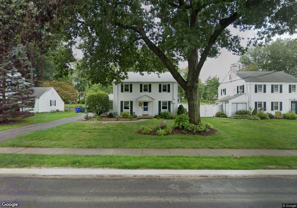
57 Glenbrook Rd West Hartford, CT 06107
Estimated Value: $512,000 - $641,000
3
Beds
3
Baths
2,004
Sq Ft
$300/Sq Ft
Est. Value
About This Home
This home is located at 57 Glenbrook Rd, West Hartford, CT 06107 and is currently estimated at $600,445, approximately $299 per square foot. 57 Glenbrook Rd is a home located in Hartford County with nearby schools including Webster Hill School, Sedgwick Middle School, and Conard High School.
Ownership History
Date
Name
Owned For
Owner Type
Purchase Details
Closed on
Jun 20, 2018
Sold by
Flynn Ann C
Bought by
Flynn Ft
Current Estimated Value
Purchase Details
Closed on
Jun 11, 1999
Sold by
Pearson Gertrude J
Bought by
Flynn Ann C
Home Financials for this Owner
Home Financials are based on the most recent Mortgage that was taken out on this home.
Original Mortgage
$132,000
Interest Rate
6.1%
Purchase Details
Closed on
Aug 15, 1997
Sold by
Cooper Dan M and Cooper Katherine
Bought by
Gabow Andrew G and Gabow Carolyn E
Purchase Details
Closed on
Jan 7, 1997
Sold by
Glynn Thomas and Glynn Denise
Bought by
Stjohn Richard and Stjohn Mary Lou
Create a Home Valuation Report for This Property
The Home Valuation Report is an in-depth analysis detailing your home's value as well as a comparison with similar homes in the area
Home Values in the Area
Average Home Value in this Area
Purchase History
| Date | Buyer | Sale Price | Title Company |
|---|---|---|---|
| Flynn Ft | -- | -- | |
| Flynn Ann C | $165,000 | -- | |
| Gabow Andrew G | $325,000 | -- | |
| Stjohn Richard | $180,900 | -- |
Source: Public Records
Mortgage History
| Date | Status | Borrower | Loan Amount |
|---|---|---|---|
| Previous Owner | Stjohn Richard | $280,000 | |
| Previous Owner | Stjohn Richard | $75,000 | |
| Previous Owner | Stjohn Richard | $120,000 | |
| Previous Owner | Stjohn Richard | $132,000 |
Source: Public Records
Tax History Compared to Growth
Tax History
| Year | Tax Paid | Tax Assessment Tax Assessment Total Assessment is a certain percentage of the fair market value that is determined by local assessors to be the total taxable value of land and additions on the property. | Land | Improvement |
|---|---|---|---|---|
| 2025 | $12,103 | $270,270 | $101,430 | $168,840 |
| 2024 | $11,446 | $270,270 | $101,430 | $168,840 |
| 2023 | $11,059 | $270,270 | $101,430 | $168,840 |
| 2022 | $10,995 | $270,270 | $101,430 | $168,840 |
| 2021 | $11,230 | $264,740 | $105,140 | $159,600 |
| 2020 | $10,618 | $254,030 | $98,000 | $156,030 |
| 2019 | $10,618 | $254,030 | $98,000 | $156,030 |
| 2018 | $10,415 | $254,030 | $98,000 | $156,030 |
| 2017 | $10,425 | $254,030 | $98,000 | $156,030 |
| 2016 | $9,044 | $228,900 | $87,570 | $141,330 |
| 2015 | $8,769 | $228,900 | $87,570 | $141,330 |
| 2014 | $8,554 | $228,900 | $87,570 | $141,330 |
Source: Public Records
Map
Nearby Homes
- 61 Woodmere Rd
- 1640 Boulevard
- 395 Park Rd
- 394 Trout Brook Dr
- 96 Bentwood Rd
- 25 Ellsworth Rd
- 50 Acadia St
- 85 Memorial Rd Unit 512
- 39 Pheasant Hill Dr
- 2 Arapahoe Rd Unit 313
- 2 Arapahoe Rd Unit 308
- 2 Arapahoe Rd Unit 611
- 2 Arapahoe Rd Unit 601
- 2 Arapahoe Rd Unit 510
- 2 Arapahoe Rd Unit 505
- 2 Arapahoe Rd Unit 604
- 2 Arapahoe Rd Unit 609
- 2 Arapahoe Rd Unit 607
- 2 Arapahoe Rd Unit 312
- 2 Arapahoe Rd Unit 603
- 61 Glenbrook Rd
- 55 Glenbrook Rd
- 51 Glenbrook Rd
- 63 Glenbrook Rd
- 58 Greenhurst Rd
- 60 Greenhurst Rd
- 56 Greenhurst Rd
- 49 Glenbrook Rd
- 62 Greenhurst Rd
- 67 Glenbrook Rd
- 58 Glenbrook Rd
- 52 Greenhurst Rd
- 62 Glenbrook Rd
- 56 Glenbrook Rd
- 66 Greenhurst Rd
- 64 Glenbrook Rd
- 50 Greenhurst Rd
- 52 Glenbrook Rd
- 45 Glenbrook Rd
- 69 Glenbrook Rd