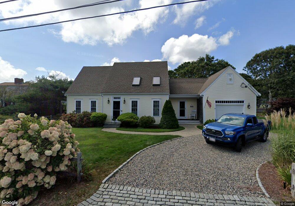
57 Glendon Rd Dennis Port, MA 02639
Dennis Port NeighborhoodEstimated Value: $752,000 - $1,072,000
3
Beds
2
Baths
1,614
Sq Ft
$586/Sq Ft
Est. Value
About This Home
This home is located at 57 Glendon Rd, Dennis Port, MA 02639 and is currently estimated at $945,194, approximately $585 per square foot. 57 Glendon Rd is a home located in Barnstable County with nearby schools including Dennis-Yarmouth Regional High School and St. Pius X. School.
Ownership History
Date
Name
Owned For
Owner Type
Purchase Details
Closed on
Apr 10, 2003
Sold by
Nbiswc Rt and Kelston David L
Bought by
Malo Carl W and Malo Jane W
Current Estimated Value
Purchase Details
Closed on
Feb 23, 2000
Sold by
Nbiswc Rt and Bane Marilyn A
Bought by
Kelston David A
Home Financials for this Owner
Home Financials are based on the most recent Mortgage that was taken out on this home.
Original Mortgage
$104,000
Interest Rate
8.24%
Create a Home Valuation Report for This Property
The Home Valuation Report is an in-depth analysis detailing your home's value as well as a comparison with similar homes in the area
Home Values in the Area
Average Home Value in this Area
Purchase History
| Date | Buyer | Sale Price | Title Company |
|---|---|---|---|
| Malo Carl W | $280,000 | -- | |
| Malo Carl W | $280,000 | -- | |
| Kelston David A | $130,000 | -- | |
| Kelston David A | $130,000 | -- |
Source: Public Records
Mortgage History
| Date | Status | Borrower | Loan Amount |
|---|---|---|---|
| Open | Kelston David A | $200,000 | |
| Previous Owner | Kelston David A | $104,000 |
Source: Public Records
Tax History
| Year | Tax Paid | Tax Assessment Tax Assessment Total Assessment is a certain percentage of the fair market value that is determined by local assessors to be the total taxable value of land and additions on the property. | Land | Improvement |
|---|---|---|---|---|
| 2025 | $4,168 | $962,600 | $373,200 | $589,400 |
| 2024 | $4,080 | $929,400 | $358,900 | $570,500 |
| 2023 | $3,974 | $850,900 | $326,300 | $524,600 |
| 2022 | $3,632 | $648,500 | $257,200 | $391,300 |
| 2021 | $0 | $594,000 | $252,100 | $341,900 |
| 2020 | $0 | $578,000 | $252,100 | $325,900 |
| 2019 | $3,297 | $534,300 | $268,400 | $265,900 |
| 2018 | $0 | $512,300 | $255,500 | $256,800 |
| 2017 | $3,026 | $492,100 | $235,300 | $256,800 |
| 2016 | $2,877 | $440,600 | $221,900 | $218,700 |
| 2015 | $2,820 | $440,600 | $221,900 | $218,700 |
| 2014 | $2,668 | $420,200 | $208,400 | $211,800 |
Source: Public Records
Map
Nearby Homes
- 56 Uncle Rolf Rd
- 183 Captain Chase Rd
- 154 Old Wharf Rd Unit 14
- 112 Old Wharf Rd Unit E4
- 230 Old Wharf Rd Unit 272
- 230 Old Wharf Rd Unit 265
- 205 Lower County Rd Unit 8
- 241 Old Wharf Rd Unit 127
- 262 Old Wharf Rd Unit 67
- 262 Old Wharf Rd Unit 5
- 262 Old Wharf Rd Unit 5
- 262 Old Wharf Rd Unit 87
- 38 Cranberry Ln
- 37 Beach Hills Rd
- 37-A Beach Hills Rd
- 27 Mayflower Ln
- 102 Lawrence Rd
- 22 Ferncliff Rd
- 59 Sea St
- 41 Center St
- 65 Glendon Rd Unit B
- 65 Glendon Rd Unit A
- 65 Glendon Rd
- 0 Glendon Rd Unit 20510276
- 0 Glendon Rd Unit 2024660
- 0 Glendon Rd Unit 7033875
- 0 Glendon Rd Unit 2024333
- 0 Glendon Rd Unit 5009348
- 0 Glendon Rd Unit 8039834
- 0 Glendon Rd Unit 9906920
- 0 Glendon Rd Unit 7034426
- 0 Glendon Rd Unit 65B 2016397
- 0 Glendon Rd Unit 1 2024730
- 0 Glendon Rd Unit 2
- 54 Lora Ln
- 50 Lora Ln
- 53 Glendon Rd
- 66 Glendon Rd
- 69A Glendon Rd
- 69-A Glendon Rd
Your Personal Tour Guide
Ask me questions while you tour the home.