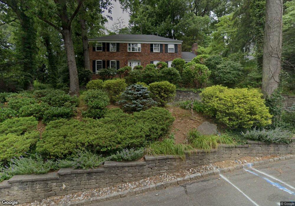
57 Gloucester Rd Summit, NJ 07901
Estimated Value: $1,378,993 - $2,199,000
Studio
--
Bath
2,581
Sq Ft
$756/Sq Ft
Est. Value
About This Home
This home is located at 57 Gloucester Rd, Summit, NJ 07901 and is currently estimated at $1,949,998, approximately $755 per square foot. 57 Gloucester Rd is a home located in Union County with nearby schools including L C Johnson Summit Middle School, Summit Sr High School, and Oak Knoll School of the Holy Child.
Ownership History
Date
Name
Owned For
Owner Type
Purchase Details
Closed on
Jun 11, 2012
Sold by
Baroody Llyod
Bought by
Menard Genevieve A
Current Estimated Value
Purchase Details
Closed on
Mar 28, 2006
Sold by
Quintana Benjamin A
Bought by
Menard Genevieve A and Baroody Lloyd
Purchase Details
Closed on
Mar 2, 2001
Sold by
Kwan Min Fun Rudolf and Kwan Har Set
Bought by
Quintana Benjamin A and Menard Genevieve A
Home Financials for this Owner
Home Financials are based on the most recent Mortgage that was taken out on this home.
Original Mortgage
$293,000
Interest Rate
7.15%
Create a Home Valuation Report for This Property
The Home Valuation Report is an in-depth analysis detailing your home's value as well as a comparison with similar homes in the area
Home Values in the Area
Average Home Value in this Area
Purchase History
| Date | Buyer | Sale Price | Title Company |
|---|---|---|---|
| Menard Genevieve A | $510,000 | -- | |
| Menard Genevieve A | $600,000 | -- | |
| Quintana Benjamin A | $693,000 | First American Title Ins Co |
Source: Public Records
Mortgage History
| Date | Status | Borrower | Loan Amount |
|---|---|---|---|
| Previous Owner | Quintana Benjamin A | $293,000 |
Source: Public Records
Tax History
| Year | Tax Paid | Tax Assessment Tax Assessment Total Assessment is a certain percentage of the fair market value that is determined by local assessors to be the total taxable value of land and additions on the property. | Land | Improvement |
|---|---|---|---|---|
| 2025 | $21,780 | $500,000 | $274,000 | $226,000 |
| 2024 | $21,635 | $500,000 | $274,000 | $226,000 |
| 2023 | $21,635 | $500,000 | $274,000 | $226,000 |
| 2022 | $21,415 | $500,000 | $274,000 | $226,000 |
| 2021 | $21,585 | $500,000 | $274,000 | $226,000 |
| 2020 | $21,800 | $500,000 | $274,000 | $226,000 |
| 2019 | $21,825 | $500,000 | $274,000 | $226,000 |
| 2018 | $21,685 | $500,000 | $274,000 | $226,000 |
| 2017 | $21,825 | $500,000 | $274,000 | $226,000 |
| 2016 | $21,505 | $500,000 | $274,000 | $226,000 |
| 2015 | $21,085 | $500,000 | $274,000 | $226,000 |
| 2014 | $20,540 | $500,000 | $274,000 | $226,000 |
Source: Public Records
Map
Nearby Homes
- 22 Brook Hollow Ln
- 78 Seven Oaks Dr
- 65 Seven Oaks Dr
- 71 Dale Dr
- 157 Grant Ave
- 15 Alison Ct
- 49 the Fellsway
- 25 Division Ave
- 226 Mountain Ave
- 17 Badgley Dr
- 709 Springfield Ave Unit One
- 709 Springfield Ave Unit 4
- 709 Springfield Ave Unit 2
- 709 Springfield Ave Unit 3
- 4 Parkview Terrace
- 63 Gallinson Dr
- 34 Grant Ave
- 27 Grant Ave
- 26 E 3rd St
- 113 Crest Dr
- 55 Gloucester Rd
- 59 Gloucester Rd
- 11 Kings Hill Ct
- 15 Kings Hill Ct
- 50 Gloucester Rd
- 61 Gloucester Rd
- 56 Gloucester Rd
- 5 Kings Hill Ct
- 52 Knob Hill Dr
- 18 Canterbury Ln
- 51 Gloucester Rd
- 42 Gloucester Rd
- 48 Knob Hill Dr
- 144 Division Ave
- 139 Division Ave
- 42 Knob Hill Dr
- 19 Kings Hill Ct
- 38 Knob Hill Dr
- 133 Division Ave
- 129 Division Ave
Your Personal Tour Guide
Ask me questions while you tour the home.