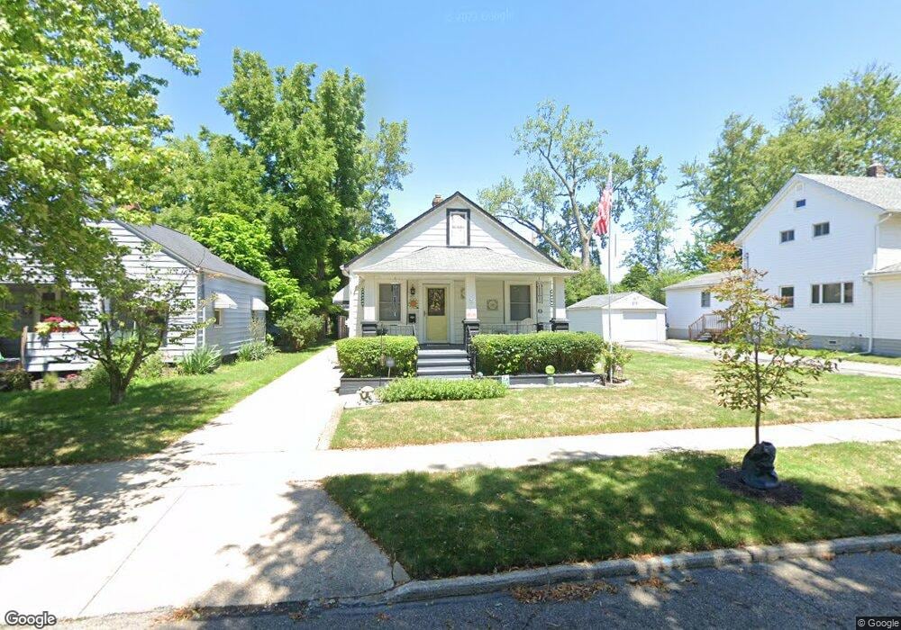
57 Henry St Bedford, OH 44146
Estimated Value: $143,000 - $196,000
3
Beds
2
Baths
1,512
Sq Ft
$105/Sq Ft
Est. Value
About This Home
This home is located at 57 Henry St, Bedford, OH 44146 and is currently estimated at $159,351, approximately $105 per square foot. 57 Henry St is a home located in Cuyahoga County with nearby schools including Heskett Middle School, Bedford High School, and Ohio College Preparatory School.
Ownership History
Date
Name
Owned For
Owner Type
Purchase Details
Closed on
May 9, 1994
Sold by
Romanik John J and Romanik Barbara E
Bought by
Missel Gail C
Current Estimated Value
Purchase Details
Closed on
Dec 30, 1986
Sold by
Romanik Mary M and Romanik Steve
Bought by
Romanik John J and Romanik Barbara E
Purchase Details
Closed on
Mar 27, 1985
Sold by
Romanik Mary M
Bought by
Romanik Mary M and Romanik Steve
Purchase Details
Closed on
Oct 4, 1984
Sold by
Mitrick John M
Bought by
Romanik Mary M
Purchase Details
Closed on
Aug 22, 1977
Sold by
Mitrik Meri
Bought by
Mitrick John M
Purchase Details
Closed on
Jan 1, 1975
Bought by
Mitrik Meri
Create a Home Valuation Report for This Property
The Home Valuation Report is an in-depth analysis detailing your home's value as well as a comparison with similar homes in the area
Home Values in the Area
Average Home Value in this Area
Purchase History
| Date | Buyer | Sale Price | Title Company |
|---|---|---|---|
| Missel Gail C | $70,500 | -- | |
| Romanik John J | $38,000 | -- | |
| Romanik Mary M | -- | -- | |
| Romanik Mary M | -- | -- | |
| Mitrick John M | -- | -- | |
| Mitrik Meri | -- | -- |
Source: Public Records
Tax History Compared to Growth
Tax History
| Year | Tax Paid | Tax Assessment Tax Assessment Total Assessment is a certain percentage of the fair market value that is determined by local assessors to be the total taxable value of land and additions on the property. | Land | Improvement |
|---|---|---|---|---|
| 2024 | $2,787 | $45,220 | $7,595 | $37,625 |
| 2023 | $2,039 | $30,800 | $6,510 | $24,290 |
| 2022 | $1,845 | $30,800 | $6,510 | $24,290 |
| 2021 | $1,776 | $30,800 | $6,510 | $24,290 |
| 2020 | $2,253 | $25,870 | $5,460 | $20,410 |
| 2019 | $2,196 | $73,900 | $15,600 | $58,300 |
| 2018 | $2,197 | $25,870 | $5,460 | $20,410 |
| 2017 | $2,234 | $25,070 | $5,010 | $20,060 |
| 2016 | $2,215 | $25,070 | $5,010 | $20,060 |
| 2015 | $2,211 | $25,070 | $5,010 | $20,060 |
| 2014 | $2,211 | $27,240 | $5,430 | $21,810 |
Source: Public Records
Map
Nearby Homes
- 33 William St
- 92 John St
- 43 Forbes Rd
- 209 Dalepark Dr Unit 7
- 209 Dalepark Dr
- 200 Dalepark Dr Unit 3
- 80 Egbert Rd
- 7262 Free Ave
- 194 Dalepark Dr Unit 5
- 7263 Free Ave
- 7349 Wright Ave
- 7222 Grove Ave
- 7228 Grove Ave
- 140 Cowles Ave
- 167 Willis St
- 772 Broadway Ave
- 6569 Pau Ct
- 6538 Pau Ct
- 7322 Kentucky Dr
- 6604 Basswood Dr