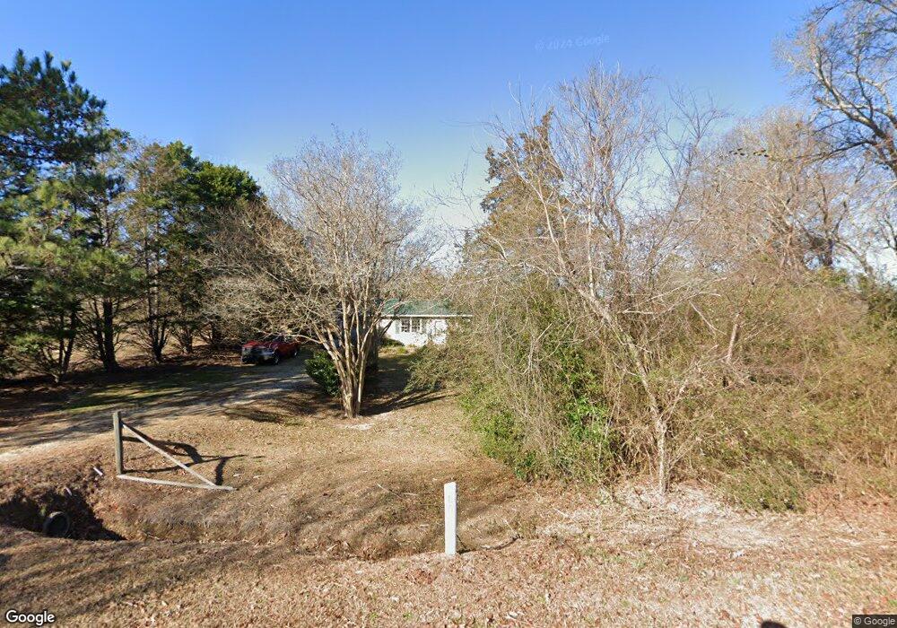
57 Jim Christian Rd Lillington, NC 27546
Estimated Value: $169,000 - $257,000
3
Beds
1
Bath
1,236
Sq Ft
$167/Sq Ft
Est. Value
About This Home
This home is located at 57 Jim Christian Rd, Lillington, NC 27546 and is currently estimated at $206,762, approximately $167 per square foot. 57 Jim Christian Rd is a home located in Harnett County with nearby schools including Lillington-Shawtown Elementary School, Harnett Central Middle School, and Harnett Central High School.
Ownership History
Date
Name
Owned For
Owner Type
Purchase Details
Closed on
Feb 10, 2016
Sold by
Spence Philip O
Bought by
Cassidy Marjorie C
Current Estimated Value
Home Financials for this Owner
Home Financials are based on the most recent Mortgage that was taken out on this home.
Original Mortgage
$68,000
Outstanding Balance
$29,254
Interest Rate
3.92%
Estimated Equity
$177,508
Create a Home Valuation Report for This Property
The Home Valuation Report is an in-depth analysis detailing your home's value as well as a comparison with similar homes in the area
Home Values in the Area
Average Home Value in this Area
Purchase History
| Date | Buyer | Sale Price | Title Company |
|---|---|---|---|
| Cassidy Marjorie C | $68,000 | -- |
Source: Public Records
Mortgage History
| Date | Status | Borrower | Loan Amount |
|---|---|---|---|
| Open | Cassidy Marjorie C | $68,000 |
Source: Public Records
Tax History Compared to Growth
Tax History
| Year | Tax Paid | Tax Assessment Tax Assessment Total Assessment is a certain percentage of the fair market value that is determined by local assessors to be the total taxable value of land and additions on the property. | Land | Improvement |
|---|---|---|---|---|
| 2025 | $888 | $114,594 | $0 | $0 |
| 2024 | $877 | $114,594 | $0 | $0 |
| 2023 | $877 | $114,594 | $0 | $0 |
| 2022 | $693 | $114,594 | $0 | $0 |
| 2021 | $693 | $71,470 | $0 | $0 |
| 2020 | $693 | $71,470 | $0 | $0 |
| 2019 | $678 | $71,470 | $0 | $0 |
| 2018 | $678 | $71,470 | $0 | $0 |
| 2017 | $41 | $71,470 | $0 | $0 |
| 2016 | $623 | $66,590 | $0 | $0 |
| 2015 | $623 | $66,590 | $0 | $0 |
| 2014 | $623 | $66,590 | $0 | $0 |
Source: Public Records
Map
Nearby Homes
- 212 Willie Cameron Rd
- 254 Willie Cameron Rd
- 246 Norman Ave
- 256 Norman Ave
- 236 Norman Ave
- 235 Norman Ave
- 223 Norman Ave
- 120 Mamie Ferguson Dr
- 310 Mamie Ferguson Dr
- 85 Bella Howington Dr
- 330 Mamie Ferguson Dr
- Porter II Plan at Griffon Pointe
- Harper II Plan at Griffon Pointe
- Wisteria II Plan at Griffon Pointe
- Sonoma II Plan at Griffon Pointe
- Hamilton Plan at Griffon Pointe
- McClean II Plan at Griffon Pointe
- Hallman Plan at Griffon Pointe
- Hayes Plan at Griffon Pointe
- Ariel II Plan at Griffon Pointe
- 3188 Us 421 N
- 3220 Us 421 N
- 3205 Us 421 N
- 3205 U S 421
- 3233 U S 421
- 3259 Us 421n
- 3039 Us 421 N
- 3259 Us 421 N
- 3280 Us 421 N
- 35 Billy Matthews Ln
- 2935 Us 421 N
- 78 Norman Christian Ln
- 100 Norman Christian Ln
- 110 Norman Christian Ln
- 120 Norman Christian Ln
- 212 Willie Cameron Rd Unit lot 3
- 232 Willie Cameron Rd
- 125 Norman Christian Ln
- 2875 Us 421 N
- 3415 Us 421 N