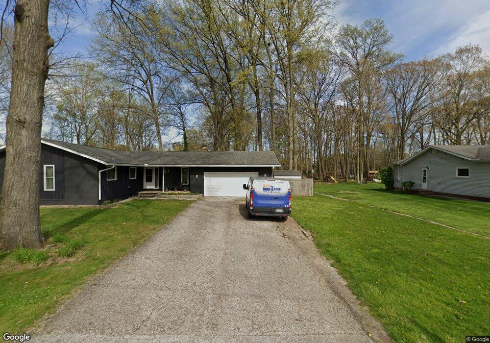
57 Joel Dr Mogadore, OH 44260
Estimated Value: $257,000 - $275,000
3
Beds
2
Baths
1,664
Sq Ft
$158/Sq Ft
Est. Value
About This Home
This home is located at 57 Joel Dr, Mogadore, OH 44260 and is currently estimated at $262,527, approximately $157 per square foot. 57 Joel Dr is a home located in Summit County with nearby schools including O.H. Somers Elementary School, Mogadore High School, and Summit Academy Akron Elementary School.
Ownership History
Date
Name
Owned For
Owner Type
Purchase Details
Closed on
Jul 31, 2006
Sold by
Pohly Lyle R and Pohly Terri M
Bought by
Brown Howard A and Brown Kimberly A
Current Estimated Value
Home Financials for this Owner
Home Financials are based on the most recent Mortgage that was taken out on this home.
Original Mortgage
$137,700
Interest Rate
6.73%
Mortgage Type
Purchase Money Mortgage
Create a Home Valuation Report for This Property
The Home Valuation Report is an in-depth analysis detailing your home's value as well as a comparison with similar homes in the area
Home Values in the Area
Average Home Value in this Area
Purchase History
| Date | Buyer | Sale Price | Title Company |
|---|---|---|---|
| Brown Howard A | $162,000 | Falls Title Agency Inc |
Source: Public Records
Mortgage History
| Date | Status | Borrower | Loan Amount |
|---|---|---|---|
| Closed | Brown Howard A | $137,700 |
Source: Public Records
Tax History
| Year | Tax Paid | Tax Assessment Tax Assessment Total Assessment is a certain percentage of the fair market value that is determined by local assessors to be the total taxable value of land and additions on the property. | Land | Improvement |
|---|---|---|---|---|
| 2025 | $4,102 | $83,371 | $19,198 | $64,173 |
| 2024 | $4,168 | $83,371 | $19,198 | $64,173 |
| 2023 | $4,168 | $83,371 | $19,198 | $64,173 |
| 2022 | $3,526 | $59,371 | $13,615 | $45,756 |
| 2021 | $3,258 | $59,371 | $13,615 | $45,756 |
| 2020 | $3,389 | $59,380 | $13,620 | $45,760 |
| 2019 | $3,194 | $52,360 | $9,080 | $43,280 |
| 2018 | $3,160 | $52,360 | $9,080 | $43,280 |
| 2017 | $3,121 | $52,360 | $9,080 | $43,280 |
| 2016 | $3,054 | $47,590 | $9,080 | $38,510 |
| 2015 | $3,121 | $47,590 | $9,080 | $38,510 |
| 2014 | $2,782 | $47,590 | $9,080 | $38,510 |
| 2013 | $2,956 | $49,860 | $9,080 | $40,780 |
Source: Public Records
Map
Nearby Homes
- 73 Kline Ave
- 0 V L Marion Ave
- 99 Meadowridge Rd
- 151 Meadowridge Rd
- 121 Meadowridge Rd
- 3755 Louise St
- 122 Fenton Ave
- 40 Hyland Dr
- 3001 Pepperhill Rd
- 81 Hyland Dr
- 38 Walnut Ct
- 62 Hyland Dr
- 360 James Ave
- 3192 Mogadore Rd
- 3774 Argonne St
- 3189-3197 Albrecht Ave
- 432 Edith Ave
- 0 Kreiner Ave
- 2904 Pepper Hill Cir
- 6 Kreiner Ave
- 59 Joel Dr
- 65 Joel Dr
- 77 Joel Dr
- 62 Kavanaugh Dr
- 0 Brentwood Allt Lot 81 All Kavanaugh Dr Dr Unit 4383156
- 2 Kavanaugh Dr
- 3507 Curtis St
- 3513 Curtis St
- 3501 Curtis St
- 3519 Curtis St
- 3495 Curtis St
- 0 Brentwood Allt Lot 82 All Kavanaugh Dr Dr Unit 4395671
- 3489 Curtis St
- 3525 Curtis St
- 3550 Mogadore Rd
- 64 Joel Dr
- 3531 Curtis St
- 3483 Curtis St
- 1 Kavanaugh Dr
- 56 Joel Dr
Your Personal Tour Guide
Ask me questions while you tour the home.