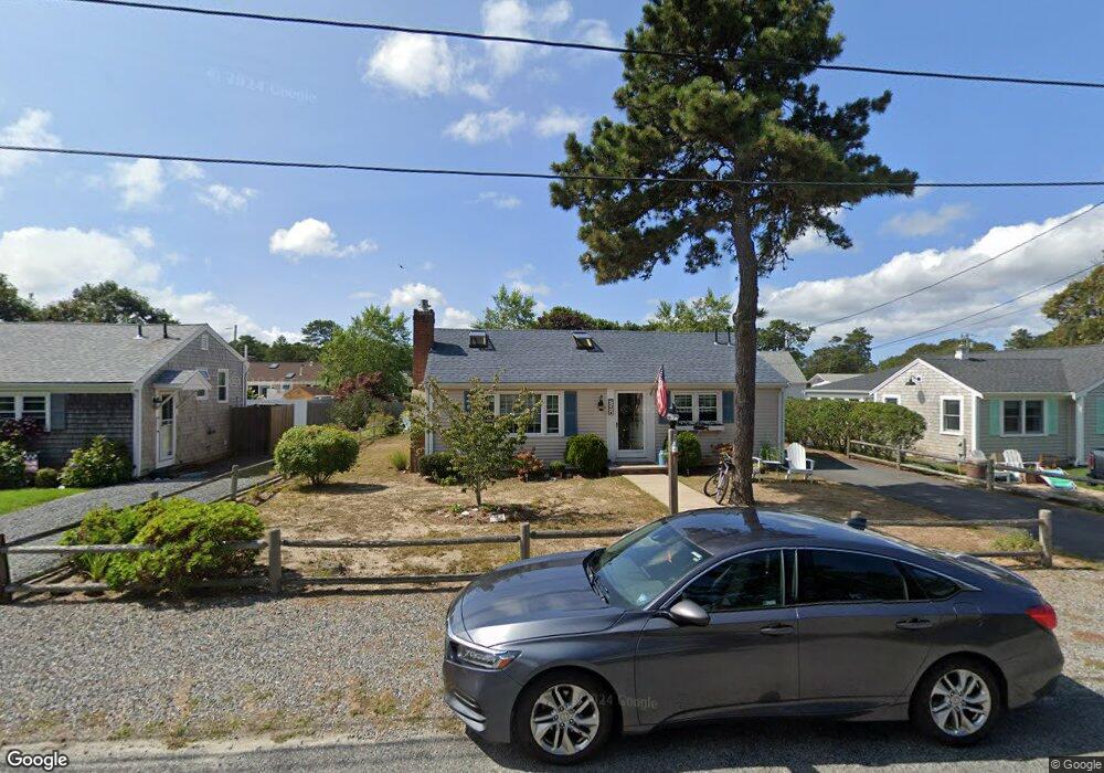
57 Lawrence Rd Dennis Port, MA 02639
Dennis Port NeighborhoodEstimated Value: $532,000 - $681,000
2
Beds
1
Bath
864
Sq Ft
$713/Sq Ft
Est. Value
About This Home
This home is located at 57 Lawrence Rd, Dennis Port, MA 02639 and is currently estimated at $616,401, approximately $713 per square foot. 57 Lawrence Rd is a home located in Barnstable County with nearby schools including Dennis-Yarmouth Regional High School and St. Pius X. School.
Ownership History
Date
Name
Owned For
Owner Type
Purchase Details
Closed on
Aug 24, 2009
Sold by
Cronin Paul J and Harrington Timothy W
Bought by
Fazio Joseph and Fazio Monica
Current Estimated Value
Home Financials for this Owner
Home Financials are based on the most recent Mortgage that was taken out on this home.
Original Mortgage
$157,000
Outstanding Balance
$102,260
Interest Rate
5.19%
Mortgage Type
Purchase Money Mortgage
Estimated Equity
$514,141
Purchase Details
Closed on
Mar 28, 1997
Sold by
Cieri Robert L and Cieri Carole M
Bought by
Cronin Paul J and Topalis Laura A
Home Financials for this Owner
Home Financials are based on the most recent Mortgage that was taken out on this home.
Original Mortgage
$73,000
Interest Rate
7.59%
Mortgage Type
Purchase Money Mortgage
Create a Home Valuation Report for This Property
The Home Valuation Report is an in-depth analysis detailing your home's value as well as a comparison with similar homes in the area
Home Values in the Area
Average Home Value in this Area
Purchase History
| Date | Buyer | Sale Price | Title Company |
|---|---|---|---|
| Fazio Joseph | $262,500 | -- | |
| Cronin Paul J | $97,000 | -- |
Source: Public Records
Mortgage History
| Date | Status | Borrower | Loan Amount |
|---|---|---|---|
| Open | Fazio Joseph | $157,000 | |
| Previous Owner | Cronin Paul J | $73,000 |
Source: Public Records
Tax History Compared to Growth
Tax History
| Year | Tax Paid | Tax Assessment Tax Assessment Total Assessment is a certain percentage of the fair market value that is determined by local assessors to be the total taxable value of land and additions on the property. | Land | Improvement |
|---|---|---|---|---|
| 2025 | $2,631 | $607,700 | $195,300 | $412,400 |
| 2024 | $2,428 | $553,100 | $187,800 | $365,300 |
| 2023 | $2,349 | $502,900 | $170,700 | $332,200 |
| 2022 | $2,241 | $400,100 | $153,800 | $246,300 |
| 2021 | $2,256 | $374,200 | $172,300 | $201,900 |
| 2020 | $2,037 | $334,000 | $150,800 | $183,200 |
| 2019 | $1,918 | $310,800 | $147,800 | $163,000 |
| 2018 | $1,820 | $287,100 | $140,700 | $146,400 |
| 2017 | $1,675 | $272,400 | $130,700 | $141,700 |
| 2016 | $1,683 | $257,700 | $140,700 | $117,000 |
| 2015 | $1,649 | $257,700 | $140,700 | $117,000 |
| 2014 | $1,516 | $238,700 | $120,600 | $118,100 |
Source: Public Records
Map
Nearby Homes
- 80 Michaels Ave
- 37 Ocean Dr Unit 2
- 64 Beaten Rd
- 31 Easy St
- 19 Standish Way
- 112 Old Wharf Rd Unit E4
- 112 Old Wharf Rd Unit E1
- 22 Wixon Rd
- 120 Old Wharf Rd Unit 11
- 154 Old Wharf Rd Unit 26
- 154 Old Wharf Rd Unit 14
- 12 Spoonbill Rd
- 61 Trotters Ln
- 4 Coffey Ln
- 71 Main St
- 15 Woodside Park Rd
- 125 Main St Unit 3
- 217 Old Wharf Rd Unit 64
- 72 Bassett Ln
- 6 Baker Way
- 61 Lawrence Rd
- 55 Lawrence Rd
- 110 Michaels Ave
- 63 Lawrence Rd
- 106 Michaels Ave
- 51 Lawrence Rd
- 114 Michaels Ave
- 52 Lawrence Rd
- 54 Lawrence Rd
- 62 Lawrence Rd
- 67 Lawrence Rd
- 49 Lawrence Rd
- 102 Michaels Ave
- 118 Michaels Ave
- 48 Lawrence Rd
- 69 Lawrence Rd
- 111 Michaels Ave
- 115 Michaels Ave
- 45 Lawrence Rd
- 98 Michaels Ave