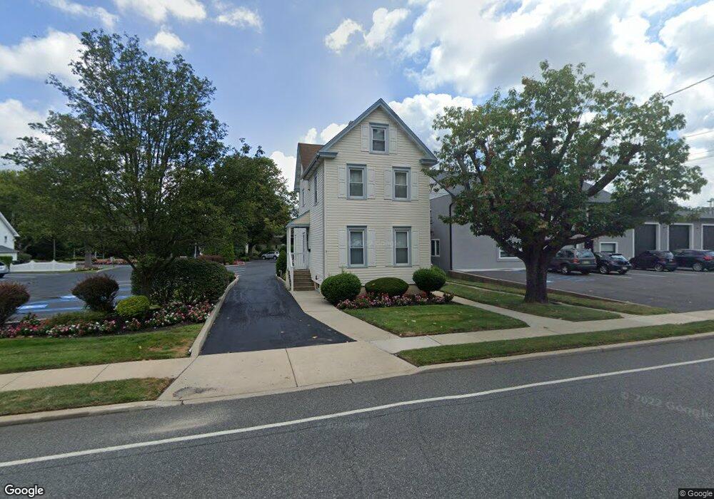
57 Main St Mantua, NJ 08051
Mantua Township NeighborhoodEstimated Value: $269,424 - $360,000
--
Bed
--
Bath
1,779
Sq Ft
$173/Sq Ft
Est. Value
About This Home
This home is located at 57 Main St, Mantua, NJ 08051 and is currently estimated at $308,356, approximately $173 per square foot. 57 Main St is a home located in Gloucester County with nearby schools including Centre City School, Clearview Regional Middle School, and Clearview Regional High School.
Ownership History
Date
Name
Owned For
Owner Type
Purchase Details
Closed on
Aug 10, 2022
Sold by
Smith Robert C and Smith Daniel N
Bought by
Rds Mantua Llc
Current Estimated Value
Purchase Details
Closed on
Feb 26, 2005
Sold by
Smith Virginia W
Bought by
Smith Robert C and Smith Daniel N
Home Financials for this Owner
Home Financials are based on the most recent Mortgage that was taken out on this home.
Original Mortgage
$85,000
Interest Rate
5%
Mortgage Type
Seller Take Back
Create a Home Valuation Report for This Property
The Home Valuation Report is an in-depth analysis detailing your home's value as well as a comparison with similar homes in the area
Home Values in the Area
Average Home Value in this Area
Purchase History
| Date | Buyer | Sale Price | Title Company |
|---|---|---|---|
| Rds Mantua Llc | -- | None Listed On Document | |
| Rds Mantua Llc | -- | None Listed On Document | |
| Smith Robert C | $85,000 | -- |
Source: Public Records
Mortgage History
| Date | Status | Borrower | Loan Amount |
|---|---|---|---|
| Previous Owner | Smith Robert C | $85,000 |
Source: Public Records
Tax History Compared to Growth
Tax History
| Year | Tax Paid | Tax Assessment Tax Assessment Total Assessment is a certain percentage of the fair market value that is determined by local assessors to be the total taxable value of land and additions on the property. | Land | Improvement |
|---|---|---|---|---|
| 2025 | $5,096 | $197,900 | $39,800 | $158,100 |
| 2024 | $5,042 | $197,900 | $39,800 | $158,100 |
| 2023 | $5,042 | $197,900 | $39,800 | $158,100 |
| 2022 | $5,499 | $157,200 | $27,000 | $130,200 |
| 2021 | $5,540 | $157,200 | $27,000 | $130,200 |
| 2020 | $5,496 | $157,200 | $27,000 | $130,200 |
| 2019 | $5,403 | $157,200 | $27,000 | $130,200 |
| 2018 | $5,326 | $157,200 | $27,000 | $130,200 |
| 2017 | $5,246 | $157,200 | $27,000 | $130,200 |
| 2016 | $5,186 | $157,200 | $27,000 | $130,200 |
| 2015 | $5,059 | $157,200 | $27,000 | $130,200 |
| 2014 | $4,889 | $157,200 | $27,000 | $130,200 |
Source: Public Records
Map
Nearby Homes
- 111 Cove Rd
- 125 Ivy Ln
- 748 Dartmouth Dr
- 1134 Tristram Cir Unit 4
- 8 Barry Dr
- 1215 Tristram Cir
- 75 Hickory Ave
- 1145 Tristram Cir
- 1147 Tristram Cir Unit 1147
- 1433 Tristram Cir
- 325 Bridgeton Pike
- 505 W Mantua Ave
- 119 Monroe Ave
- 7 Manchester Ct
- 261 Tony Cir
- 213 Barclay Ct
- 100 Buddy Powell Ln
- 19 Marathon Dr
- 205 Redbud Ln Unit 205
- 114 Buddy Powell Ln