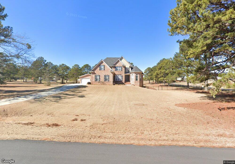
57 Mallard Ln Locust Grove, GA 30248
Estimated Value: $626,000 - $684,000
5
Beds
4
Baths
3,107
Sq Ft
$208/Sq Ft
Est. Value
About This Home
This home is located at 57 Mallard Ln, Locust Grove, GA 30248 and is currently estimated at $645,065, approximately $207 per square foot. 57 Mallard Ln is a home located in Henry County with nearby schools including Bethlehem Elementary School, Luella Middle School, and Luella High School.
Ownership History
Date
Name
Owned For
Owner Type
Purchase Details
Closed on
Jun 29, 2009
Sold by
Lindsey Charles A
Bought by
Bos John D and Bos Janna E
Current Estimated Value
Home Financials for this Owner
Home Financials are based on the most recent Mortgage that was taken out on this home.
Original Mortgage
$332,000
Outstanding Balance
$216,244
Interest Rate
5.27%
Mortgage Type
New Conventional
Estimated Equity
$428,821
Purchase Details
Closed on
Mar 18, 2005
Sold by
Milton David
Bought by
Lindsey Charles A
Home Financials for this Owner
Home Financials are based on the most recent Mortgage that was taken out on this home.
Original Mortgage
$344,000
Interest Rate
5.63%
Mortgage Type
New Conventional
Purchase Details
Closed on
Apr 29, 2003
Sold by
Zacks Props Inc
Bought by
Milton David
Create a Home Valuation Report for This Property
The Home Valuation Report is an in-depth analysis detailing your home's value as well as a comparison with similar homes in the area
Home Values in the Area
Average Home Value in this Area
Purchase History
| Date | Buyer | Sale Price | Title Company |
|---|---|---|---|
| Bos John D | $445,000 | -- | |
| Lindsey Charles A | $430,000 | -- | |
| Milton David | $62,500 | -- |
Source: Public Records
Mortgage History
| Date | Status | Borrower | Loan Amount |
|---|---|---|---|
| Open | Bos John D | $332,000 | |
| Previous Owner | Lindsey Charles A | $344,000 | |
| Previous Owner | Lindsey Charles A | $43,000 |
Source: Public Records
Tax History Compared to Growth
Tax History
| Year | Tax Paid | Tax Assessment Tax Assessment Total Assessment is a certain percentage of the fair market value that is determined by local assessors to be the total taxable value of land and additions on the property. | Land | Improvement |
|---|---|---|---|---|
| 2024 | $8,921 | $252,000 | $30,000 | $222,000 |
| 2023 | $9,886 | $256,680 | $30,000 | $226,680 |
| 2022 | $8,409 | $218,160 | $30,000 | $188,160 |
| 2021 | $8,370 | $217,160 | $30,000 | $187,160 |
| 2020 | $7,869 | $204,080 | $30,000 | $174,080 |
| 2019 | $6,544 | $169,560 | $30,000 | $139,560 |
| 2018 | $5,868 | $151,920 | $26,000 | $125,920 |
| 2016 | $5,469 | $141,520 | $26,000 | $115,520 |
| 2015 | $5,848 | $146,840 | $26,000 | $120,840 |
| 2014 | $5,450 | $135,160 | $24,000 | $111,160 |
Source: Public Records
Map
Nearby Homes
- 167 Pintail Way
- 0 Mallard Ln Unit LOT 51 10565157
- 369 Canvasback Trail
- 1004 Linford Ct
- Wagener Plan at Kingston
- 302 Linford Dr
- Wynwood Plan at Kingston
- Rainier Plan at Kingston
- Rosemary II Plan at Kingston
- Clarity Plan at Kingston
- Lauren II Plan at Kingston
- Henry II Plan at Kingston
- Meridian II Plan at Kingston
- 242 Linford Dr
- 238 Linford Dr
- 512 Dolce Rd
- 305 Canvasback Trail
- 335 Canvasback Trail
- 443 Lothbury Ave
- 1405 Landon Dr