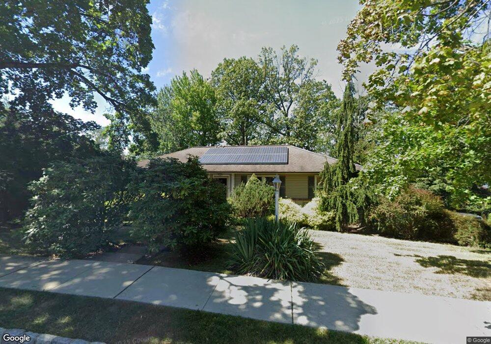
57 Manger Rd West Orange, NJ 07052
Estimated Value: $689,000 - $771,000
--
Bed
--
Bath
1,578
Sq Ft
$464/Sq Ft
Est. Value
About This Home
This home is located at 57 Manger Rd, West Orange, NJ 07052 and is currently estimated at $732,759, approximately $464 per square foot. 57 Manger Rd is a home located in Essex County with nearby schools including West Orange High School, Golda Och Academy, and Mount Carmel Guild High School.
Ownership History
Date
Name
Owned For
Owner Type
Purchase Details
Closed on
Oct 26, 2010
Sold by
Ciamillo Theodore Frank and Ciamillo Denise A
Bought by
Gebreyesus Samson and Abraha Helen
Current Estimated Value
Home Financials for this Owner
Home Financials are based on the most recent Mortgage that was taken out on this home.
Original Mortgage
$312,885
Outstanding Balance
$206,226
Interest Rate
4.25%
Mortgage Type
FHA
Estimated Equity
$526,533
Purchase Details
Closed on
Sep 24, 1993
Sold by
Ciamillo Helen
Bought by
Gamillo Theodore
Home Financials for this Owner
Home Financials are based on the most recent Mortgage that was taken out on this home.
Original Mortgage
$70,000
Interest Rate
6.9%
Purchase Details
Closed on
Apr 10, 1991
Sold by
Pecoriello-Ciamello Helen
Bought by
Pecorillo-Ciamello Helen
Create a Home Valuation Report for This Property
The Home Valuation Report is an in-depth analysis detailing your home's value as well as a comparison with similar homes in the area
Home Values in the Area
Average Home Value in this Area
Purchase History
| Date | Buyer | Sale Price | Title Company |
|---|---|---|---|
| Gebreyesus Samson | $340,000 | Multiple | |
| Gamillo Theodore | $110,000 | -- | |
| Pecorillo-Ciamello Helen | $100 | -- |
Source: Public Records
Mortgage History
| Date | Status | Borrower | Loan Amount |
|---|---|---|---|
| Open | Gebreyesus Samson | $312,885 | |
| Previous Owner | Gamillo Theodore | $70,000 |
Source: Public Records
Tax History Compared to Growth
Tax History
| Year | Tax Paid | Tax Assessment Tax Assessment Total Assessment is a certain percentage of the fair market value that is determined by local assessors to be the total taxable value of land and additions on the property. | Land | Improvement |
|---|---|---|---|---|
| 2025 | $15,265 | $729,600 | $345,000 | $384,600 |
| 2024 | $15,265 | $332,000 | $147,300 | $184,700 |
| 2022 | $14,731 | $332,000 | $147,300 | $184,700 |
| 2021 | $14,455 | $332,000 | $147,300 | $184,700 |
| 2020 | $14,223 | $332,000 | $147,300 | $184,700 |
| 2019 | $13,815 | $332,000 | $147,300 | $184,700 |
| 2018 | $13,406 | $332,000 | $147,300 | $184,700 |
| 2017 | $13,234 | $332,000 | $147,300 | $184,700 |
| 2016 | $12,915 | $332,000 | $147,300 | $184,700 |
| 2015 | $12,672 | $332,000 | $147,300 | $184,700 |
| 2014 | $12,423 | $332,000 | $147,300 | $184,700 |
Source: Public Records
Map
Nearby Homes
- 29 Carolina Ave
- 33 Mcguire Dr
- 28 Mcguire Dr
- 27 Morris Rd
- 75 Nance Rd
- 863 Pleasant Valley Way
- 18 Belle Terre Rd
- 29 Crestmont Rd
- 26 Crestmont Rd
- 11 Buckingham Rd
- 7 Buckingham Rd
- 7 Cheshire Terrace
- 7 Wessman Dr
- 18 Sunnyside Rd
- 163 Marion Dr
- 149 Marion Dr
- 173 Marion Dr
- 149 Marion Dr Unit 145
- 145 Marion Dr Unit 145
- 24 Suburban Dr