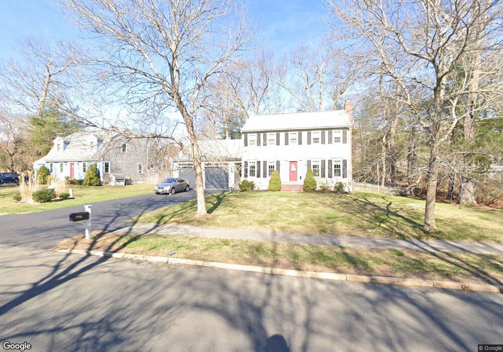
57 Morningside Dr Rockland, MA 02370
Estimated Value: $673,000 - $702,000
3
Beds
2
Baths
1,727
Sq Ft
$397/Sq Ft
Est. Value
About This Home
This home is located at 57 Morningside Dr, Rockland, MA 02370 and is currently estimated at $686,199, approximately $397 per square foot. 57 Morningside Dr is a home located in Plymouth County with nearby schools including Rockland Senior High School, Calvary Chapel Academy, and St Bridget School.
Ownership History
Date
Name
Owned For
Owner Type
Purchase Details
Closed on
Jun 25, 2019
Sold by
Grant Dennis G and Grant Bonnie F
Bought by
Grant Ft
Current Estimated Value
Purchase Details
Closed on
Apr 2, 2009
Sold by
Ferns Bonnie P
Bought by
Grant Dennis G and Ferns Bonnie P
Home Financials for this Owner
Home Financials are based on the most recent Mortgage that was taken out on this home.
Original Mortgage
$250,000
Interest Rate
4.92%
Mortgage Type
Purchase Money Mortgage
Create a Home Valuation Report for This Property
The Home Valuation Report is an in-depth analysis detailing your home's value as well as a comparison with similar homes in the area
Home Values in the Area
Average Home Value in this Area
Purchase History
| Date | Buyer | Sale Price | Title Company |
|---|---|---|---|
| Grant Ft | -- | -- | |
| Grant Dennis G | -- | -- |
Source: Public Records
Mortgage History
| Date | Status | Borrower | Loan Amount |
|---|---|---|---|
| Previous Owner | Grant Dennis G | $50,000 | |
| Previous Owner | Grant Dennis G | $250,000 | |
| Previous Owner | Grant Dennis G | $200,000 |
Source: Public Records
Map
Nearby Homes
- 7 Hayford Trail Unit 12
- 5 Hayford Trail Unit 11
- 17 Hayford Trail Unit 12
- 22 Howland Trail Unit 34
- 10 Proud Foot Way
- 5 Alpine St
- 23 Live Oak Way
- 724 Whitman St
- 214 Winter St
- 168 Spring St
- 170 Pleasant St
- 291 Raynor Ave
- 810 Brookline Way
- 608 Plymouth St
- 696 Summer St
- 61 Suffolk St
- 8 Pat Rose Way
- 9 Pat Rose Way
- 5 Pat Rose Way
- Lot 5 Princeton Way
- 55 Morningside Dr
- 59 Morningside Dr
- 54 Millbrook Dr
- 52 Millbrook Dr (Lot #)
- 53 Morningside Dr
- 50 Millbrook Dr
- 58 Morningside Dr
- 50 Lot 50 Millbrook Dr
- 57 Millbrook Dr
- 62 Morningside Dr
- 60 Morningside Dr
- 48 Millbrook Dr
- 63 Morningside Dr
- 51 Morningside Dr
- 53 Millbrook Dr
- 51 Millbrook Dr
- 29 Birch Bottom Cir
- 95 Millbrook Dr
- 46 Millbrook Dr
- 1 Reed Bent Rd
Your Personal Tour Guide
Ask me questions while you tour the home.