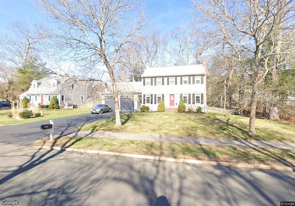
57 Morningside Dr Rockland, MA 02370
Estimated Value: $673,000 - $725,000
About This Home
This home is located at 57 Morningside Dr, Rockland, MA 02370 and is currently estimated at $694,191, approximately $401 per square foot. 57 Morningside Dr is a home located in Plymouth County with nearby schools including Rockland Senior High School, Calvary Chapel Academy, and St Bridget School.
Ownership History
We collect this data history from publicly available records. To have your information removed, we recommend requesting removal directly through your county’s website.
Purchase Details
Purchase Details
Home Financials for this Owner
Home Financials are based on the most recent Mortgage that was taken out on this home.Home Values in the Area
Average Home Value in this Area
Purchase History
We collect this data history from publicly available records. To have your information removed, we recommend requesting removal directly through your county’s website.
| Date | Buyer | Sale Price | Title Company |
|---|---|---|---|
| -- | -- | ||
| -- | -- |
Mortgage History
We collect this data history from publicly available records. To have your information removed, we recommend requesting removal directly through your county’s website.
| Date | Status | Borrower | Loan Amount |
|---|---|---|---|
| Previous Owner | $50,000 | ||
| Previous Owner | $250,000 | ||
| Previous Owner | $200,000 |
Tax History
We collect this data history from publicly available records. To have your information removed, we recommend requesting removal directly through your county’s website.
| Year | Tax Paid | Tax Assessment Tax Assessment Total Assessment is a certain percentage of the fair market value that is determined by local assessors to be the total taxable value of land and additions on the property. | Land | Improvement |
|---|---|---|---|---|
| 2025 | $8,449 | $618,100 | $240,300 | $377,800 |
| 2024 | $8,201 | $583,300 | $226,700 | $356,600 |
| 2023 | $8,299 | $545,300 | $217,900 | $327,400 |
| 2022 | $8,007 | $478,000 | $189,400 | $288,600 |
| 2021 | $7,658 | $443,200 | $180,000 | $263,200 |
| 2020 | $7,390 | $422,300 | $171,500 | $250,800 |
| 2019 | $7,265 | $405,400 | $163,300 | $242,100 |
| 2018 | $7,221 | $396,300 | $184,600 | $211,700 |
| 2017 | $6,973 | $377,300 | $184,600 | $192,700 |
| 2016 | $6,751 | $365,100 | $177,500 | $187,600 |
| 2015 | $6,440 | $338,400 | $165,900 | $172,500 |
| 2014 | $6,122 | $333,800 | $162,700 | $171,100 |
Map
- 103 Standpipe Dr
- 5 Satucket Rd
- 55 Plymouth St Unit 40L
- 55 Plymouth St Unit J35
- 418 Beech St
- 12 Driftwood Ln
- 822 Whitman St
- 842 Whitman St
- 867 Whitman St
- 724 Whitman St
- 45 Brigham St
- 560 South Ave
- 214 Winter St
- 177 Pleasant St
- 143 Cranberry Rd
- 321 Birchbark Dr
- 38 Carleton St
- 24 Bowker Ave
- 285 Raynor Ave
- 338 Levin Rd
- 55 Morningside Dr
- 53 Morningside Dr
- 50 Millbrook Dr
- 52 Millbrook Dr (Lot #)
- 54 Millbrook Dr
- 50 Lot 50 Millbrook Dr
- 59 Morningside Dr
- 51 Morningside Dr
- 48 Millbrook Dr
- 58 Morningside Dr
- 49 Morningside Dr
- 46 Millbrook Dr
- 1 Reed Bent Rd
- 57 Millbrook Dr
- 60 Morningside Dr
- 51 Millbrook Dr
- 53 Millbrook Dr
- 62 Morningside Dr
- 95 Millbrook Dr
- 63 Morningside Dr
Ask me questions while you tour the home.