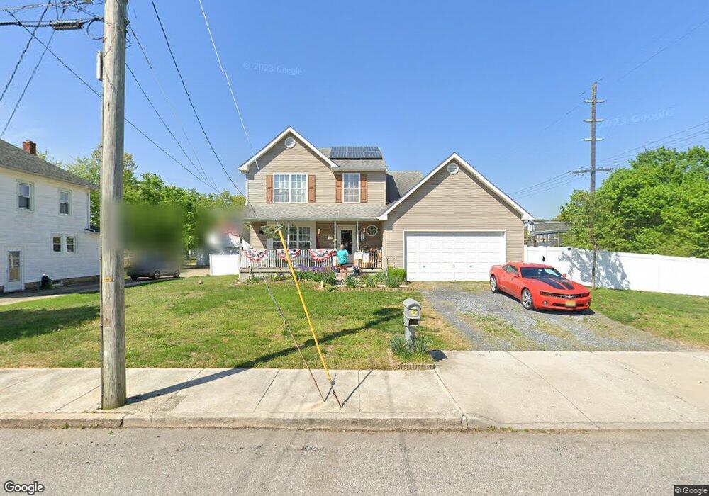
57 N Maple Ave Gibbstown, NJ 08027
Greenwich Township NeighborhoodEstimated Value: $337,970 - $390,000
--
Bed
--
Bath
1,984
Sq Ft
$183/Sq Ft
Est. Value
About This Home
This home is located at 57 N Maple Ave, Gibbstown, NJ 08027 and is currently estimated at $362,493, approximately $182 per square foot. 57 N Maple Ave is a home located in Gloucester County with nearby schools including Nehaunsey Middle School and Guardian Angels Regional School.
Ownership History
Date
Name
Owned For
Owner Type
Purchase Details
Closed on
Oct 27, 2005
Sold by
Elite Construction Corp
Bought by
Barger Samuel H and Barger Lisa M
Current Estimated Value
Home Financials for this Owner
Home Financials are based on the most recent Mortgage that was taken out on this home.
Original Mortgage
$127,350
Outstanding Balance
$69,905
Interest Rate
6.07%
Mortgage Type
Fannie Mae Freddie Mac
Estimated Equity
$292,588
Purchase Details
Closed on
Sep 2, 1996
Sold by
Smith Paul
Bought by
The Bank Of Gloucester County
Purchase Details
Closed on
Mar 8, 1995
Sold by
Mulhern Thomas
Bought by
Smith Paul
Create a Home Valuation Report for This Property
The Home Valuation Report is an in-depth analysis detailing your home's value as well as a comparison with similar homes in the area
Home Values in the Area
Average Home Value in this Area
Purchase History
| Date | Buyer | Sale Price | Title Company |
|---|---|---|---|
| Barger Samuel H | $227,335 | Congress | |
| The Bank Of Gloucester County | -- | -- | |
| Smith Paul | -- | Pilgrim Title Agency |
Source: Public Records
Mortgage History
| Date | Status | Borrower | Loan Amount |
|---|---|---|---|
| Open | Barger Samuel H | $127,350 |
Source: Public Records
Tax History Compared to Growth
Tax History
| Year | Tax Paid | Tax Assessment Tax Assessment Total Assessment is a certain percentage of the fair market value that is determined by local assessors to be the total taxable value of land and additions on the property. | Land | Improvement |
|---|---|---|---|---|
| 2025 | $7,595 | $220,600 | $35,400 | $185,200 |
| 2024 | $7,196 | $220,600 | $35,400 | $185,200 |
| 2023 | $7,196 | $220,600 | $35,400 | $185,200 |
| 2022 | $7,200 | $220,600 | $35,400 | $185,200 |
| 2021 | $6,875 | $220,600 | $35,400 | $185,200 |
| 2020 | $7,225 | $220,600 | $35,400 | $185,200 |
| 2019 | $7,229 | $220,600 | $35,400 | $185,200 |
| 2018 | $7,024 | $220,600 | $35,400 | $185,200 |
| 2017 | $6,854 | $220,600 | $35,400 | $185,200 |
| 2016 | $6,779 | $220,600 | $35,400 | $185,200 |
| 2015 | $6,561 | $220,600 | $35,400 | $185,200 |
| 2014 | $6,278 | $220,600 | $35,400 | $185,200 |
Source: Public Records
Map
Nearby Homes
- 431 Washington St
- 433 Jefferson St
- 132 Tomlin Station Rd
- 157 S Poplar St
- 752 Duncan Ave
- 268 Memorial Ave
- W Broad St
- 0 S Democrat Rd Unit NJGL2065008
- 456 Freund Ave
- 126 Repaupo Station Rd
- 43 45 Repaupo Station Rd
- 0 Swedesboro Ave Unit NJGL2061592
- 792 Paulsboro Rd
- 788 Paulsboro Rd
- 330 Croce Ave
- 0 Rd Unit NJGL2061600
- 219 Vanneman Blvd
- 344 W Washington St
- L18 20 W Broad St
- 120 Bartram Ave
- 55 N Maple Ave
- 53 N Maple Ave
- 515 Washington St
- 66 N Repauno Ave
- 64 N Repauno Ave
- 68 N Repauno Ave
- 62 N Repauno Ave
- 56 N Repauno Ave
- 52 N Repauno Ave
- 452 Railroad Ave
- 505 Washington St
- 102 N Repauno Ave Unit 7
- 102 N Repauno Ave Unit 6
- 102 N Repauno Ave Unit 5
- 102 N Repauno Ave Unit 3
- 102 N Repauno Ave Unit 2
- 102 N Repauno Ave
- 102 N Repauno Ave Unit C
- 107 Dupont Ave
- 461 Washington St Unit 463